MyTopo
Stratton Maine US Topo Map
Couldn't load pickup availability
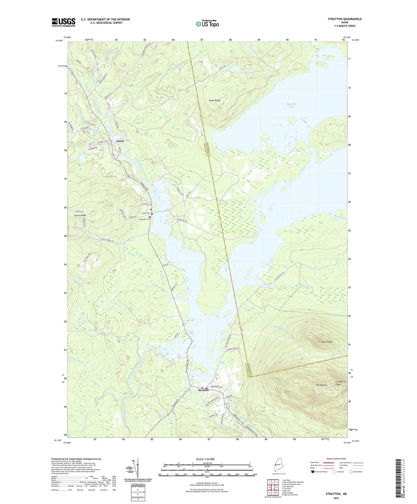
2021 topographic map quadrangle Stratton in the state of Maine. Scale: 1:24000. Based on the newly updated USGS 7.5' US Topo map series, this map is in the following counties: Franklin, Somerset. The map contains contour data, water features, and other items you are used to seeing on USGS maps, but also has updated roads and other features. This is the next generation of topographic maps. Printed on high-quality waterproof paper with UV fade-resistant inks.
Quads adjacent to this one:
West: Tim Mountain
Northwest: Jim Pond
North: King And Bartlett Mountain
Northeast: King And Bartlett Lake
East: The Horns
Southeast: Sugarloaf Mountain
South: Black Nubble
Southwest: Quill Hill
Contains the following named places: Bigelow Range Trail, Bradbury Brook, Butler Brook, Butler Pond, Cathedral Pines Campground, Cherry Run, Cold Brook, Cranberry Peak, Dead River Historical Society, East Nubble, Eustis, Eustis Cemetery, Eustis Fire Department, Eustis Post Office, Eustis Power Dam, Eustis Ridge, Flagstaff Cemetery, Flagstaff Memorial Church, Flagstaff Township, Jim Pond Brook, Lutton Brook, Nash Stream, North Branch Dead River, North Branch Dead River Reservoir, Reed Brook, South Branch Dead River, Stratton, Stratton Brook, Stratton Post Office, Stratton Public Library, Stratton School, Tea Brook, Tim Brook, Town of Eustis, Trout Brook, Veazy Ridge, Viles Brook, Wethern Pond, Whiskey Brook