MyTopo
Telos Lake Maine US Topo Map
Couldn't load pickup availability
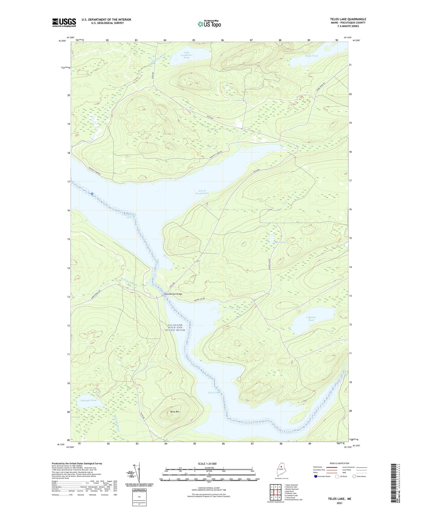
2021 topographic map quadrangle Telos Lake in the state of Maine. Scale: 1:24000. Based on the newly updated USGS 7.5' US Topo map series, this map is in the following counties: Piscataquis. The map contains contour data, water features, and other items you are used to seeing on USGS maps, but also has updated roads and other features. This is the next generation of topographic maps. Printed on high-quality waterproof paper with UV fade-resistant inks.
Quads adjacent to this one:
West: Mud Pond
Northwest: Soper Mountain
North: Haymock Lake
Northeast: Beetle Mountain
East: Webster Lake
Southeast: Nesowadnehunk Lake
South: Telos Brook
Southwest: Cuxabexis Lake
Contains the following named places: Arm of Chamberlain, Boy Scout Campsite, Chamberlain Bridge, Chamberlain-Telos Lake, Coffeelos Pond, Field Campsite, High Bank Campsite, Imlos Pond, Kellogg Brook, Ledge Point Campsite, Little Leadbetter Pond, Meadow Brook, Midnight Brook, Midnight Pond, Nugent Chamberlain Lake Seaplane Base, Round Pond, Snake Pond, T6 R11 WELS, Telos Dam, Telos Lake, Telos Landing, Telos Mountain, The Arm Campsite, Thoroughfare Campsite, Throughfare Campsite