MyTopo
Ten Mile Lake Maine US Topo Map
Couldn't load pickup availability
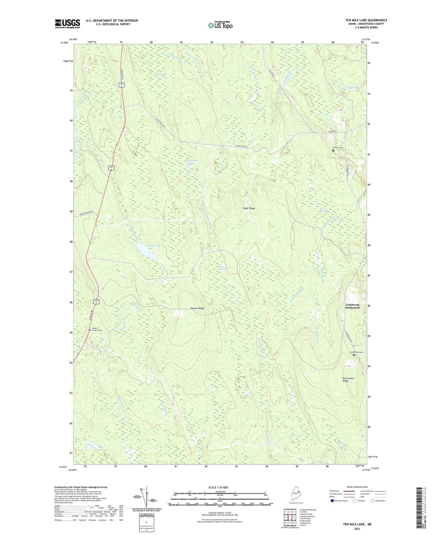
2021 topographic map quadrangle Ten Mile Lake in the state of Maine. Scale: 1:24000. Based on the newly updated USGS 7.5' US Topo map series, this map is in the following counties: Aroostook. The map contains contour data, water features, and other items you are used to seeing on USGS maps, but also has updated roads and other features. This is the next generation of topographic maps. Printed on high-quality waterproof paper with UV fade-resistant inks.
Quads adjacent to this one:
West: Monument Brook
Northwest: Meduxnekeag Lake
North: Linneus
Northeast: Houlton South
East: North Amity
Southeast: Orient
South: Haynesville
Southwest: Alder Brook
Contains the following named places: Burnt Dam Ridge, Coffin Bog, Coffin Brook, Davis Brook Bog, Elevenmile Lake, Estabrook Cemetery, Estabrook Settlement, First Brook, Forkstown Township, Foss Brook, Haney Brook, Hiram T Smith Grave, Jimmy Brook Bog, North Branch Meduxnekeag Stream, Second Brook, South Branch Meduxnekeag Stream, Stetson Ridge, Stony Brook, Sugar Ridge, TA R2 WELS, Tenmile Brook, Tenmile Lake, Wilcox Cemetery, Wilcox Settlement, Yellow Brook