MyTopo
Meduxnekeag Lake Maine US Topo Map
Couldn't load pickup availability
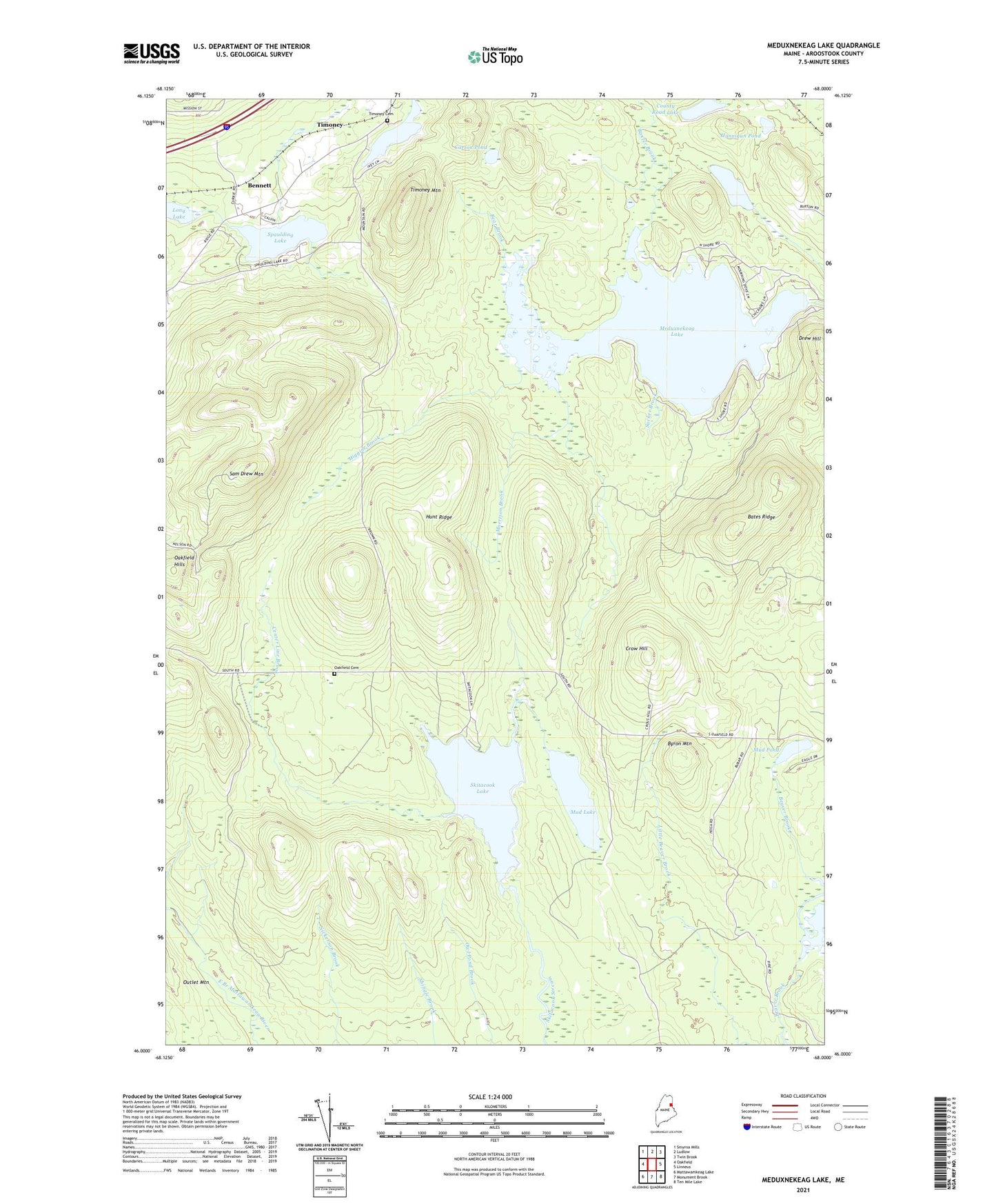
2024 topographic map quadrangle Meduxnekeag Lake in the state of Maine. Scale: 1:24000. Based on the newly updated USGS 7.5' US Topo map series, this map is in the following counties: Aroostook. The map contains contour data, water features, and other items you are used to seeing on USGS maps, but also has updated roads and other features. This is the next generation of topographic maps. Printed on high-quality waterproof paper with UV fade-resistant inks.
Quads adjacent to this one:
West: Oakfield
Northwest: Smyrna Mills
North: Ludlow
Northeast: Twin Brook
East: Linneus
Southeast: Ten Mile Lake
South: Monument Brook
Southwest: Mattawamkeag Lake
This map covers the same area as the classic USGS quad with code o46068a1.
Contains the following named places: Bates Ridge, Baxter Brook, Bear Brook, Beaver Brook Lake, Bennett, Byron Mountain, Byron School, Carson Pond, Center Line Brook, County Road Lake, Crow Hill, Drew Hill, Drews Lake Dam, Gould Pond, Hannigan Pond, Higgins Brook, Hunt Ridge, Meduxnekeag Lake, Morrison Brook, Mud Lake, Mud Pond, Oakfield Cemetery, Oakfield Hills, Sam Drew Mountain, Skitacook Lake, Spaulding Lake, Sucker Brook, Timoney, Timoney Cemetery, Timoney Lake, Timoney Mountain, Town of Oakfield, ZIP Code: 04763