
MyTopo
Trout Mountain Maine US Topo Map
Couldn't load pickup availability
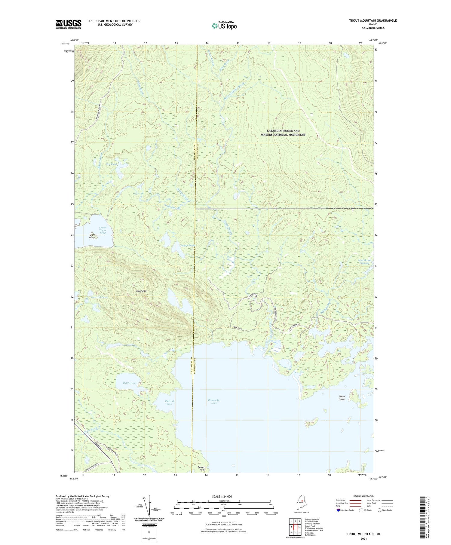
2021 topographic map quadrangle Trout Mountain in the state of Maine. Scale: 1:24000. Based on the newly updated USGS 7.5' US Topo map series, this map is in the following counties: Penobscot, Piscataquis. The map contains contour data, water features, and other items you are used to seeing on USGS maps, but also has updated roads and other features. This is the next generation of topographic maps. Printed on high-quality waterproof paper with UV fade-resistant inks.
Quads adjacent to this one:
West: Abol Pond
Northwest: Mount Katahdin
North: Katahdin Lake
Northeast: Deasey Mountain
East: Whetstone Mountain
Southeast: Millinocket
South: Norcross
Southwest: Pemadumcook Lake
Contains the following named places: Balm of Gilead Brook, Beaver Brook, Big Mud Brook, Bottle Pond, Clark Island, Logan Ponds, Lower Togue Pond, Millinocket Lake, Mud Brook Flowage, Oak Hill Pond, Otter Brook, Pickerel Cove, Sandy Stream, Spring Brook, State Island, T2 R8 WELS, Tea Pond, Togue Stream, Trout Mountain, Twin Ponds


