MyTopo
Waldoboro West Maine US Topo Map
Couldn't load pickup availability
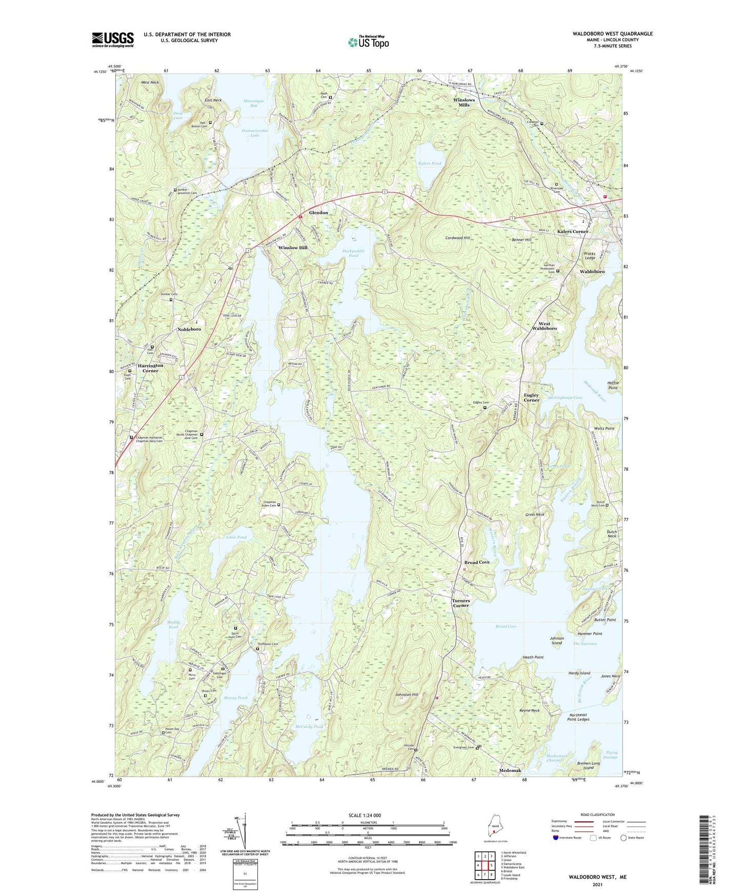
2024 topographic map quadrangle Waldoboro West in the state of Maine. Scale: 1:24000. Based on the newly updated USGS 7.5' US Topo map series, this map is in the following counties: Lincoln. The map contains contour data, water features, and other items you are used to seeing on USGS maps, but also has updated roads and other features. This is the next generation of topographic maps. Printed on high-quality waterproof paper with UV fade-resistant inks.
Quads adjacent to this one:
West: Damariscotta
Northwest: North Whitefield
North: Jefferson
Northeast: Union
East: Waldoboro East
Southeast: Friendship
South: Louds Island
Southwest: Bristol
This map covers the same area as the classic USGS quad with code o44069a4.
Contains the following named places: A D Gray Middle School, Back Meadow Brook, Beaverdam Brook, Benner Hill, Biscay Pond, Bremen, Bremen Fire Department, Bremen Post Office, Bremen Public Library, Bremen Rescue First Responders - Ambulance, Bremen School, Bremen Union Church, Bremen Volunteer Fire Department, Broad Cove, Butter Point, Cordwood Hill, Creamer Cemetery, Damariscotta Montessori School, Deep Cove, Duck Puddle Campground, Duckpuddle Pond, Dunbar Cemetery, Dutch Neck Cemetery, East Neck, Eastern Branch, Eugley Cemetery, Eugley Corner, Evergreen Cemetery, First Baptist Church, German Protestant Cemetery, Glendon, Gross Neck, Gross Pond, Hall Cemetery, Hardy Island, Harrington Corner, Havener Cove, Havener Point, Heath Point, Hillside Cemetery, Hoffse Point, Johnson Island, Johnston Hill, Jones Neck, Kalers Corner, Kalers Pond, Knowlton Corner, Lake Pemaquid Campground, Little Pond, McCurdy Pond, Medomak, Medomak River, Medomak River Reservoir, Meetinghouse Cove, Miller School, Minnehatta Fire Station, Muddy Pond, Muscongus Bay, Noble Monument, Nobleboro, Nobleboro Central School, Nobleboro Post Office, Northeast Point Ledges, Old German Meeting House, Pemaquid Pond, Procks Ledge, Riverside Cemetery, Saint Pauls Chapel, Sprague Corner, The Narrows, Town of Damariscotta, Town of Nobleboro, Trash Cemetery, Turners Corner, Waldoboro, Waldoboro Census Designated Place, Waldoboro Dam, Waldoboro Emergency Medical Ambulance Service, Waldoboro Police Department, Waldoboro Volunteer Fire Department, West Neck, West Waldoboro, Western Brook, Winslow Hill, Winslows Mills, Woltz Point, ZIP Codes: 04543, 04555, 04572