MyTopo
Waldoboro East Maine US Topo Map
Couldn't load pickup availability
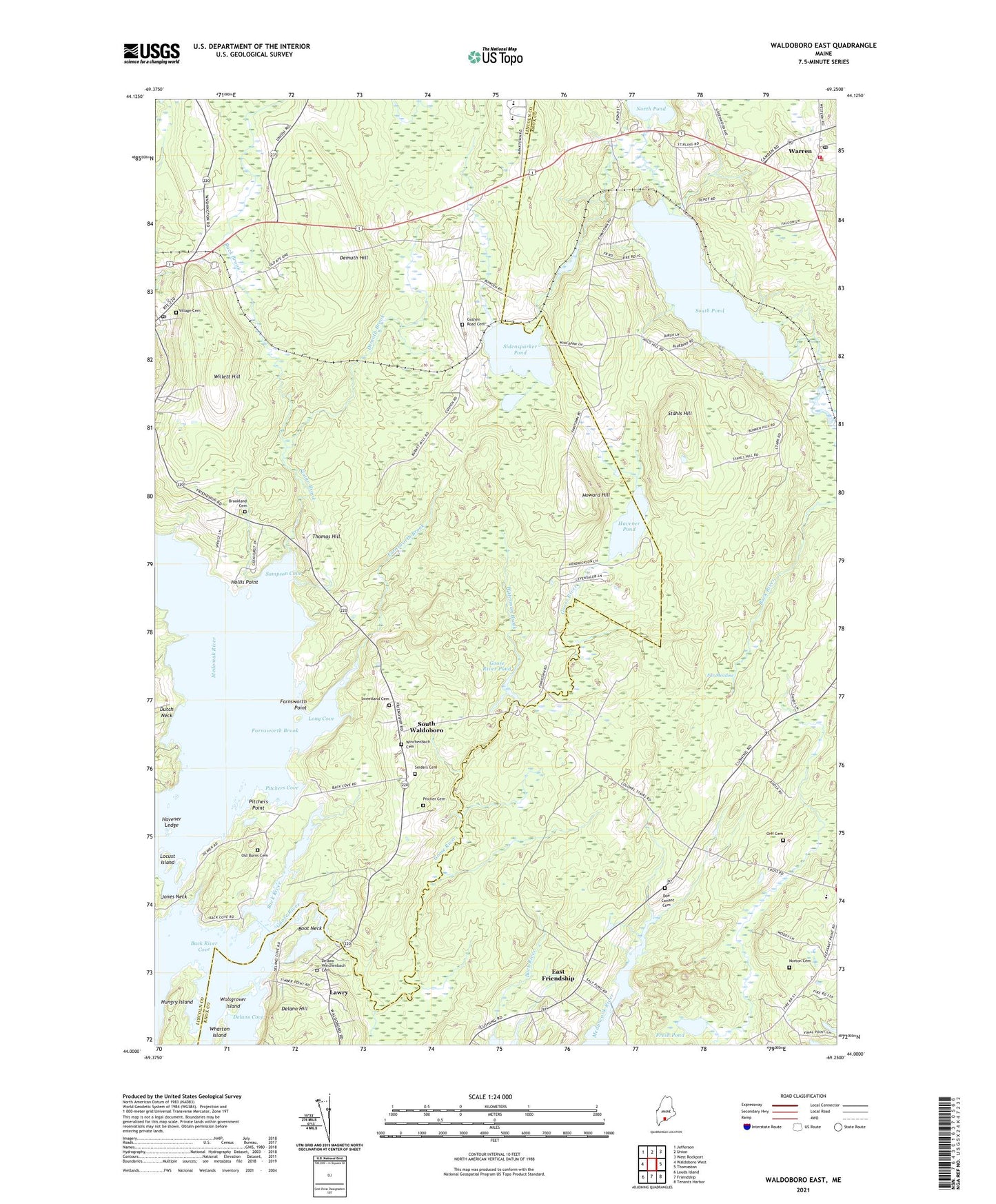
2021 topographic map quadrangle Waldoboro East in the state of Maine. Scale: 1:24000. Based on the newly updated USGS 7.5' US Topo map series, this map is in the following counties: Lincoln, Knox. The map contains contour data, water features, and other items you are used to seeing on USGS maps, but also has updated roads and other features. This is the next generation of topographic maps. Printed on high-quality waterproof paper with UV fade-resistant inks.
Quads adjacent to this one:
West: Waldoboro West
Northwest: Jefferson
North: Union
Northeast: West Rockport
East: Thomaston
Southeast: Tenants Harbor
South: Friendship
Southwest: Louds Island
Contains the following named places: Back Brook, Back River, Back River Cove, Boot Neck, Broad Bay Congregational Church, Cushing Community School, Delano Hill, Demuth Brook, Demuth Hill, Dutch Neck, East Friendship, Far Meadow, Farnsworth Brook, Farnsworth Point, First Baptist Church, Fresh Pond, Goose River, Goose River Dam, Goose River Pond, Havener Ledge, Havener Pond, Hollis Point, Howard Hill, Kimberly Airport, Lawry, Locust Island, Long Cove, Loons Cry Campground, Medomak Middle School, Medomak Valley High School, Orff Cemetery, Pitchers Cove, Pitchers Point, Sampson Cove, Sandy Shore Recreational Vehicle Resort, Sidensparker Pond, Slaigo Brook, South Pond, South Waldoboro, Stahls Hill, Thomas Hill, Town of Cushing, Town of Waldoboro, Waldoboro Post Office, Waldoboro Public Library, Waldoborough Historical Society Museum, Warren Ambulance Service, Warren Post Office, Warren Sawmill Pond, Warren Sawmill Pond Dam, Warren Station, Warren Volunteer Fire Department, Waterman Brook, Wentworth Corners, Wharton Island, Willett Hill, Wolsgrover Island, ZIP Code: 04563