MyTopo
Cherryfield Maine US Topo Map
Couldn't load pickup availability
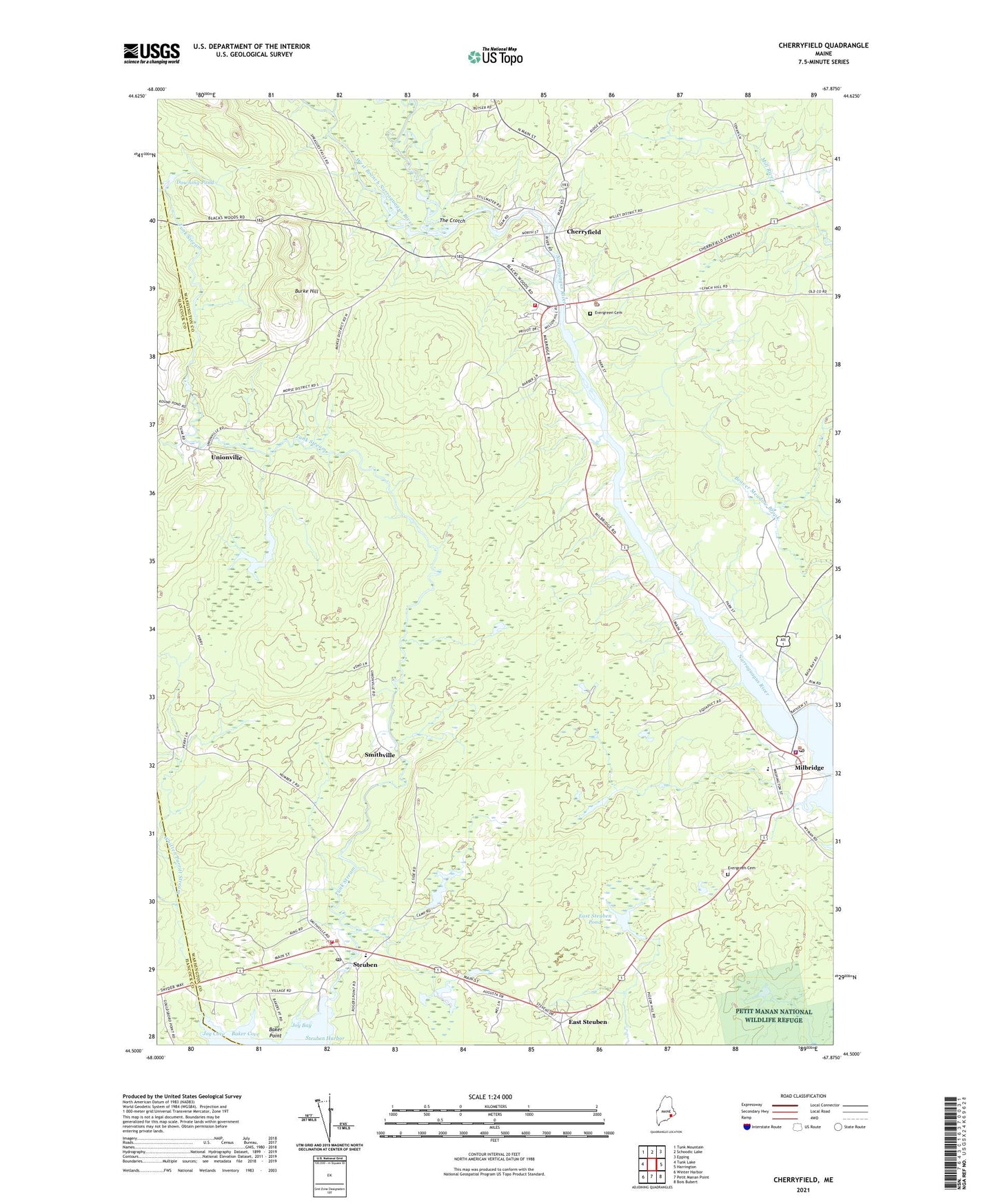
2024 topographic map quadrangle Cherryfield in the state of Maine. Scale: 1:24000. Based on the newly updated USGS 7.5' US Topo map series, this map is in the following counties: Washington, Hancock. The map contains contour data, water features, and other items you are used to seeing on USGS maps, but also has updated roads and other features. This is the next generation of topographic maps. Printed on high-quality waterproof paper with UV fade-resistant inks.
Quads adjacent to this one:
West: Tunk Lake
Northwest: Tunk Mountain
North: Schoodic Lake
Northeast: Epping
East: Harrington
Southeast: Bois Bubert
South: Petit Manan Point
Southwest: Winter Harbor
This map covers the same area as the classic USGS quad with code o44067e8.
Contains the following named places: Baker Cove, Baker Point, Burke Hill, Cherryfield, Cherryfield Academy, Cherryfield Ambulance Service, Cherryfield Dam, Cherryfield Elementary School, Cherryfield Historic District, Cherryfield Post Office, Cherryfield Public Library, Cherryfield Volunteer Fire Department, Cherryfield-Narraguagus Historical Society, Downing Pond, East Steuben, East Steuben Dam, East Steuben Pond, Ella Lewis School, Evergreen Cemetery, Henry D Moore Library, Mahanon Branch, Mainayr Campground, Milbridge, Milbridge Census Designated Place, Milbridge Elementary School, Milbridge Heliport, Milbridge Police Department, Milbridge Post Office, Milbridge Public Library, Milbridge Volunteer Fire Department, Milbridge Volunteer Rescue, Narraguagus Airport, Narraguagus River Reservoir, Petit Manan Ambulance Milbridge, Smithville, Steuben, Steuben Harbor, Steuben Post Office, Steuben Volunteer Fire Department, The Crotch, Tunk Stream, Unionville, West Branch Narraguagus River, Whitten Parritt Stream, WRMO-FM (Milbridge), ZIP Code: 04658