MyTopo
Burrsville Maryland US Topo Map
Couldn't load pickup availability
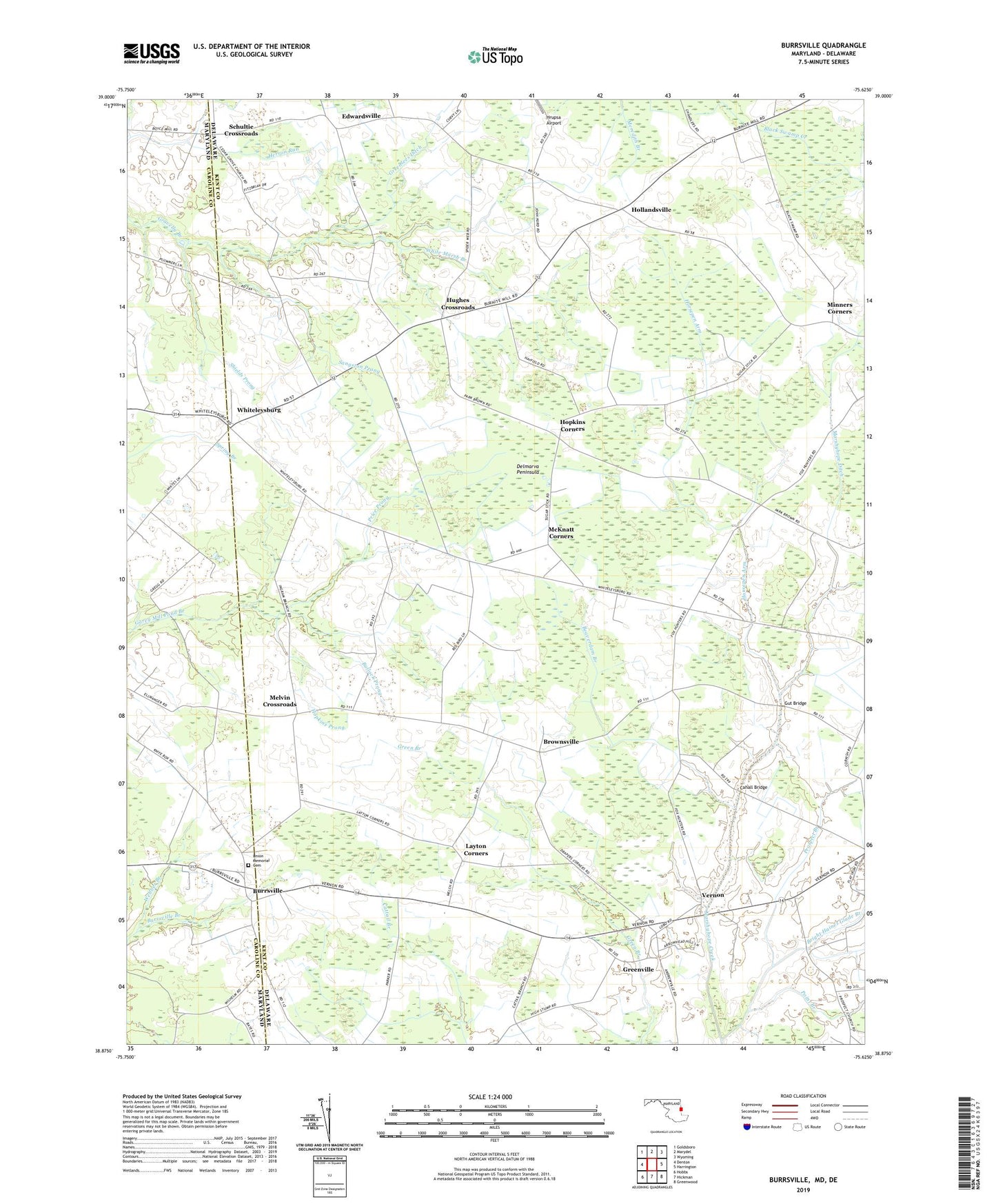
2019 topographic map quadrangle Burrsville in the states of Delaware, Maryland. Scale: 1:24000. Based on the newly updated USGS 7.5' US Topo map series, this map is in the following counties: Caroline, Kent. The map contains contour data, water features, and other items you are used to seeing on USGS maps, but also has updated roads and other features. This is the next generation of topographic maps. Printed on high-quality waterproof paper with UV fade-resistant inks.
Quads adjacent to this one:
West: Denton
Northwest: Goldsboro
North: Marydel
Northeast: Wyoming
East: Harrington
Southeast: Greenwood
South: Hickman
Southwest: Hobbs
Contains the following named places: Anthonys Corners, Beaverdam Branch, Black Arm Prong, Bright Haines Glade Branch, Brownsville, Bullock Prong, Burrsville, Burrsville Branch, Burrsville Church of God, Cahall Bridge, Cedar Grove Church, Drapers Corners, Dyke Pond, Edwardsville, Greenlees Ditch, Greens Corner, Greens Corners, Greenville, Gut Bridge, Hollandsville, Hopkins Corners, Hopkins Prong, Horsepen Arm, Hughes Crossroads, Ingram Branch, Layton Corners, Manship Church, Marshyhope Ditch, McKnatt Corners, Melvin Crossroads, Minners Corners, Mispillion Hundred, Point Branch, Price Prong, Prong Number Two, Prospect Branch, Prospect Church, Sangston Prong, Schultie Crossroads, Shields Prong, Union Church, Union Corners, Union Memorial Cemetery, Vernon, Webber Branch, Wesley Church, White Marsh Branch, Whiteleysburg, Whites Church, ZIP Code: 19952