MyTopo
Marydel Maryland US Topo Map
Couldn't load pickup availability
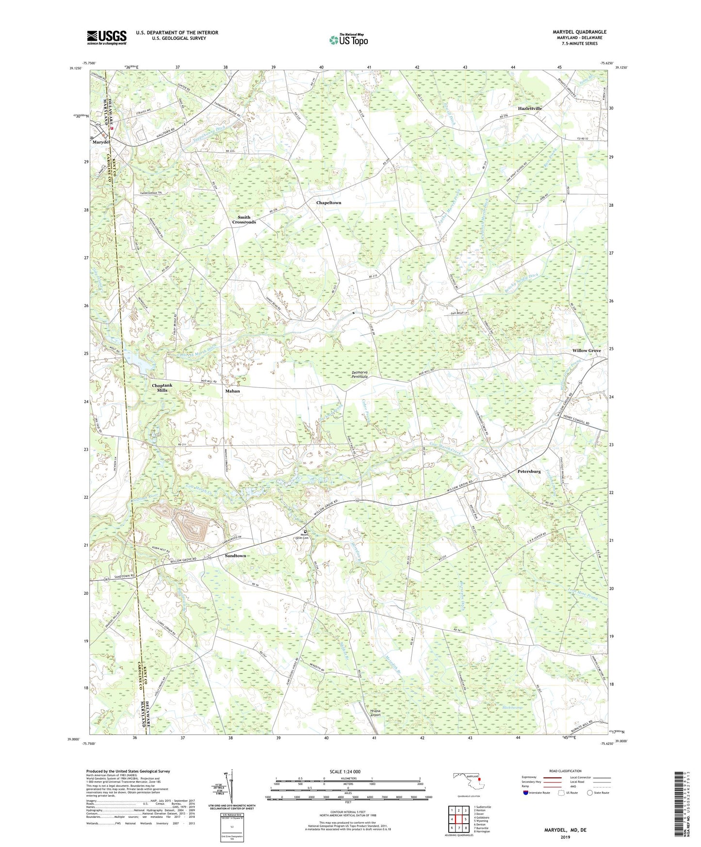
2023 topographic map quadrangle Marydel in the states of Delaware, Maryland. Scale: 1:24000. Based on the newly updated USGS 7.5' US Topo map series, this map is in the following counties: Caroline, Kent. The map contains contour data, water features, and other items you are used to seeing on USGS maps, but also has updated roads and other features. This is the next generation of topographic maps. Printed on high-quality waterproof paper with UV fade-resistant inks.
Quads adjacent to this one:
West: Goldsboro
Northwest: Sudlersville
North: Kenton
Northeast: Dover
East: Wyoming
Southeast: Harrington
South: Burrsville
Southwest: Denton
This map covers the same area as the classic USGS quad with code o39075a6.
Contains the following named places: Beachy Neidig Ditch, Black Swamp, Calvary United Methodist Church, Chapeltown, Choptank Mills, Cohee Prong, Cow Marsh Baptist Meeting House, Cow Marsh Church, Cow Marsh Creek, Culbreth Marsh Ditch, Ditch Road Ditch, Dover Bible Chapel, Fivefoot Prong, Harrington Beaverdam Ditch, Hazlettville, Horsepen Ditch, Hrupsa Airport, Immaculate Conception Catholic Church, Iron Mine Prong, Jackson Prong, Lords Corner, Luther Marvel Prong, Mahan, Marydel, Marydel Post Office, Marydel Volunteer Fire Company, Meredith Branch, Mount Olive Cemetery, Mud Millpond, Norman G Wilder Wildlife Area, Oak Point Acres, Oak Point School, Petersburg, Powell Ditch, Probst Mobile Home Park, Ross Prong, Sandtown, Sandtown Branch, Smith Crossroads, Tappahanna Ditch, Thomas Chapel, Tidy Island Creek, Town of Marydel, Wildcat Branch, Willow Grove, Willow Grove Prong, Yarema Ditch, ZIP Codes: 19934, 19964