MyTopo
Church Hill Maryland US Topo Map
Couldn't load pickup availability
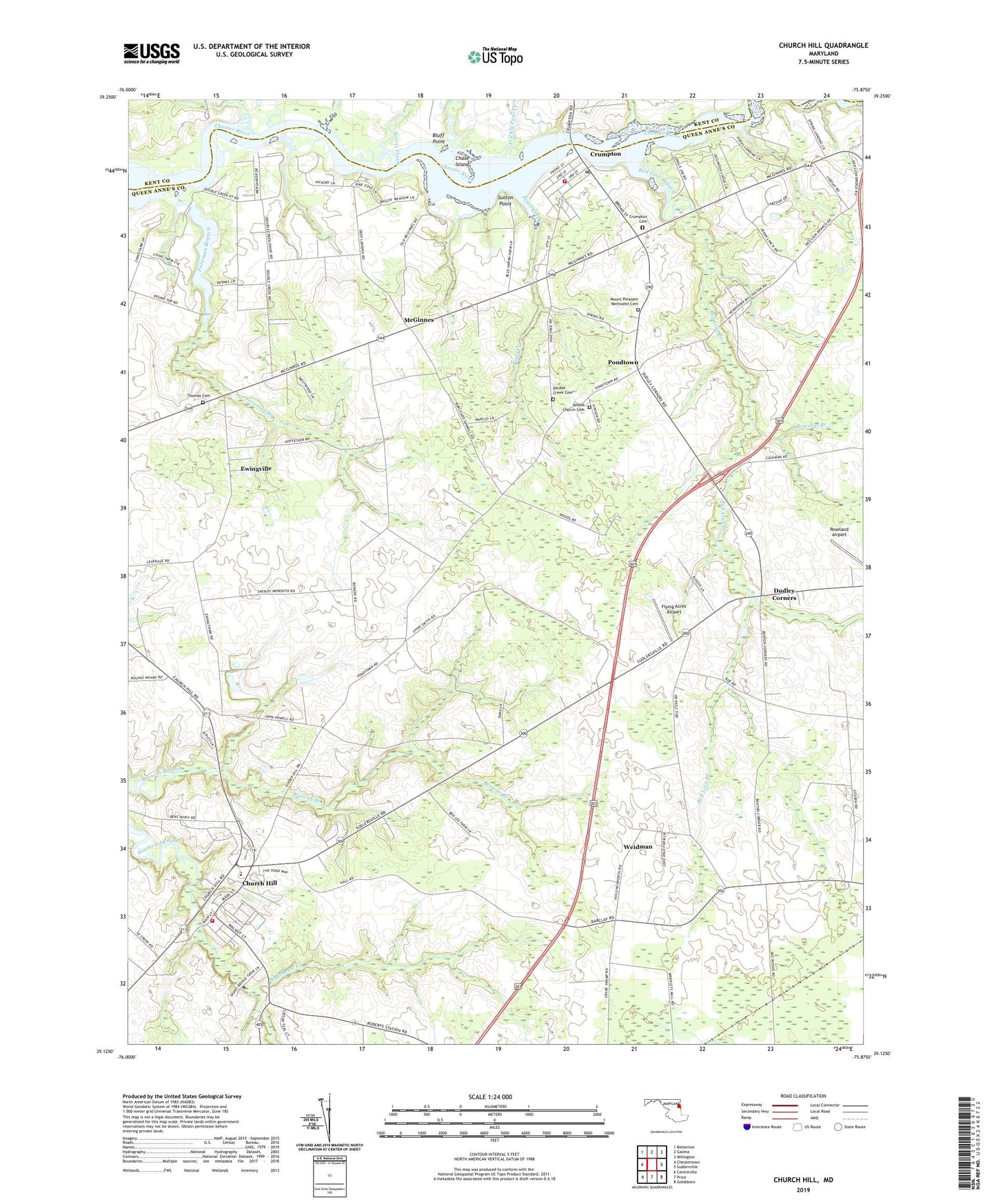
2019 topographic map quadrangle Church Hill in the state of Maryland. Scale: 1:24000. Based on the newly updated USGS 7.5' US Topo map series, this map is in the following counties: Queen Anne's, Kent. The map contains contour data, water features, and other items you are used to seeing on USGS maps, but also has updated roads and other features. This is the next generation of topographic maps. Printed on high-quality waterproof paper with UV fade-resistant inks.
Quads adjacent to this one:
West: Chestertown
Northwest: Betterton
North: Galena
Northeast: Millington
East: Sudlersville
Southeast: Goldsboro
South: Price
Southwest: Centreville
Contains the following named places: Ben Lee Estates, Benton Corners, Bethel Church, Bethel Church Cemetery, Birres Creek, Bluff Point, Boyer Chapel, Callisters Ferry, Cassinelli Vineyards and Winery, Char-Nor Manor, Chase Island, Chesterville Branch, Church Hill, Church Hill Elementary School, Church Hill Farms, Church Hill Post Office, Church Hill Town Hall, Church Hill United Methodist Church, Church Hill Volunteer Fire Company Station 5, Cronshaw, Crumpton, Crumpton Cemetery, Crumpton Census Designated Place, Crumpton Park, Crumpton Post Office, Crumpton Seniors Center, Crumpton United Methodist Church, Crumpton Volunteer Fire Department Station 7, Deep Landing, District 2 Church Hill, District 7 Crumpton, Dogwood Lodge, Double Creek Cemetery, Double Creek Church, Double Creek Wood, Ducks Neck Campground, Dudley Corners, Dudleys Chapel, Eastern Shore Academy of the Seventh Day Adventists, Ewingville, Flying Acres Airport, Ford Landing, Foreman Branch, Goosehaven Creek, Home Missionary Church, Jeffers Chapel United Methodist Church, Kingdom Hall of Jehovahs Witnesses, Kirby Landing, McGinnes, Mount Pleasant Church, Mount Pleasant Methodist Cemetery, Mussel Shoals, Newmans Corner, Norris Creek, Pearl Creek, Pheasantfield, Pine Cove, Pine Springs Mobile Home Park, Piney Shores, Pinkney Park, Pondtown, Pondtown School, Prickly Pear Creek, Queen Annes County Landfill, Red Lion Branch, Roseland Airport, Rowsbys Branch, Sagefield, Saint Lukes Church, Spring Landing, Springview, Spry Landing, Stevens Corner, Sutton Point, The Meadows, The Village at Church Hill Crossing, Thomas Cemetery, Town of Church Hill, Travilla Wharf, Weidman, ZIP Code: 21628