MyTopo
Earleville Maryland US Topo Map
Couldn't load pickup availability
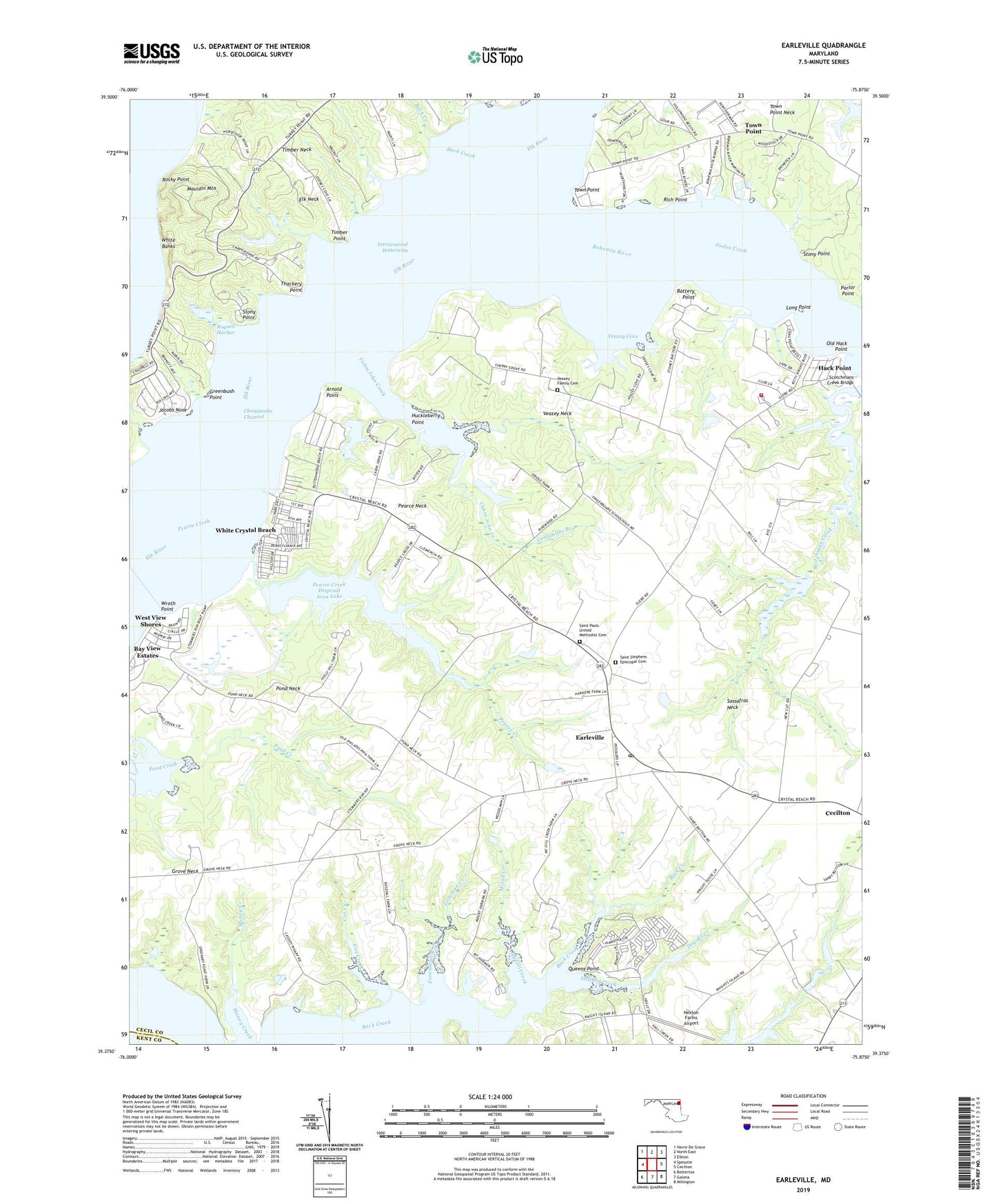
2023 topographic map quadrangle Earleville in the state of Maryland. Scale: 1:24000. Based on the newly updated USGS 7.5' US Topo map series, this map is in the following counties: Cecil, Kent. The map contains contour data, water features, and other items you are used to seeing on USGS maps, but also has updated roads and other features. This is the next generation of topographic maps. Printed on high-quality waterproof paper with UV fade-resistant inks.
Quads adjacent to this one:
West: Spesutie
Northwest: Havre De Grace
North: North East
Northeast: Elkton
East: Cecilton
Southeast: Millington
South: Galena
Southwest: Betterton
This map covers the same area as the classic USGS quad with code o39075d8.
Contains the following named places: Antler Creek, Arnold Point, Back Creek, Battery Point, Battery Point Farms, Bay View Estates, Beach Fishery, Beaver Dam Fishery, Bohemia Acres, Bohemia Country Club, Bohemia River, Bohemia River Marina, Bohemia Vista Marina, Buttonwood Beach, Cabin John Creek, Camp Brisson, Camp Chesapeake, Camp Red Mill, Cassidy Wharf, Cassidy Wharf Farm, Chestnut Lane Farms, Collins Fishery, Cox Creek, Crawford Acres, District 1 Cecilton, Dowdel Creek, Downs Branch, Earleville, Earleville Post Office, Earleville Wildlife Management Area, Elk Neck State Park, Ford Farms, Ford Landing, Foreman Creek, Frazers Lake Dam, Goldsmiths Branch, Green Briar, Greenbush Point, Grove Neck, Grove Neck School, Hack Point, Hacks Point Acres, Hacks Point Fire Company, Hexton Farms Airport, Honeysuckle Knoll, Huckleberry Point, Indian Acres, Indian Cabin Fishery, Jacobs Nose, Jamisons School, John Town, Knight Island, Long Point, Long Point Marina, Mauldin Mountain, McGill Creek, Mill Pond, Morgan Creek, Mount Harmon, Mount Pleasant Farm, Mulberry Dock, Old Hack Point, Panagopulos Farm Pond Dam, Parlor Point, Pearce Creek, Pearce Creek Disposal Area Dam, Pearce Creek Disposal Area Lake, Pearce Neck, Pond Neck, Pooles Creek, Queens Point, Reybold Wharf, Rich Point, Richmonds Marina, Rocky Point, Rogues Harbor, Saint Marks Church, Saint Pauls Church, Saint Pauls United Methodist Cemetery, Saint Stephens Church, Saint Stephens Episcopal Cemetery, Sandy Hill Camp, Sassafras Neck, Sassafras Neck Methodist Church, Scotchmans Creek Bridge, Scotchmans Glen, Snow Hill, Stemmers Run Wildlife Management Area, Stony Point, Sunset Point, Sweet Potato Creek, Thackery Point, The Woods of Town Point, Timber Neck, Timber Point, Tower Point, Town Point, Town Point Methodist Church, Town Point Neck, Two Rivers, Two Rivers Marina, Veazey Cove, Veazey Family Cemetery, Veazey Fishery, Veazey Neck, Wapiti Creek, West View Shores, White Banks, White Crystal Beach, Wil-O-Mar Farms, Wilsons Fishery, Wroth Point, ZIP Codes: 21919, 21930