MyTopo
Spesutie Maryland US Topo Map
Couldn't load pickup availability
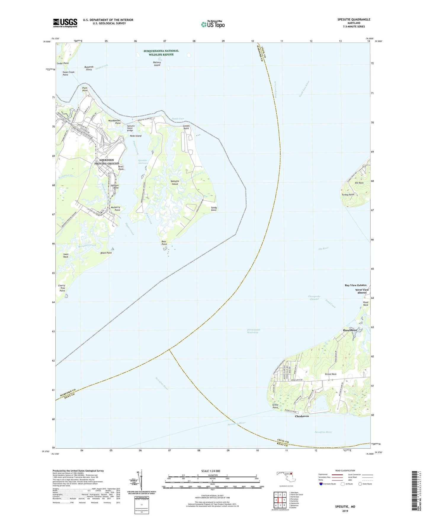
2023 topographic map quadrangle Spesutie in the state of Maryland. Scale: 1:24000. Based on the newly updated USGS 7.5' US Topo map series, this map is in the following counties: Harford, Cecil, Kent. The map contains contour data, water features, and other items you are used to seeing on USGS maps, but also has updated roads and other features. This is the next generation of topographic maps. Printed on high-quality waterproof paper with UV fade-resistant inks.
Quads adjacent to this one:
West: Perryman
Northwest: Aberdeen
North: Havre De Grace
Northeast: North East
East: Earleville
Southeast: Galena
South: Betterton
Southwest: Hanesville
This map covers the same area as the classic USGS quad with code o39076d1.
Contains the following named places: Back Creek, Battery Island, Bear Point, Black Point, Brier Point, Buzzards Glory, Cedar Point, Cherry Tree Point, Chesapeake Haven, Chesapeake Isle, Cheshaven, Cranberry Fishery, Dipper Creek, Elk River, Fishing Battery Lighthouse, Grove Point, Grove Point Disposal Area Dam, Grove Point Disposal Area Lake, Grove Point Fishery, Grove Point Girl Scout Camp, Grove Point Wildlife Sanctuary, Hazelmoor, Johnson Point, Little Mosquito Creek, Locust Point, Money Land Fishery, Mosquito Creek, Mulberry Point, Neds Island, Plum Point, Pond Creek, Sands Cove, Sandy Point, Sassafras River, Snug Harbor Boy Scout Camp, Spesutie Island, Spesutie Island Bridge, Spesutie Narrows, Susquehanna National Wildlife Refuge, Swan Creek, Swan Creek Point, Turkey Point, Turkey Point Lighthouse, Woodpecker Point, Woodrest Creek