MyTopo
Gunpowder Neck Maryland US Topo Map
Couldn't load pickup availability
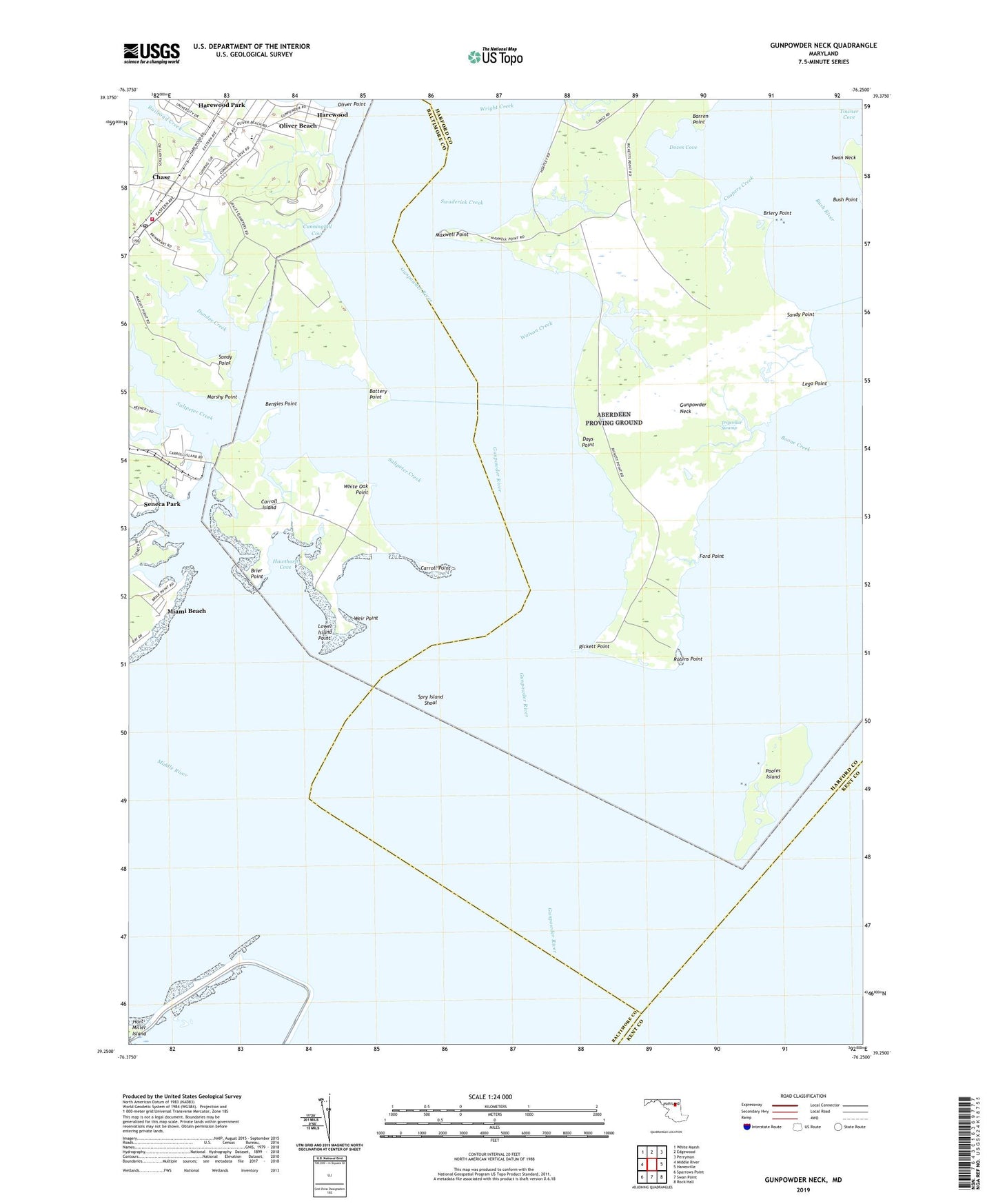
2023 topographic map quadrangle Gunpowder Neck in the state of Maryland. Scale: 1:24000. Based on the newly updated USGS 7.5' US Topo map series, this map is in the following counties: Harford, Baltimore, Kent. The map contains contour data, water features, and other items you are used to seeing on USGS maps, but also has updated roads and other features. This is the next generation of topographic maps. Printed on high-quality waterproof paper with UV fade-resistant inks.
Quads adjacent to this one:
West: Middle River
Northwest: White Marsh
North: Edgewood
Northeast: Perryman
East: Hanesville
Southeast: Rock Hall
South: Swan Point
Southwest: Sparrows Point
This map covers the same area as the classic USGS quad with code o39076c3.
Contains the following named places: Baltimore County Fire Department Chase - Station 54, Barren Point, Battery Point, Bengies Point, Boone Creek, Brier Point, Briery Point, Bush Point, Carroll Island, Carroll Point, Chase, Chase Post Office, Chase Station, Christian Fellowship Church, Coopers Creek, Cunninghill Cove, Days Point, Doves Cove, Dundee Creek, Dundee Natural Environment Area, Ford Point, Goose Harbor Marina, Grace Church of God, Graces Quarters, Gunpowder Neck, Gunpowder River, Gunpowder State Park, Harewood, Harewood Station, Hart-Miller Island, Hart-Miller Pleasure Islands Natural Resources Management Park, Hawthorn Cove, J and C Unity Christian Church, Lego Point, Lower Island Point, Marshy Point, Marshy Point Nursery, Maxwell Point, Miami Beach, Miami Beach Park, Oliver Beach, Oliver Beach Elementary School, Oliver Point, Phillips Island, Pooles Island, Pooles Island Light, Porters Seneca Park Marina, Rickett Point, Robins Point, Saltpeter Creek, Sandy Point, Seneca Creek, Seneca Park, Spry Island, Spry Island Shoal, Swaderick Creek, Tripcellar Swamp, Watson Creek, Weir Point, White Oak Point, Woods at Bay Country, Wright Creek