MyTopo
Swan Point Maryland US Topo Map
Couldn't load pickup availability
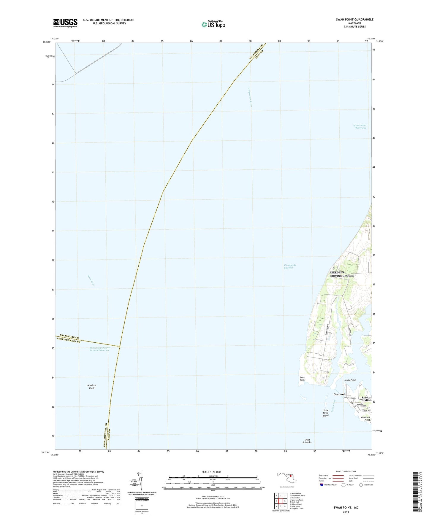
2023 topographic map quadrangle Swan Point in the state of Maryland. Scale: 1:24000. Based on the newly updated USGS 7.5' US Topo map series, this map is in the following counties: Kent, Baltimore, Anne Arundel. The map contains contour data, water features, and other items you are used to seeing on USGS maps, but also has updated roads and other features. This is the next generation of topographic maps. Printed on high-quality waterproof paper with UV fade-resistant inks.
Quads adjacent to this one:
West: Sparrows Point
Northwest: Middle River
North: Gunpowder Neck
Northeast: Hanesville
East: Rock Hall
Southeast: Langford Creek
South: Love Point
Southwest: Gibson Island
This map covers the same area as the classic USGS quad with code o39076b3.
Contains the following named places: Brewerton Channel Eastern Extension, Deep Landing, Gratitude, Gratitude Post Office, Gratitude Yacht Harbor, Harts Point, Little Neck Farms, Little Neck Island, Ninefoot Knoll, Osprey Point Marina, Swan Creek, Swan Creek Marina, Swan Island, Swan Point, Swan Point Bar, Tavern Creek, Windmill Point