MyTopo
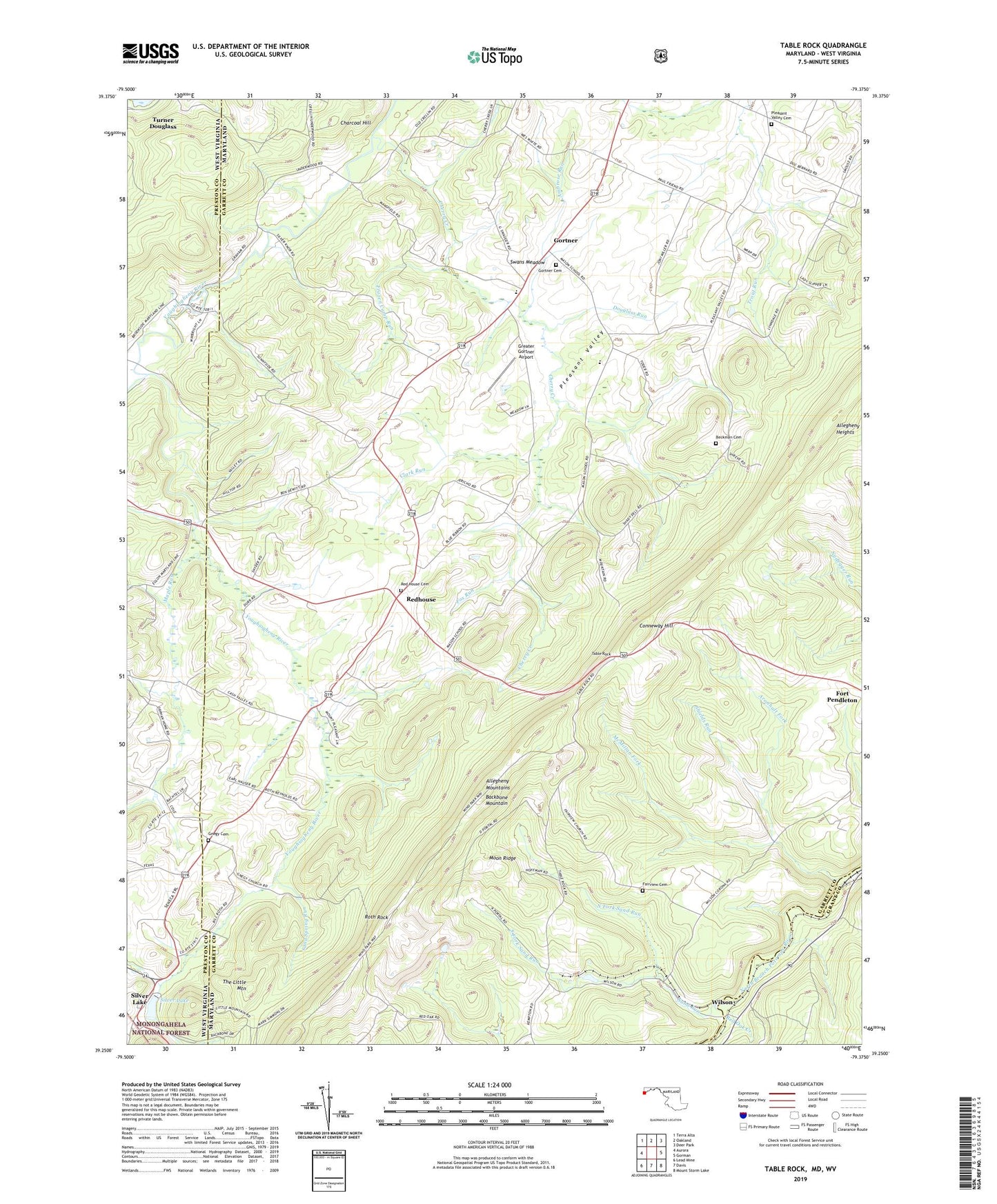
Table Rock Maryland US Topo Map
Couldn't load pickup availability
Also explore the Table Rock Forest Service Topo of this same quad for updated USFS data
2023 topographic map quadrangle Table Rock in the states of Maryland, West Virginia. Scale: 1:24000. Based on the newly updated USGS 7.5' US Topo map series, this map is in the following counties: Garrett, Preston, Grant. The map contains contour data, water features, and other items you are used to seeing on USGS maps, but also has updated roads and other features. This is the next generation of topographic maps. Printed on high-quality waterproof paper with UV fade-resistant inks.
Quads adjacent to this one:
West: Aurora
Northwest: Terra Alta
North: Oakland
Northeast: Deer Park
East: Gorman
Southeast: Mount Storm Lake
South: Davis
Southwest: Lead Mine
Contains the following named places: Allegheny Heights, Ambrose Run, Aronhalt Fork, Beckman Cemetery, Charcoal Hill, Cherry Creek, Clark Run, Conneway Hill, Corunna School, District 8 Red House, Douglass Run, Fairview Cemetery, Fairview Church, Fox Run, Frozen Camp Run, Glade View Church of the Brethren, Gnegy Cemetery, Gnegy Church, Gortner, Gortner Cemetery, Gortner Union Church, Greater Gortner Airport, Lynndale School, Maple Run, McMillan Fork, Moon Ridge, North Fork Sand Run, Pleasant Valley, Pleasant Valley Cemetery, Pleasant Valley Church, Pleasant Valley Greenhouse, Red House Cemetery, Red House Elementary School, Red Oak Creek, Redhouse, Rhine Creek, Roth Rock, Saint Johns Lutheran Church, Sand Run, Sand Spring Run, Shady Dell Grange Hall, Shields Run, Silver Lake, South Fork Sand Run, Sunnyside, Sunnyside Grange Hall, Sunnyside School, Swan Meadow K - 8 School, Swans Meadow, Table Rock, Triple Silo Farm, Wilson, Wilson Post Office