MyTopo
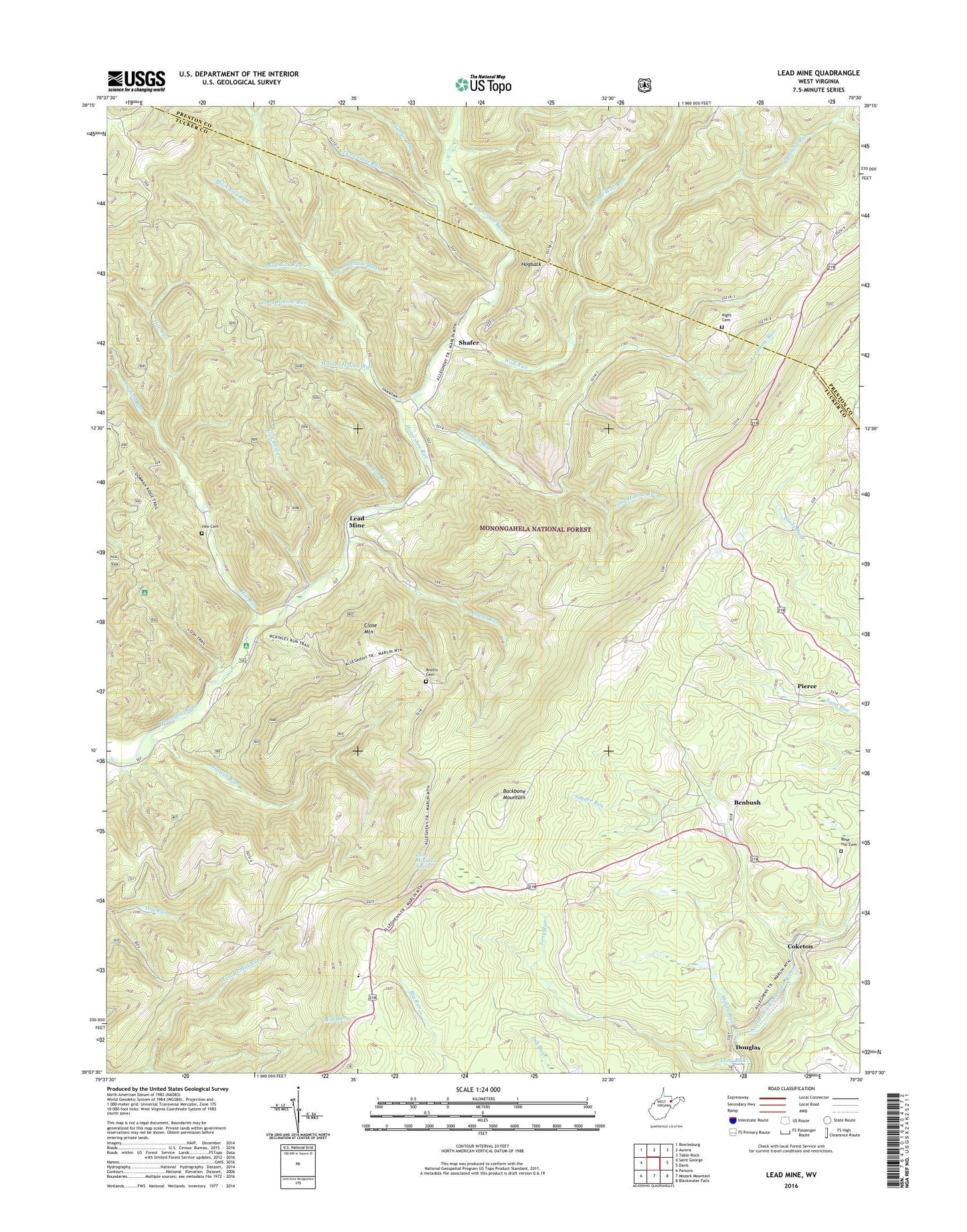
Lead Mine West Virginia US Topo Map
Couldn't load pickup availability
Also explore the Lead Mine Forest Service Topo of this same quad for updated USFS data
2023 topographic map quadrangle Lead Mine in the state of West Virginia. Scale: 1:24000. Based on the newly updated USGS 7.5' US Topo map series, this map is in the following counties: Tucker, Preston. The map contains contour data, water features, and other items you are used to seeing on USGS maps, but also has updated roads and other features. This is the next generation of topographic maps. Printed on high-quality waterproof paper with UV fade-resistant inks.
Quads adjacent to this one:
West: Saint George
Northwest: Rowlesburg
North: Aurora
Northeast: Table Rock
East: Davis
Southeast: Blackwater Falls
South: Mozark Mountain
Southwest: Parsons
This map covers the same area as the classic USGS quad with code o39079b5.
Contains the following named places: Benbush, Black Lick Run, Blackwater Wildlife Management Area, Bonifield Run, Cannon School, Close Mountain, Close Mountain School, Close Mountain Spring, Coketon, Douglas, Evans Mill, Fairfax District, Fairfax Quarry, Forty Three, Hickory Grove School, Hile Cemetery, Hile Run, Hogback, Horseshoe YMCA Camp, Horseshore Recreation Site, Kight Cemetery, Knotts Family Cemetery, Laurel Run, Lead Mine, Leadmine Run, Left Branch Mill Run, Lick Drain, Lime Hollow Run, Long Hollow Run, Long Run, Lynn Run, Maxwell Run, Middle Run, Mount Grove Church, Mount Hope School, Mount Olive Church, Mud Lick Run, North Branch Wolf Run, Pierce, Pine Grove School, Rams Hollow Run, Rose Hill Cemetery, Sell School, Shafer, Shaffertown School, Snyder Run, Stanbaugh School, Sugarland Church, Sugarland School, Tanner Run, Tucker County Ambulance Authority Squad 54734, Tucker County High School, Twelvemile Run, Walnut Hollow Run, Wolf Run, ZIP Code: 26292