MyTopo
Union Bridge Maryland US Topo Map
Couldn't load pickup availability
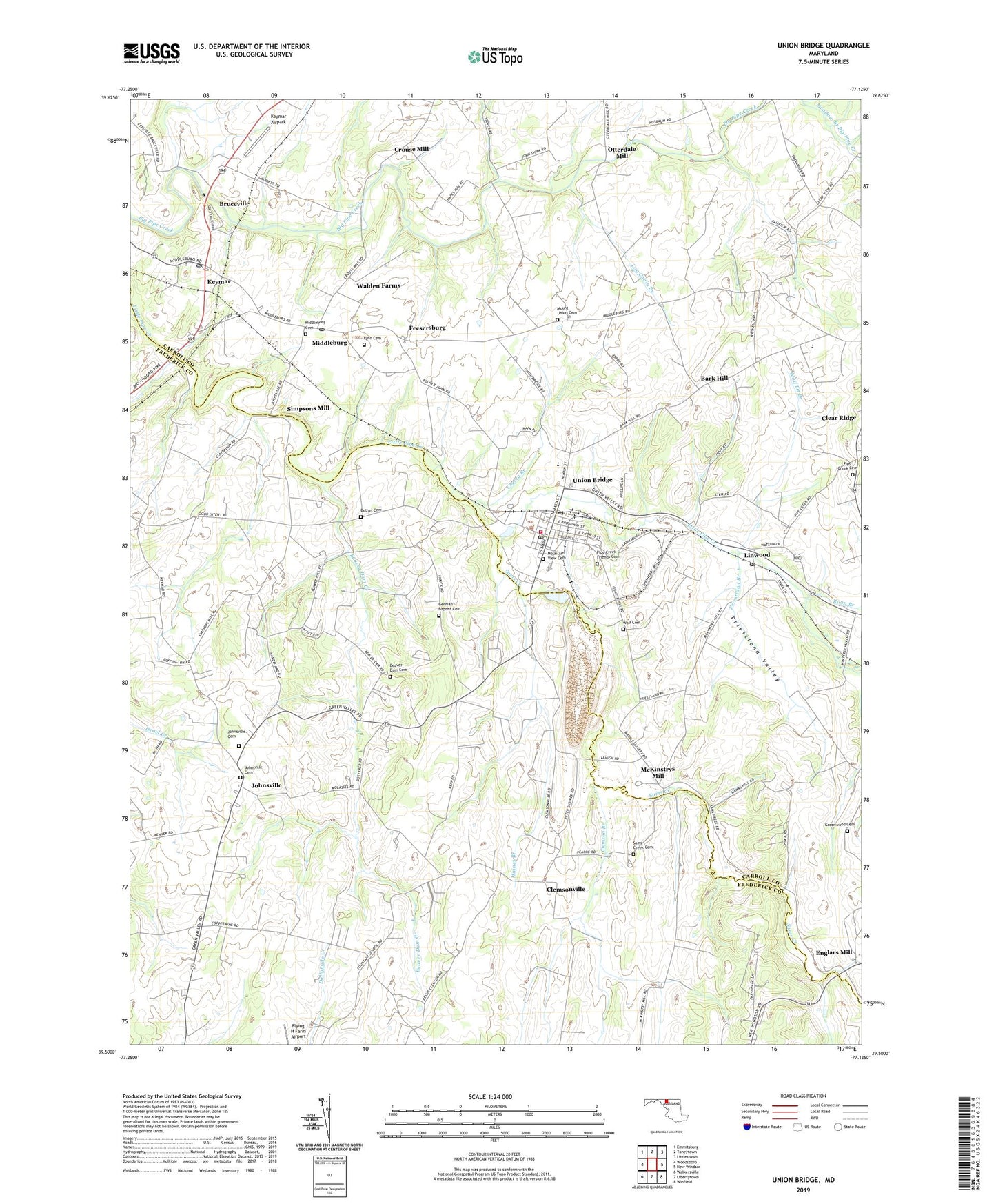
2023 topographic map quadrangle Union Bridge in the state of Maryland. Scale: 1:24000. Based on the newly updated USGS 7.5' US Topo map series, this map is in the following counties: Carroll, Frederick. The map contains contour data, water features, and other items you are used to seeing on USGS maps, but also has updated roads and other features. This is the next generation of topographic maps. Printed on high-quality waterproof paper with UV fade-resistant inks.
Quads adjacent to this one:
West: Woodsboro
Northwest: Emmitsburg
North: Taneytown
Northeast: Littlestown
East: New Windsor
Southeast: Winfield
South: Libertytown
Southwest: Walkersville
This map covers the same area as the classic USGS quad with code o39077e2.
Contains the following named places: Bark Hill, Bark Hill Bible Church, Bark Hill Church of God, Beaver Dam Cemetery, Beaver Dam Creek, Beaver Dam Presbyterian Church, Bellevue Heights, Bethel, Bethel Cemetery, Bethel Church, Bowens Chapel, Bowling Brook Preparatory School, Bruceville, Bruceville Station, Bunker Hill Estates, Carroll County Fire Department Station 8 Union Bridge Fire Department, Cedarbrook Farms, Cherry Branch, Church of the Brethren, Clemson Branch, Clemsonville, Coppermine Estates, Crouse Mill, District 10 Middleburg, District 12 Union Bridge, District 17 Johnsville, Edgewood, Edgewood School, Elmer A Wolfe Elementary School, Englars Mill, Fairview Acres, Fairview School, Feesersburg, Francis Scott Key High School, Frederick, Fues Mill, German Baptist Cemetery, German Baptist Church, Glenn Hill, Goodintent School, Gospel Spreading Church of God, Greenwood Associate Reformed Presbyterian Church, Greenwood Cemetery, Greenwood Church of the Brethren, Greenwood Schoolhouse, Grossnickle, Haines Branch, Hard Lodging Historic Site, Harmon Haven, Hidden Creek, Johnsville, Johnsville Cemetery, Johnsville Farms, Johnsville Methodist Church, Johnsville Methodist Protestant Church, Key Heights, Keymar, Keymar Airpark, Keymar Post Office, Keyview, Linwood, Linwood Brethren Church, Linwood Historic District, Linwood Post Office, Log Cabin Branch, Lovejoy Estates, Lynn Cemetery, M R P Airpark, McKinstrys Mill, Middleburg, Middleburg Cemetery, Middleburg Post Office, Middleburg United Methodist Church, Mount Olive Church, Mount Union Cemetery, Mount Union Church, Mountain View Cemetery, Mountain View School, Mounts Scenic Acres, Otterdale Mill, Pipe Creek, Pipe Creek Cemetery, Pipe Creek Church, Pipe Creek Friends Cemetery, Pipe Creek Friends Meeting House, Priestland Branch, Priestland School, Priestland Valley, Quaker Heights, Rabbit Run, Roop Branch, Saint James Lutheran Church, Sams Creek, Sams Creek Cemetery, Sams Creek Church, Sams Creek Methodist Protestant Church, Sharretts, Simpsons Mill, Stone Manor, Stultz Mill, Town of Union Bridge, Trevanion, Union Bridge, Union Bridge Baptist Church, Union Bridge Community Park, Union Bridge Post Office, Union Bridge Quarry, Union Bridge Town Hall, Union Bridge United Methodist Church, Union Hills, Unity Branch, Walden Farms, Walls Mill, Weishaars Mill, West View Terrace, Western Maryland Railroad Museum, Windsor View, Wolf Cemetery, Wolf Pit Branch, ZIP Code: 21791