MyTopo
Littlestown Pennsylvania US Topo Map
Couldn't load pickup availability
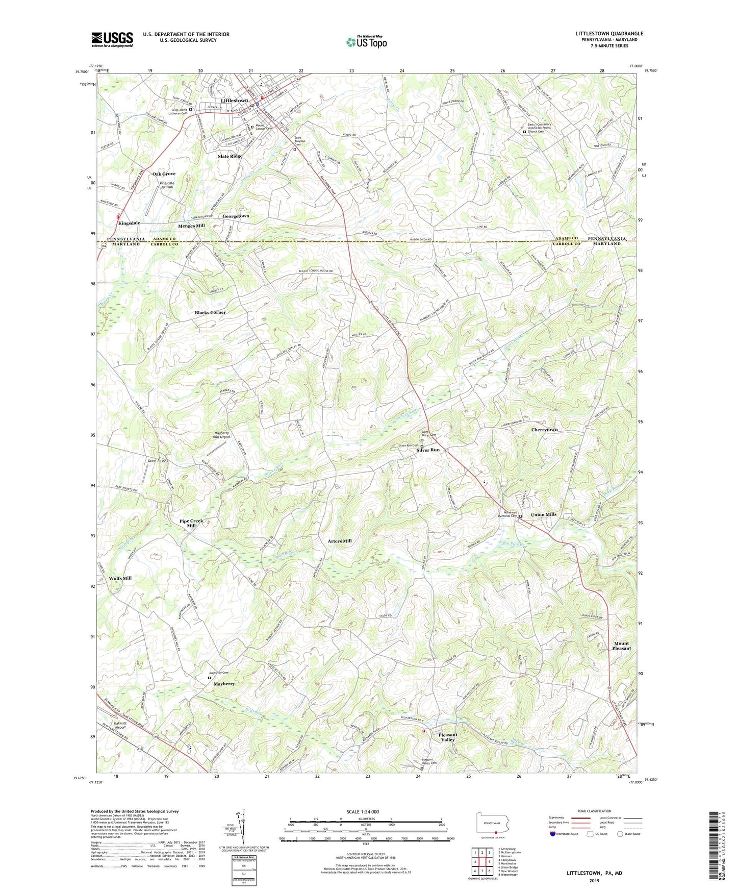
2023 topographic map quadrangle Littlestown in the states of Maryland, Pennsylvania. Scale: 1:24000. Based on the newly updated USGS 7.5' US Topo map series, this map is in the following counties: Adams, Carroll. The map contains contour data, water features, and other items you are used to seeing on USGS maps, but also has updated roads and other features. This is the next generation of topographic maps. Printed on high-quality waterproof paper with UV fade-resistant inks.
Quads adjacent to this one:
West: Taneytown
Northwest: Gettysburg
North: McSherrystown
Northeast: Hanover
East: Manchester
Southeast: Westminster
South: New Windsor
Southwest: Union Bridge
This map covers the same area as the classic USGS quad with code o39077f1.
Contains the following named places: Allandale, Alpha Fire Company 1 Station 20, Arters Mill, Arters Mill Estates, Arundel Volunteer Fire Department, Arundel Volunteer Fire Department Company 7, Babylon Heights, Barts - Centenary United Methodist Church Cemetery, Barts Church, Bear Branch, Bear Mount School, Bear Run, Black and Decker Manufacturing Company Dam, Blacks Corner, Blacks School, Borough of Littlestown, Breezewood Estates, Cambridge Estates, Carroll County Fire Department Station 6 Pleasant Valley Fire Company, Carroll County Sports Complex, Charles Carroll Elementary School, Cherry Grove School, Cherrytown, Chestnut Hill School, Colonial Hills, Deep Run, District 3 Myers, Doderer Mill, Faith Bible Church, Frosted Pumpkin Farms, Georgetown, Green Valley School, Greenfield, Greer Airport, Hahns Mill, Hidden Oaks, Hoot'N Hollow, Huckleberry Bottom, Humbert School, Humbert Schoolhouse Estates, Joan Lou Farms, Keystone Landfill, Kingsdale, Kingsdale Air Park, Kingsdale Volunteer Fire Company, Koontz Spring, Larox Miracle Land, Liebno Estates, Linden Estates, Little Acres, Littlestown, Littlestown Library, Littlestown Police Department, Littlestown Post Office, Locust Neck Heights, Makoutz Airport, Mayberry, Mayberry Bethel Church of God, Mayberry Cemetery, Mayberry Ridge, Mayberry Run Airport, Menges Mill, Morehead Memorial Cemetery, Morehead United Methodist Church, Mount Carmel Cemetery, Mount Pleasant, Mount Pleasant School, Mount Pleasant School House, Oak Grove, Oakgrove School, Pine Grove School, Piney Creek, Pipe Creek Mill, Pleasant Grove School, Pleasant Valley, Pleasant Valley Cemetery, Pleasant Valley Farms, Richardson Ridge, Runnymeade Summit, Runnymede Elementary School, Saint Aloysius Cemetery, Saint Johns Church, Saint John's Lutheran Cemetery, Saint Mary Evangelical Lutheran Church, Saint Marys Cemetery, Saint Marys Lutheran Church Cemetery, Saint Marys United Church of Christ, Saint Matthew Lutheran Church, School House Number 76, School House Number 96, Shoemakers Lot, Shour Valley, Silver Hills, Silver Run, Silver Run Estates, Slate Ridge, Township of Germany, Twin Lakes, Union Mills, Union Mills Homestead Park, Wolfs Mill, ZIP Code: 21158