MyTopo
Cotuit Massachusetts US Topo Map
Couldn't load pickup availability
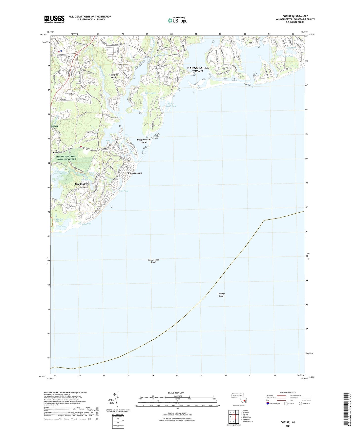
2021 topographic map quadrangle Cotuit in the state of Massachusetts. Scale: 1:24000. Based on the newly updated USGS 7.5' US Topo map series, this map is in the following counties: Barnstable. The map contains contour data, water features, and other items you are used to seeing on USGS maps, but also has updated roads and other features. This is the next generation of topographic maps. Printed on high-quality waterproof paper with UV fade-resistant inks.
Quads adjacent to this one:
West: Falmouth
Northwest: Pocasset
North: Sandwich
Northeast: Hyannis
East: Hyannis OE S
South: Edgartown OE E
Southwest: Edgartown
Contains the following named places: Abigails Brook, Anns Cove, Bluff Point, Cotuit, Cotuit Anchorage, Cotuit Bay, Cotuit Fire District, Cotuit Heliport, Cotuit Highlands, Cotuit Post Office, Crocker Neck, Daniels Island, Dead Neck, Dean Pond, Eel River, Eldridge Shoal, Flat Pond, Flat Pond Marshes, Fullers Marsh, Gooseberry Island, Great Neck, Great River Marshes, Handy Point, Holly Marsh, Jehu Pond, Jim Pond, Lewis Pond, Lily Pond, Little Island, Little River, Little Thatch Island, Lone Rock, Lowell Park, Mashpee Fire and Rescue Department, Mashpee National Wildlife Refuge, Mashpee Neck, Mashpee Neck Census Designated Place, Mashpee Police Department, Mashpee Post Office, Mashpee River, Maushop Village, Meadow Point, Neck Pond, New Seabury, New Seabury Census Designated Place, New Seabury Golf Club, Noisy Point, Ockway Bay, Osterville Grand Island, Oyster Harbors, Oyster Harbors Beach, Parker Pond, Pine Tree Corner, Pinquickset Cove, Pocknett Neck, Poppenesset Bird Sanctuary, Popponesset, Popponesset Bay, Popponesset Beach, Popponesset Census Designated Place, Popponesset Creek, Popponesset Island, Popponesset Island Census Designated Place, Punkhorn Point, Quaker Run, Rock Landing, Rushy Marsh Pond, Ryefield Point, Sampsons Island, Sampsons Island Sanctuary, Santuit River, Seabrook, Seabrook Census Designated Place, Seapuit Heliport, Seapuit River, Shoestring Bay, Simons Narrows, South Mashpee, Succonnesset Point, Succonnesset Shoal, Thatch Island, Tims Cove, Tims Point, Town of Mashpee, West Bay, West Bay Entrance Light, Wianno, Wianno Head, Wills Hill, Witch Pond, Wreck Shoal, ZIP Codes: 02635, 02649