MyTopo
Mount Holyoke Massachusetts US Topo Map
Couldn't load pickup availability
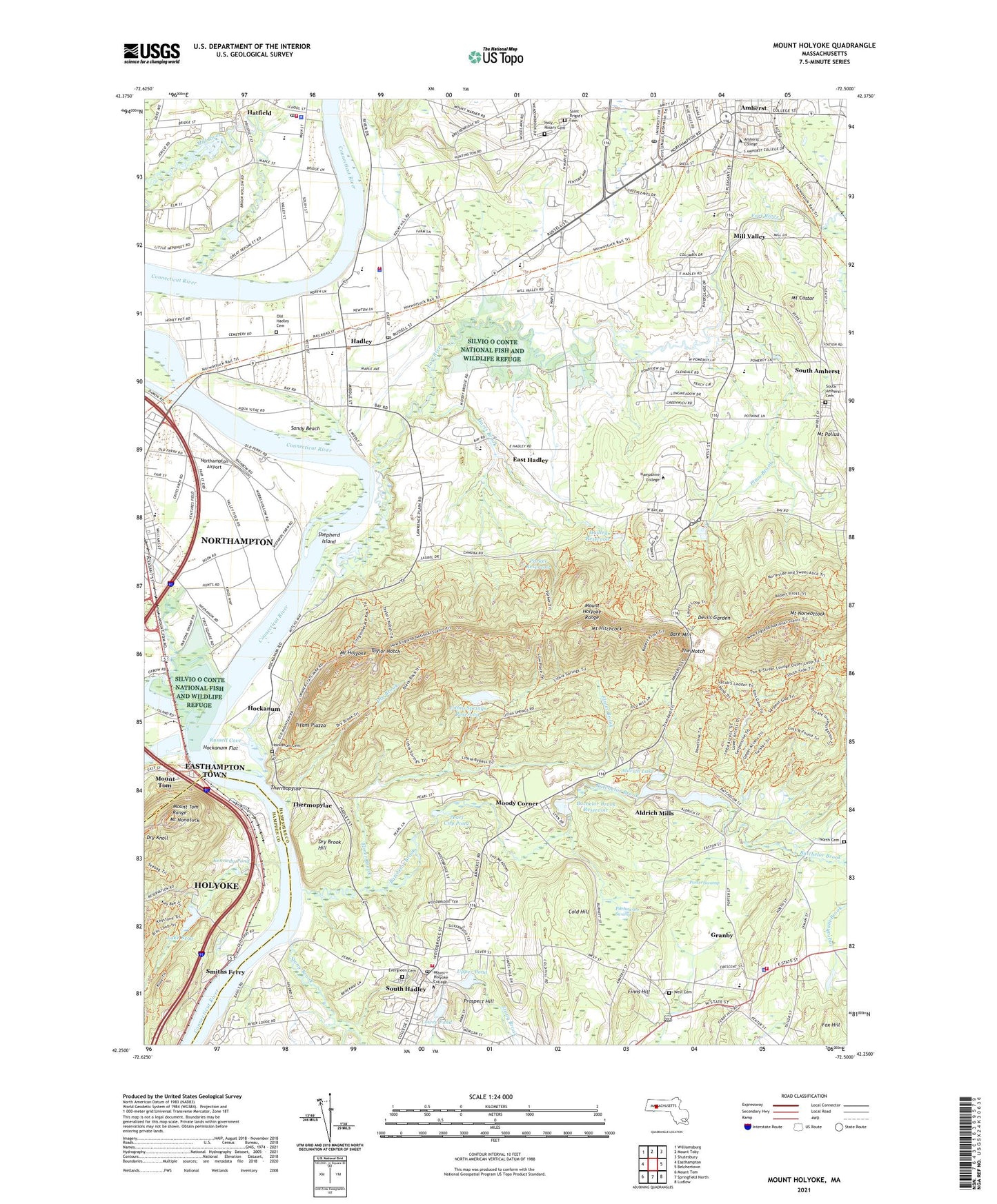
2024 topographic map quadrangle Mount Holyoke in the state of Massachusetts. Scale: 1:24000. Based on the newly updated USGS 7.5' US Topo map series, this map is in the following counties: Hampshire, Hampden. The map contains contour data, water features, and other items you are used to seeing on USGS maps, but also has updated roads and other features. This is the next generation of topographic maps. Printed on high-quality waterproof paper with UV fade-resistant inks.
Quads adjacent to this one:
West: Easthampton
Northwest: Williamsburg
North: Mount Toby
Northeast: Shutesbury
East: Belchertown
Southeast: Ludlow
South: Springfield North
Southwest: Mount Tom
This map covers the same area as the classic USGS quad with code o42072c5.
Contains the following named places: Abbey Hall, Adele Simmons Hall, Aldrich Lake, Aldrich Lake Dam, Aldrich Mills, Alumni Gymnasium, Alumni House, American Legion Hall, Amherst College, Amherst Common, Amherst Golf Course, Amherst History Museum, Amherst Post Office, Amherst Shoppers Park, Amherst Shoppers Park Shopping Center, Appleton Hall, Arms Music Center, Atkins Farms, Bachelor Brook Reservoir, Bare Mountain, Barrett Hall, Batchelor Brook, Betty Shabazz Cultural Center, Blair Hall, Blanchard Campus Center, Bob Stiles House Museum, Boy Scout Camp, Brigham Hall, Buckland Hall, Buckley Recital Hall, Buczala Farm, Cage Building, Campus Plaza, Campus Plaza Shopping Center, Carr Laboratories, Center for Religious Life, Chapin Auditorium, Chapin Hall, Chapman Hall, Charles Drew House, Ciruti Center for Foreign Languages, Clapp Labs, Clark House, Cleveland Hall, Cohan Dormitory, Cold Hill, Cole Science Center, Converse Hall, Coolidge Hall, Crocker Farm Elementary School, Crossett Hall, Crown Athletic Center, Dakin House, Davenport Squash Courts, Davis Hall, DeBevoise Field House, Devils Garden, Dickinson Hall, Dry Brook, Dry Brook Hill, Dwight Hall, East Hadley, Eliot House, Elmer Brook, Elwell Island, Elwell State Park, Epstein Dam, Everett Wing Career Resource Center, Evergreen Cemetery, Fayerweather Hall, Finns Hill, Fish and Wildlife Center, Fort River, Fox Hill, Francis Perkins House, Franklin Patterson Hall, Gamble Auditorium, Garman House, Getel Amphitheater, Goodwin Memorial Library, Gorsy Child Study Center, Granby, Granby Census Designated Place, Granby Free Public Library, Granby Townhall, Groff Park, Grosvenor House, Grove Health Center, Hadley, Hadley Center Historic District, Hadley Farm Museum, Hadley Post Office, Hadley Reservoir, Hadley Town Hall, Hadley Village Barn Shops, Hadley Village Barn Shops Shopping Center, Ham Hall, Hamilton House, Hampshire College, Hampshire College Farm Center, Hampshire County Fairgrounds, Hampshire Mall Shopping Center, Harold F Johnson Library Center, Harts Brook, Hatfield, Hatfield Census Designated Place, Hatfield Center School, Hatfield Elementary School, Hatfield Post Office, Hatfield Public Library, Hatfield Town Hall, Hickory RIdge Country Club, Hitchcock Field, Hitchcock House, Hockanum, Hockanum Flat, Holy Rosary Cemetery, Holyoke Country Club, Hooker Auditorium, Hop Brook, Hopkins Academy, Humphries House, Ingraham Brook, James Hall, Jenkins Hall, Joseph Skinner Museum, Keefe Campus Center, Keefe Health Center, Kendall Sports Complex, Kennedy Pond, Kirby Theater, Laboratory Theater, LaFleur Airport, Lake Bray, Lake Bray Dam, Lebron-Wiggins-Pran Cultural Center, LeFrak Gymnasium, Leland House, Life Sciences Building, Lithia Springs Reservoir, Lithia Springs Reservoir Dam, Little Red Schoolhouse, Longsworth Art Village, Lord Jeffery Inn, Lower Pond, MacGregor Hall, Manhan River, Mary Lyon Hall, Mary Wooley Hall, Masters House, Mayo-Smith House, McCrays Farms, Mead Art Museum, Meed Hall, Memorial Field, Merrill Center, Merrill House, Miles-Smith Science Library, Mill River, Mill Valley, Milliken Hall, Montague Hall, Moody Corner, Moore Dormitory, Morgan Hall, Morrow Dormitory, Mount Castor, Mount Hitchcock, Mount Holyoke, Mount Holyoke College, Mount Holyoke College Art Museum, Mount Holyoke College Lower Pond Dam, Mount Holyoke College Upper Dam, Mount Holyoke Range, Mount Nonotuck, Mount Norwottock, Mount Pollux, Mount Tom, Mount Tom Range, Mount Tom State Reservation, Mountain Farms Mall, Mountain Farms Mall Shopping Center, New Directions School, Northampton Airport, Northampton School for Girls, Old Hadley Cemetery, Old Mill Pond, Old Mill Site Historic District, Parker Reservoir, Parker Reservoir Dam, Pearl City Pond, Pitchawam Swamp, Plum Brook, Porter Swamp, Pratt Field, Pratt Pool, Prospect Hill, Quenneville Dam, Russell Cove, Russell School, Saint Brigid's Cemetery, Sandy Beach, Sheldon Field, Shepherd Island, Skinner State Park, Small Ones Farm, Smith Academy, Smiths Ferry, South Amherst, South Amherst Census Designated Place, South Hadley, South Hadley Center School, South Hadley Post Office, Stony Brook, Talcott Aboretum, Taylor Notch, The Common School, The Notch, The Orchards Country Club, Thermopylae, Titans Piazza, Town of Amherst, Town of Granby, Town of Hadley, Town of South Hadley, Upper Pond, Valley Christian School, Village Commons Shopping Center, War Memorial, West Street School, Williams Street School, WMHC-FM (South Hadley), Woodbridge Street Historic District, ZIP Codes: 01035, 01075


