MyTopo
Newburyport East Massachusetts US Topo Map
Couldn't load pickup availability
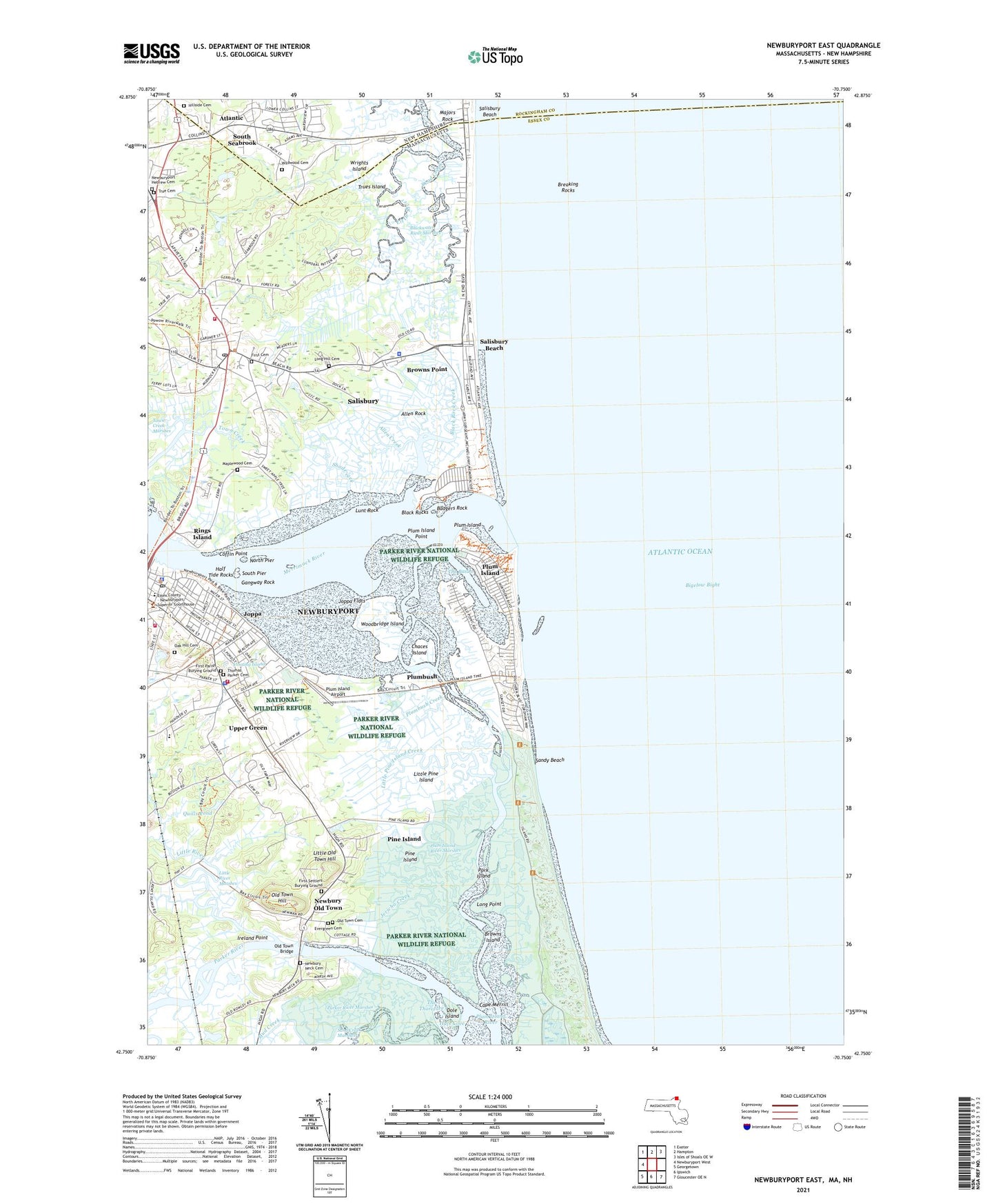
2024 topographic map quadrangle Newburyport East in the states of Massachusetts, New Hampshire. Scale: 1:24000. Based on the newly updated USGS 7.5' US Topo map series, this map is in the following counties: Essex, Rockingham. The map contains contour data, water features, and other items you are used to seeing on USGS maps, but also has updated roads and other features. This is the next generation of topographic maps. Printed on high-quality waterproof paper with UV fade-resistant inks.
Quads adjacent to this one:
West: Newburyport West
Northwest: Exeter
North: Hampton
Northeast: Isles of Shoals OE W
Southeast: Gloucester OE N
South: Ipswich
Southwest: Georgetown
Contains the following named places: Adams Campground, Allen Creek, Allen Rock, Atlantic, Badgers Rock, Bartlett Mall, Black Rock Creek, Black Rocks, Blackwater River Marshes, Breaking Rocks, Brown Square, Browns Island, Browns Point, Butlers Toothpick, Cape Merrill, Carolton Creek, Central Congregational Church, Chaces Island, Coffin House, Coffin House Museum, Coffin Point, Cushing, Cushing House, Dalton House, Dead Creek, Dole Island, First Cemetery, First Parish Burying Ground, First Religious Society Church, First Settlers Burying Ground, Floating Island, Fox Island Creek, Frog Pond, Gangway Rock, George W Brown School, Greater Newburyport Chamber of Commerce, Green Street Cemetery, Half Tide Rocks, Harbor School, Hate Cove, Healy House, Hillside Cemetery, Hope Chapel, Immaculate Conception School, Ireland Point, Isley House, Jackman School, Jericho Creek, Joppa, Joppa Flats, Joppan House, Kents Island, LIttle Old Town Hill, Little Pine Island, Little Pine Island Creek, Little River, Little River Marshes, Long Hill Cemetery, Long Point, Lunt Rock, Majors Rock, Maplewood Cemetery, Merrimack River, Morrill Creek, Mud Creek, Newbury Elementary School, Newbury Fire Department, Newbury Old Town, Newbury Police Department, Newburyport Fire Department, Newburyport Harbor Light, Newburyport Hebrew Cemetery, Newburyport Montessori School, Newburyport Police Department, Newburyport Post Office, Newburyport Public Library, North Pier, North Pier Light, Oak Hill Cemetery, Old Town Bridge, Old Town Cemetery, Old Town Hill, Outer Badger Rocks, Parker River, Parker River Marshes, Patmos, Pine Island, Pine Island Creek, Plum Island, Plum Island Airport, Plum Island Point, Plum Island River, Plum Island River Marshes, Plumbush, Plumbush Creek, Pork Island, Quills Pond, Rand Church, Rings Island, Salisbury, Salisbury Beach, Salisbury Beach State Reservation, Salisbury Census Designated Place, Salisbury Elementary School Library, Salisbury Fire Department, Salisbury Police Department, Salisbury Post Office, Salisbury Public Library, Sandy Beach, Sawyer Creek, Shad Creek, South Pier, South Seabrook, Sow and Pigs, Star of the Sea Chapel, The Basin, The Thorofare, Town Creek Marshes, Town of Newbury, Town of Salisbury, True Cemetery, Trues Island, Upper Green, Wildwood Cemetery, WNBP-AM (Newburyport), Woodbridge Island, Woodbridge School, Wrights Island, ZIP Codes: 01951, 01952


