MyTopo
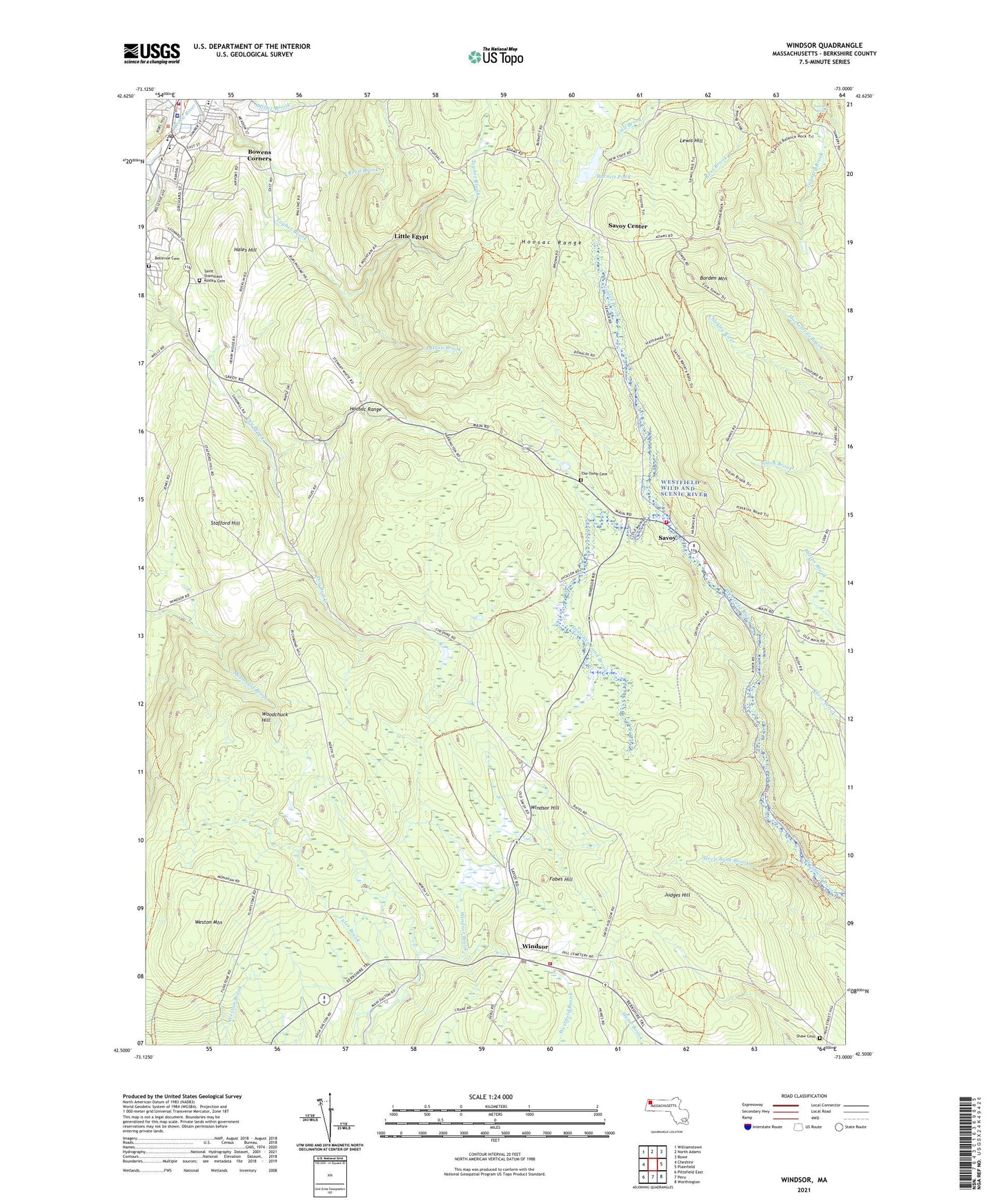
Windsor Massachusetts US Topo Map
Couldn't load pickup availability
2024 topographic map quadrangle Windsor in the state of Massachusetts. Scale: 1:24000. Based on the newly updated USGS 7.5' US Topo map series, this map is in the following counties: Berkshire. The map contains contour data, water features, and other items you are used to seeing on USGS maps, but also has updated roads and other features. This is the next generation of topographic maps. Printed on high-quality waterproof paper with UV fade-resistant inks.
Quads adjacent to this one:
West: Cheshire
Northwest: Williamstown
North: North Adams
Northeast: Rowe
East: Plainfield
Southeast: Worthington
South: Peru
Southwest: Pittsfield East
Contains the following named places: Adams, Adams Community Center, Adams Fire Department Alert Hose Company, Adams Police Department, Adams Post Office, Adams Townhall, Air Hill Farms Landing Strip, Baker Brook, Bellevue Cemetery, Borden Mountain, Bowens Corners, Burnett Pond, Center Brook, Chalet Wildlife Management Area, Crane School, Drowned Land Brook, Eugene D Moran Wildlife Management Area, First Baptist Church, Fobes Hill, Hales Hill, Hollow School, Hoosac Valley Middle and High School, Hoxie Brook, Judges Hill, Kendalls Landing Area, Lewis Hill, Little Egypt, Notchview Reservation, Notre Dame Church of Adams, Parker Brook, Patton Brook, Pecks Brook, Pioneer Monument, Plunkett Elementary School, Plunkett Medical Center, Reed Brook, Ross Brook, Rusek Whipple Square, Saint Marks Episcopal Church, Saint Stanislaus Kostka Cemetery, Saint Stanislaus Kostka Roman Catholic Church, Saint Stanislaus School, Savoy, Savoy Center, Savoy Fire Department, Savoy Hollow Brook, Savoy Mountain State Forest, Savoy Wildlife Management Area, Shaw Cemetery, South Adams Regional Hospital, Stafford Hill, Stafford Hill Wildlife Management Area, Steep Bank Brook, Summer Street Historic District, Susan B Anthony, Susan B Anthony Birthplace, Susan B Anthony Homestead, Susan B Anthony Resource Center, Tannery Falls, The Tomb Cemetery, Town of Savoy, Town of Windsor, Tyler Brook, Walker Lookout Tower, Weston Mountain, Windsor, Windsor Fire Department, Windsor Hill, Windsor James State Park, Windsor Police Department, Windsor Post Office, Windsor State Forest, Windsor Town Hall, Woodchuck Hill, ZIP Codes: 01220, 01256, 01270