MyTopo
Plainfield Massachusetts US Topo Map
Couldn't load pickup availability
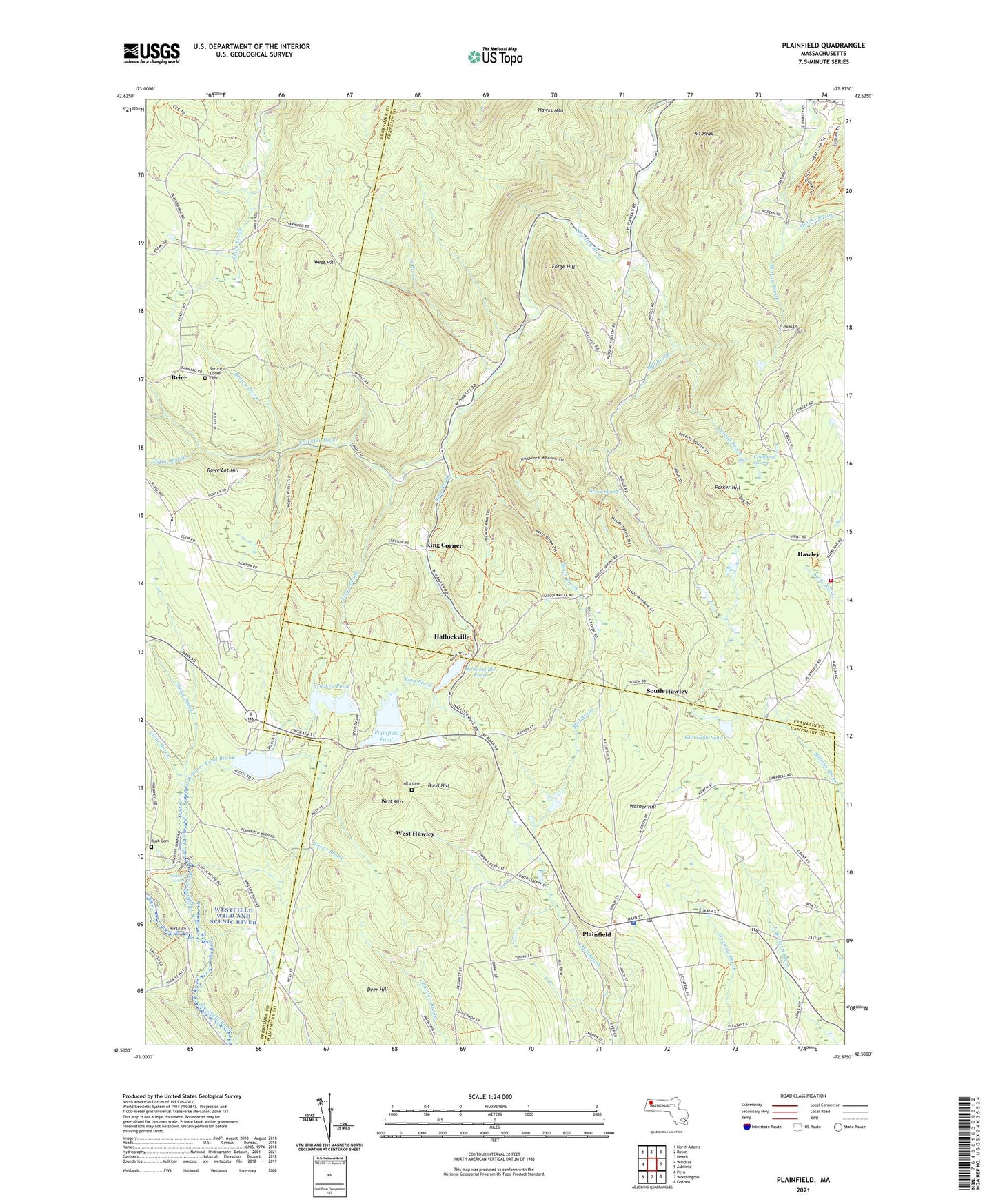
2024 topographic map quadrangle Plainfield in the state of Massachusetts. Scale: 1:24000. Based on the newly updated USGS 7.5' US Topo map series, this map is in the following counties: Franklin, Hampshire, Berkshire. The map contains contour data, water features, and other items you are used to seeing on USGS maps, but also has updated roads and other features. This is the next generation of topographic maps. Printed on high-quality waterproof paper with UV fade-resistant inks.
Quads adjacent to this one:
West: Windsor
Northwest: North Adams
North: Rowe
Northeast: Heath
East: Ashfield
Southeast: Goshen
South: Worthington
Southwest: Peru
Contains the following named places: Allis Cemetery, Basin Brook, Beaver Pond, Bond Hill, Brier, Brown Brook, Bush Cemetery, Clear Brook, Cranberry Swamp, Crooked Pond, Crooked Pond Dam, Deer Hill, Forge Hill, Fuller Brook, Gun Club Pond, Gun Club Pond Dam, Hallockville, Hallockville Pond, Hallockville Pond Dam, Hawks Brook, Hawks Mountain, Hawley, Hawley Fire Department, Horsefords Brook, King Brook, King Corner, Mill Brook, Moody Spring, Mount Peak, Nemasket Park Dam, Nemasket River Reservoir, North Brook, Oakmont Regional High School, Parker Hill, Phelps Brook, Plainfield, Plainfield Fire Department, Plainfield Fire EMS, Plainfield Police Department, Plainfield Pond, Plainfield Post Office, Plainfield Town Hall, Potash Brook, Prospect Street School, Rowe Lot Hill, Shaw Memorial Library, South Hawley, Spruce Corner Cemetery, Tilton Brook, Tower Brook, Town of Hawley, Town of Plainfield, Warner Hill, West Hawley, West Hill, West Mountain, Windsor Jambs, Windsor Jambs Brook, Windsor Pond Brook, ZIP Codes: 01070, 01339