MyTopo
Sandwich Massachusetts US Topo Map
Couldn't load pickup availability
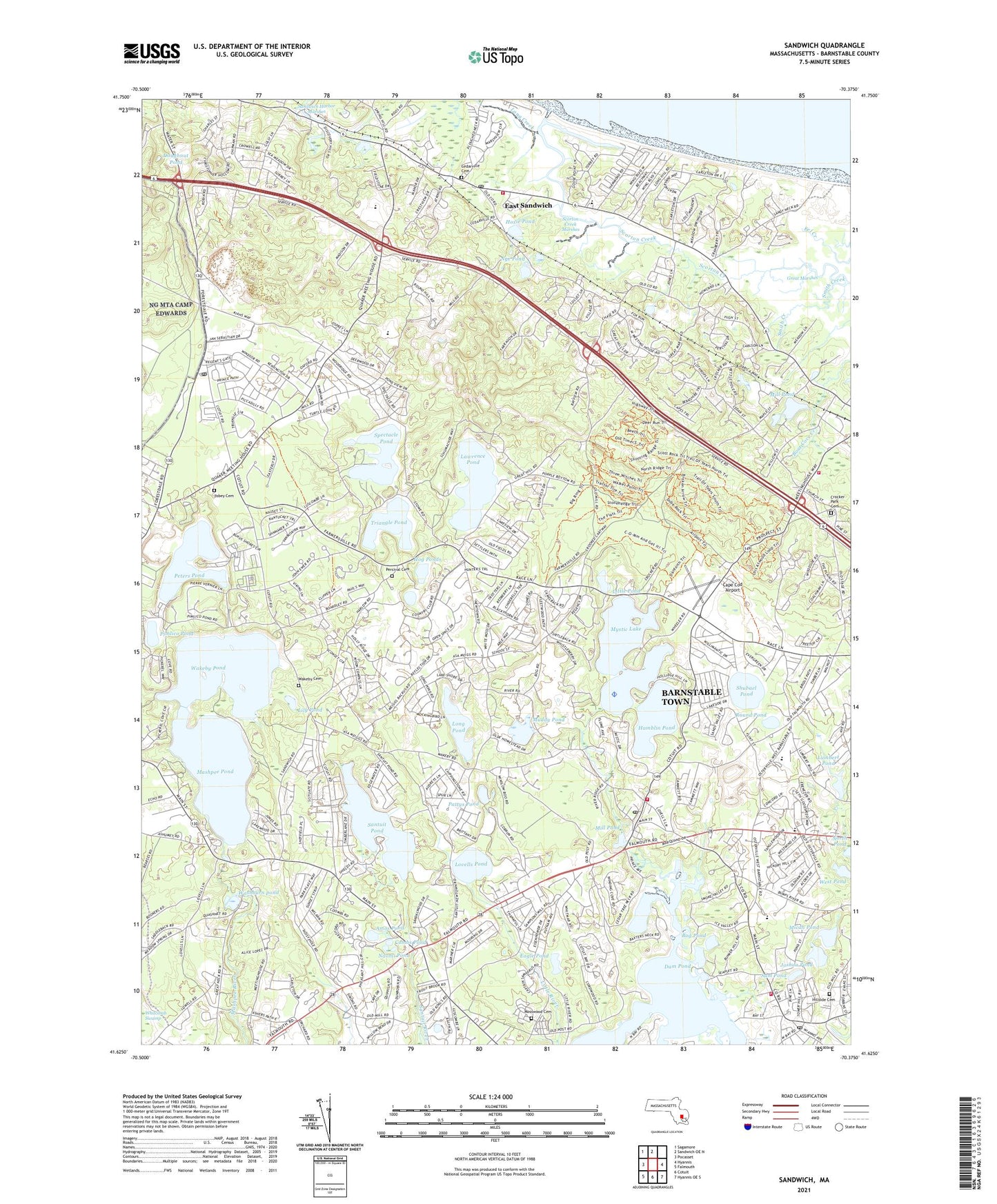
2021 topographic map quadrangle Sandwich in the state of Massachusetts. Scale: 1:24000. Based on the newly updated USGS 7.5' US Topo map series, this map is in the following counties: Barnstable. The map contains contour data, water features, and other items you are used to seeing on USGS maps, but also has updated roads and other features. This is the next generation of topographic maps. Printed on high-quality waterproof paper with UV fade-resistant inks.
Quads adjacent to this one:
West: Pocasset
Northwest: Sagamore
North: Sandwich OE N
East: Hyannis
Southeast: Hyannis OE S
South: Cotuit
Southwest: Falmouth
Contains the following named places: 4-H Club Camp, Amos Pond, Barnstable County Fairgrounds, Baxter Neck, Bayberry Christian School, Benjamin Marstons Mill Site, Bodfish Park, Bog Pond, Briants Neck, Camp Burgess, Camp Hayward, Camp Lyndon, Cape Cod Academy, Cape Cod Airport, Carsley Neck, Cedarville Cemetery, Centerville - Osterville - Marstons Mills Fire District Station 2, Centerville - Osterville - Marstons Mills Fire District Station 3, Cleveland Island, Combs Pond, Conaumet Cove, Conaumet Neck, Conaumet Point, Crocker Park Cemetery, Dam Pond, Dare School, Davis Elementary School, Discovery Hill, Doughnut Pond, Eagle Pond, East Sandwich, East Sandwich Census Designated Place, East Sandwich Post Office, East Sandwich Station, Eleanors Cove, Elephantback Hill, Farmersville, Forestdale, Forestdale Post Office, Fullers Point, Green Briar Jam Kitchen, Hamblin Pond, Hillside Cemetery, Hog Ponds, Hoxie Pond, Ishem Pond, Jefferson Island, Joshua Pond, Keith Island, Lawrence Pond, Lily Pond, Little Pond, Long Creek, Long Pond, Lovells Pond, Lowell Holly Reservation, Lumbert Pond, Marston Mills Heliport, Marstons Mill River, Marstons Mills, Marstons Mills Post Office, Mashpee, Mashpee Pond, Mashpee River Dam, Massachusetts State Fish Hatchery, Massachusetts State Game Farm, Micah Pond, Middle Pond, Mill Pond, Mosswood Cemetery, Muddy Pond, Mystic Lake, Naomi Pond, Newtown, North Bay, North Bay Heliport, Nye Family House, Nye Pond, Oak Ridge School Library, Old Briar Patch Trails, Old Indian Church, Old Parsonage, Old Quaker Meetinghouse, Osterville, Osterville Baptist Church, Osterville Free Library, Osterville Post Office, Pattys Pond, Percival Cemetery, Peters Pond, Pickerel Cove, Pimlico Pond, Pine Island, Pinkham Island, Plowed Neck, Point Isabella, Pondsville, Prince Cove, Rehabilitation Hospital of the Cape and Islands Medical Library, Riverview School, Round Pond, Saint Judes Chapel, Saint Marys Island, Sam Pond, Sams Cove, Sandwich Fire Department Station 2, Sandwich High School Library, Sandy Neck Beach, Santuit, Santuit Pond, Scorton Creek Marshes, Scorton Harbor, Scorton Hill, Scorton Neck Beach, Scorton Shores, Shubael Pond, Smith Creek, Spectacle Pond, Spring Hill, Telegraph Hill, The Springs, Tobey Cemetery, Town of Sandwich, Triangle Pond, Uncle Georges Cove, Wakeby, Wakeby Cemetery, Wakeby Pond, Washburn pond, West Barnstable Fire Department, West Parrish Church, West Pond, WSDH-FM (Sandwich), ZIP Codes: 02537, 02563, 02648, 02655