MyTopo
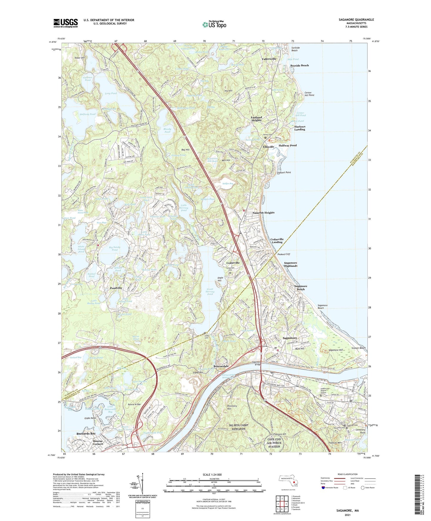
Sagamore Massachusetts US Topo Map
Couldn't load pickup availability
2024 topographic map quadrangle Sagamore in the state of Massachusetts. Scale: 1:24000. Based on the newly updated USGS 7.5' US Topo map series, this map is in the following counties: Plymouth, Barnstable. The map contains contour data, water features, and other items you are used to seeing on USGS maps, but also has updated roads and other features. This is the next generation of topographic maps. Printed on high-quality waterproof paper with UV fade-resistant inks.
Quads adjacent to this one:
West: Wareham
Northwest: Plymouth
North: Manomet
East: Sandwich OE N
Southeast: Sandwich
South: Pocasset
Southwest: Onset
This map covers the same area as the classic USGS quad with code o41070g5.
Contains the following named places: Bass Creek, Bay Hill, Bay View Cemetery, Bayside Beach, Bennett Pond, Big Rocky Pond, Big Sandy Pond, Black Jimmy Pond, Black Pond, Bloody Pond, Bourne Bridge, Bourne Corners, Bourne Fire Department Station 3, Bourne High School, Bournedale, Briggs Reservoir, Burgess Museum, Buttermilk Bay, Buzzards Bay Census Designated Place, Camp Baird, Camp Bournedale, Camp Child, Camp Clark, Camp Dennen, Camp Massasoit, Cape Cod Canal, Cape Cod Canal Range Light, Cedarville, Cedarville Cemetery, Cedarville Landing, Cemetery Point, Center Hill Point, Center Hill Pond, Century Bogs, Cotton Pond, Covel Pond, Cranberry Hill Organic Farm, Dexter Grist Mill, Dierks Pond, Dillingham House, Discovery Hill, Dugway Pond, Eagle Hill, East Boat Basin, Eastland Heights, Elbow Pond, Ellis Bog, Ellis House, Ellis Pond, Ellisville, Ellisville Harbor, Ellisville Harbor State Park, Ellisville Landing, Ezekiel Pond, Faunce Church, Faunces Mountain, Flat Swamp, Flatrock Hill, Foundry Pond, Freeman Cemetery, Gallows Pond, Garland Bog, Gibbs Bog, Gibbs Narrows, Gibbs Neck, Gibbs Pond, Goat Pasture Pond, Grassy Pond, Great Herring Pond, Great Maring Pond, Halfway Pond, Harlow - Savery Cemetery, Harlows Landing, Hathaway Pond, Hedges Bog, Hedges Pond, Heritage Plantation of Sandwich, Herring River, Hio Hill, Horse Pond, Indian Cemetery, Island Pond, Jakes Pond, Lilly Pond, Little Buttermilk Bay, Little Duck Pond, Little Herring Pond, Little Long Pond, Little Rocky Pond, Little Sandy Pond, Long Duck Pond, Long Pond, Long Swamp, Lookout Point, Mare Pond, Morey Hole, Morton Pond, Moss Hill, Mountain Hill, Mountain Hill Bogs, Myles Standish State Forest, Nameloc Heights, Nightingale Pond, Nye Bog, Nye Bog Reservoir, Nye Bog Reservoir Dam, Peaked Cliff, Pickerel Pond, Plimoth Commons Mobile Home Park, Plymouth Fire Department Station 4, Plymouth Fire Department Station 6, Pondville, Queen Sewell Pond, Rocky Pond, Round Pond, Saddle and Pilgrim Graves, Sagamore, Sagamore Beach, Sagamore Beach Post Office, Sagamore Bridge, Sagamore Census Designated Place, Sagamore Elementary School, Sagamore Highlands, Sagamore Hill, Sagamore Post Office, Salt Pond, Sandwich Marina, Sandwich Post Office, Savery Grassy Pond, Savery Pond, Scusset Beach, Scusset Mill Creek, Scusset River, Shawme Lake, Shawme-Crowell State Forest, Ship Pond, Signal Hill, South Elementary School, Squaw Swamp, Storrow Camp, Surfside Beach, Tays Bog, The Baird Center, The Historical Museum, The Sandwich Town Hall, Tower Hill, Triangle Pond, Tuppers Creek, Vallersville, Wall Pond, Ware Bogs, Weeks Pond, White Island Bogs, White Island Pond, White Island Pond Dam, Whitecliff Country Club, Whites Pond, ZIP Codes: 02532, 02561, 02562


