MyTopo
Ware Massachusetts US Topo Map
Couldn't load pickup availability
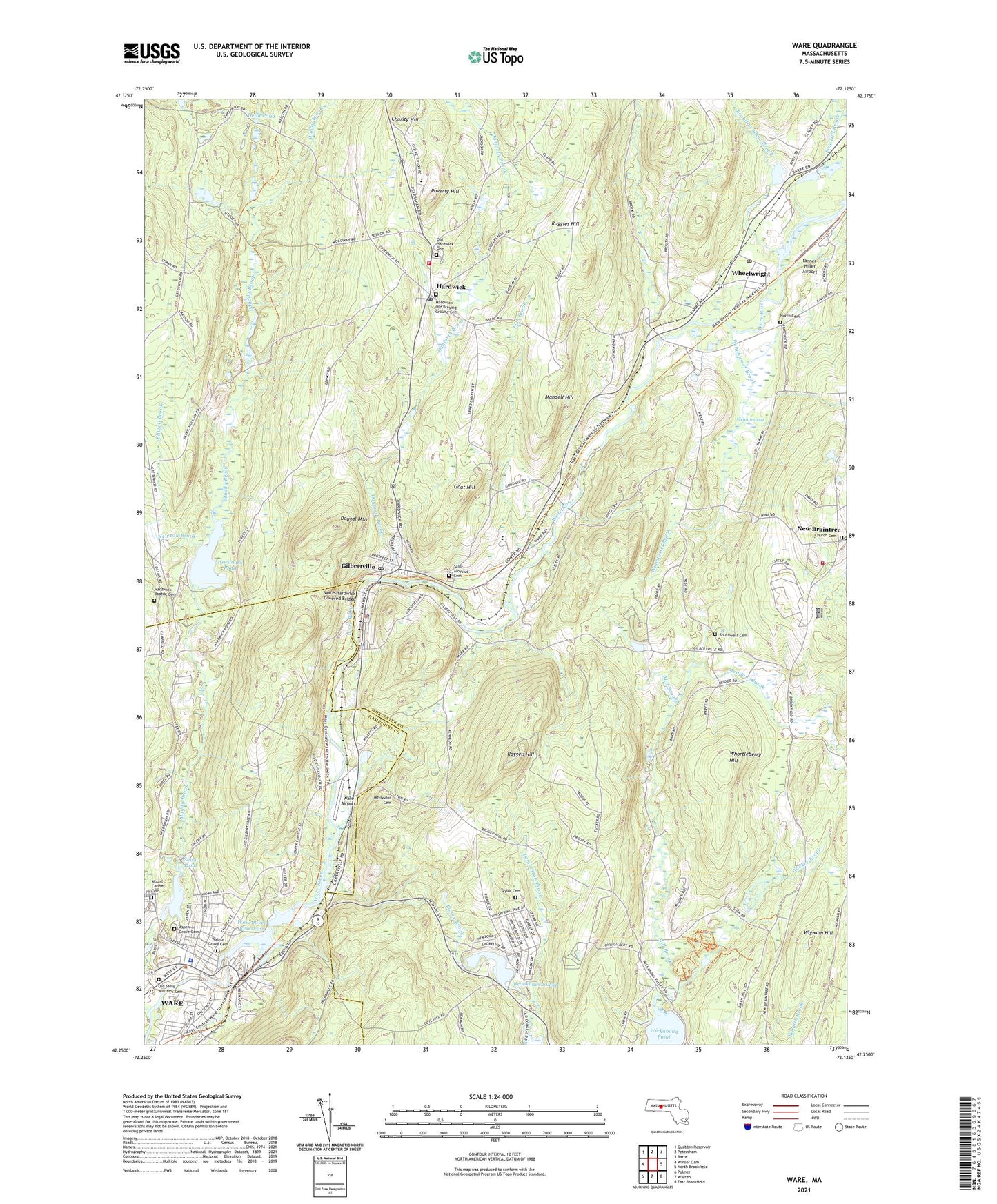
2021 topographic map quadrangle Ware in the state of Massachusetts. Scale: 1:24000. Based on the newly updated USGS 7.5' US Topo map series, this map is in the following counties: Worcester, Hampshire. The map contains contour data, water features, and other items you are used to seeing on USGS maps, but also has updated roads and other features. This is the next generation of topographic maps. Printed on high-quality waterproof paper with UV fade-resistant inks.
Quads adjacent to this one:
West: Winsor Dam
Northwest: Quabbin Reservoir
North: Petersham
Northeast: Barre
East: North Brookfield
Southeast: East Brookfield
South: Warren
Southwest: Palmer
Contains the following named places: Aspen Grove Cemetery, Baystate Mary Lane Hospital, Broadmeadow Brook, Brookhaven Lake, Brookhaven Lake Dam, Chaflin School, Charity Hill, Church Street Historic District, Danforth Brook, Dead Pond, Dougal Mountain, Eagle Hill School, Ellwell Brook, Fish Brook, Furnace, Gilbertville, Gilbertville Post Office, Goat Hill, Greenville Park, Hardwick, Hardwick Fire Department, Hardwick Police Station, Hardwick Pond, Hardwick Pond Dam, Hardwick Post Office, Hardwick Rescue and Emergency Squad, Lighthouse Baptist Church, Lower Canal Dam, Mandell Hill, Meadow Brook, Meninimisset, Methodist Cemetery, Moose Brook, Mount Carmel Cemetery, Mount Carmel Church, Muddy Brook, New Braintree, New Braintree Congregational Church, New Braintree Fire Station, Newton Brook, North Cemetery, Old Saint Williams Cemetery, Pierce Brook, Pine Hill Brook, Pioneer Valley Academy, Poverty Hill, Quabbin Valley Baptist Church, Ragged Hill, Ragged Hill Orchard, Richardson School, Ruggles Hill, Saint Aloysius Cemetery, Saint Aloysius School, Saint Mary School, Snow Pond, Snow Pond Dam, South Street School, Southwest Cemetery, Spaulding School, Sucker Brook, Tanner-Hiller Airport, Taylor Cemetery, Town of Hardwick, Town of New Braintree, Town of West Brookfield, Trinity Episcopal Church, United Church of Ware, Walnut Grove Cemetery, Ware, Ware Airport, Ware Census Designated Place, Ware Industries Main Upper Dam, Ware Middle School, Ware Millyard Historic District, Ware Police Department, Ware River Reservoir, Ware Town Hall, Ware-Hardwick Covered Bridge, West Brookfield State Forest, Wheelwright, Wheelwright Post Office, Whortleberry Hill, Wigwam Hill, Winimusset Brook, Young Mens Library Association, ZIP Codes: 01031, 01037, 01094, 01531