MyTopo
Warren Massachusetts US Topo Map
Couldn't load pickup availability
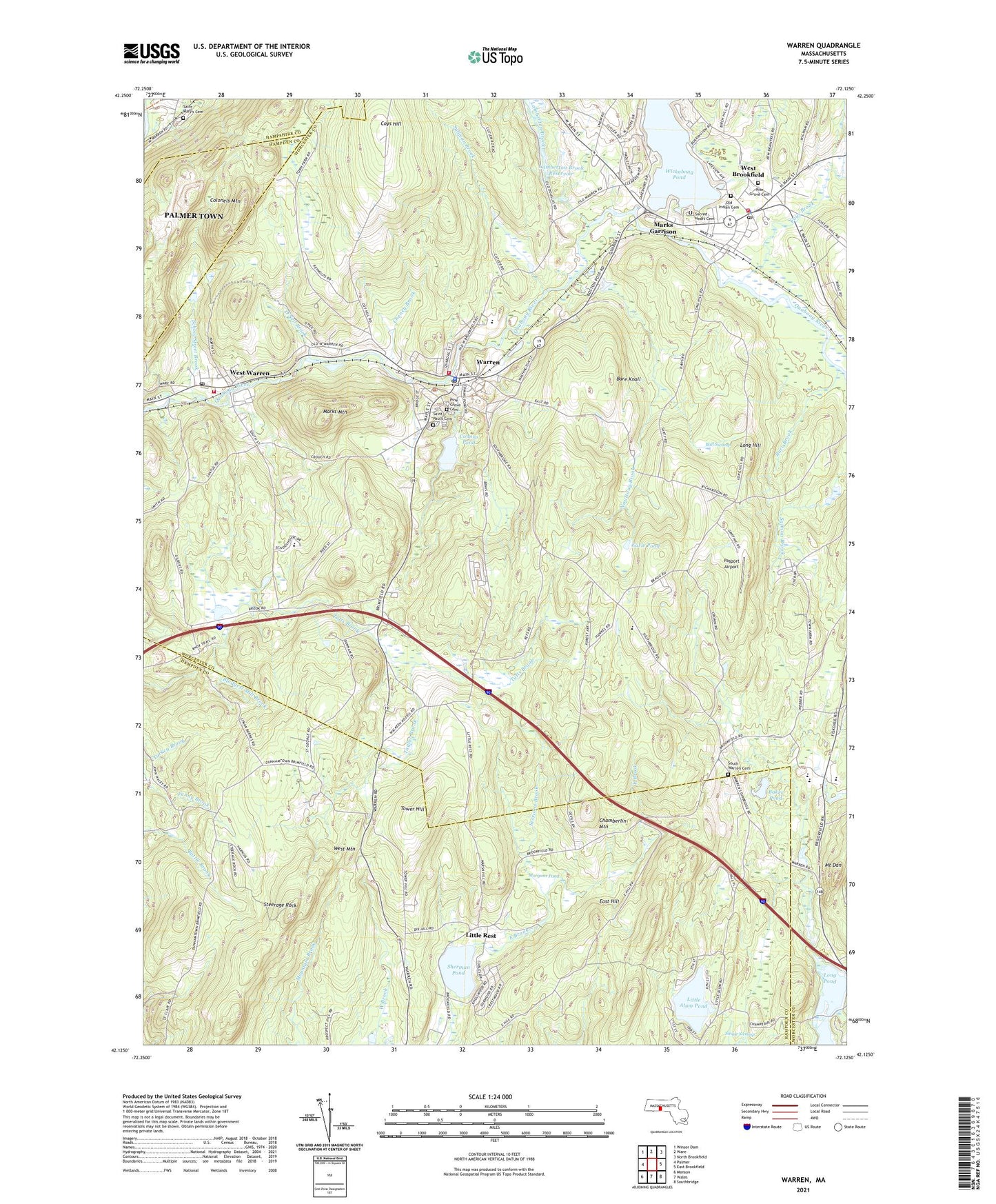
2024 topographic map quadrangle Warren in the state of Massachusetts. Scale: 1:24000. Based on the newly updated USGS 7.5' US Topo map series, this map is in the following counties: Worcester, Hampden, Hampshire. The map contains contour data, water features, and other items you are used to seeing on USGS maps, but also has updated roads and other features. This is the next generation of topographic maps. Printed on high-quality waterproof paper with UV fade-resistant inks.
Quads adjacent to this one:
West: Palmer
Northwest: Winsor Dam
North: Ware
Northeast: North Brookfield
East: East Brookfield
Southeast: Southbridge
South: Wales
Southwest: Monson
This map covers the same area as the classic USGS quad with code k42072b1.
Contains the following named places: Baker Pond, Ball Swamp, Bare Knoll, Beaudry Pond, Beaudry Pond Dam, Bradish Brook, Breezeland Orchards, Brookfield Mobile Home Park, Burr Brook, Chamberlin Mountain, Cheney Brook, Colonels Mountain, Comins Pond, Comins Pond Dam, Coys Brook, Coys Hill, Dean Park, Earle Pond, East Hill, East School, First Congregational Church, Lamberton Brook, Lamberton Brook Dam, Lamberton Brook Reservoir, Lamoureux Greenhouses, Little Alum Pond, Little Rest, Long Hill, Marks Garrison, Marks Mountain, Mill Brook, Morgans Pond, Mount Dan, Naultaug Brook, Old Indian Cemetery, O'Neil Brook, Pasport Airport, Pine Grove Cemetery, Quaboag Regional Middle High School, Quoboag River Reservoir, Sacred Heart Cemetery, Sacred Heart of Jesus Church, Saint Mary's Cemetery, Saint Paul's Cemetery, School Street Brook, Sessions Brook, Sherman Pond, South Warren Cemetery, Steerage Rock, Sullivan Brook, Tantasqua Regional High School, Tantasqua Regional Junior High School, Tantasqua Regional Vocational High School, Taylor Brook, Tower Hill, Town of Brimfield, Town of Warren, Tufts Brook, W D Cheney Dam, WARE-AM (Ware), Warren, Warren Census Designated Place, Warren Fire Department Ambulance, Warren Fire Department Station 1, Warren Fire Department Station 2, Warren Police Department, Warren Post Office, West Brookfield, West Brookfield Census Designated Place, West Brookfield Center Historic District, West Brookfield Elementary School, West Brookfield Fire Department, West Brookfield Police Department, West Brookfield Post Office, West Brookfield Rescue Squad, West Brookfield Town Hall, West Mountain, West Warren, West Warren Census Designated Place, West Warren Mill Pond Dam, West Warren Post Office, Wickaboag Pond, WYDN-TV (Worcester), ZIP Codes: 01010, 01083, 01092, 01585