MyTopo
West Granville Massachusetts US Topo Map
Couldn't load pickup availability
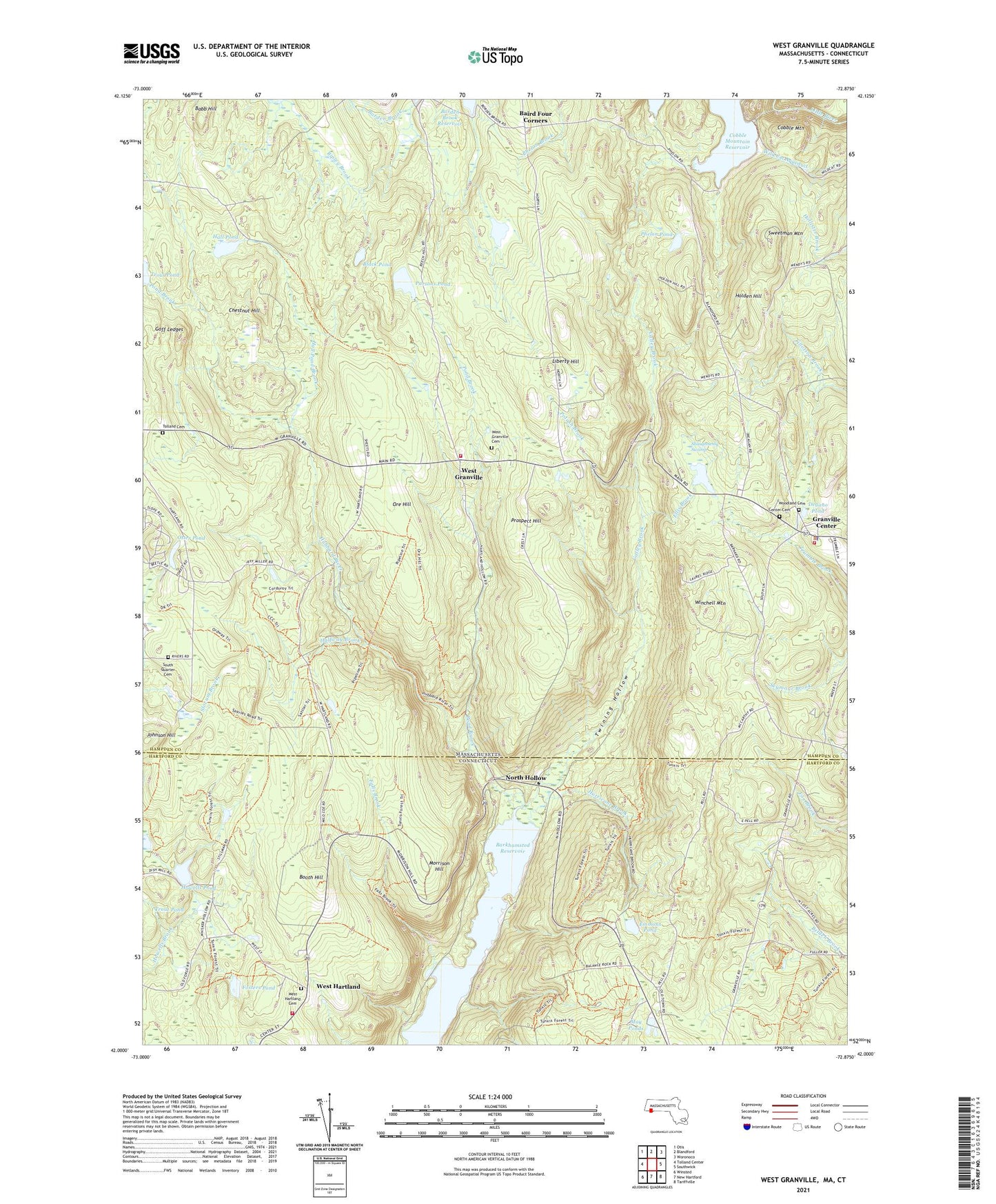
2024 topographic map quadrangle West Granville in the states of Massachusetts, Connecticut. Scale: 1:24000. Based on the newly updated USGS 7.5' US Topo map series, this map is in the following counties: Hampden, Hartford. The map contains contour data, water features, and other items you are used to seeing on USGS maps, but also has updated roads and other features. This is the next generation of topographic maps. Printed on high-quality waterproof paper with UV fade-resistant inks.
Quads adjacent to this one:
West: Tolland Center
Northwest: Otis
North: Blandford
Northeast: Woronoco
East: Southwick
Southeast: Tariffville
South: New Hartford
Southwest: Winsted
Contains the following named places: Babb Hill, Babcock Brook, Baird Four Corners, Barber Camp, Barkhamsted Reservoir, Black Pond, Booth Hill, Center Cemetery, Chestnut Hill, Cobble Mountain, Degano Pond, Ellis Brook, Emmons Pond, Falls Brook, Fosters Pond, Fosters Pond Dam, Goff Ledges, Granville Center, Granville Center Town Hall, Granville Fire Department Center Headquaters, Granville Fire Department Station 2, Granville Police Department, Granville State Forest, Halfway Brook, Hall Pond, Hall Pond Brook, Hartland Public Library, Holden Hill, Howells Pond, Howells Pond Dam, Hubbard River, Hurricane Brook, Johnson Hill, Liberty Hill, May Ponds, Morehaven Airport, Morrison Hill, North Hollow, Ore Hill, Otter Pond, Parsons Pond, Phelon Pond, Phelon Pond Dam, Pond Brook, Potash Brook, Prospect Hill, Ripley Brook, Shaughnessy Swamp, South Quarter Cemetery, Sweetman Mountain, Tolland Cemetery, Town of Granville, Town of Hartland, Trout Pond, Trout Pond Dam, Tunxis State Forest, Twining Hollow, Valley Brook, West Granville, West Hartland, West Hartland Cemetery, West Hartland Post Office, West Hartland Volunteer Fire Department, Wild Cat Aqueduct, Winchell Mountain, ZIP Codes: 01034, 06027, 06091