MyTopo
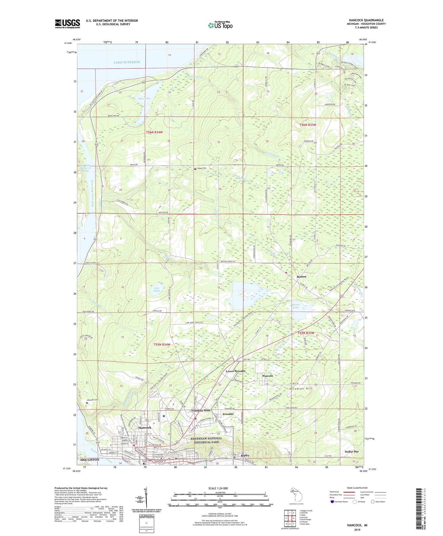
Hancock Michigan US Topo Map
Couldn't load pickup availability
2023 topographic map quadrangle Hancock in the state of Michigan. Scale: 1:24000. Based on the newly updated USGS 7.5' US Topo map series, this map is in the following counties: Houghton. The map contains contour data, water features, and other items you are used to seeing on USGS maps, but also has updated roads and other features. This is the next generation of topographic maps. Printed on high-quality waterproof paper with UV fade-resistant inks.
Quads adjacent to this one:
West: Oskar
North: Muggun Creek
Northeast: Ahmeek
East: Laurium
Southeast: Point Mills
South: Chassell
Southwest: South Range
This map covers the same area as the classic USGS quad with code o47088b5.
Contains the following named places: Arcadian, Arcadian Hill, Arens Fuel Company, Barkell Elementary School, Bear Lake, Begunn Creek, Birch Grove Mobile Home Park, Boston, Boston Creek, Boston Lake, Boston Station, Boston Volunteer Fire Department, Chapel of Saint Matthew, Church of Christ, Church of the Resurrection, City of Hancock, Clairmont Transfer Company, Cole Creek, Cole Creek Light, Copper Country Church of the Nazarene, Copper Country Concrete Company, Copper Country Historical Marker, Copper Country Learning Center, Demmon Post Office, Dollar Bay Census Designated Place, Finlandia Hall, Finlandia University, Finnish-American Heritage Center, Finnish-American Historical Archives, First United Methodist Church, Franklin Mine, Franklin Mine Post Office, Franklin Station, Glad Tidings Assembly of God Church, Gloria Dei Lutheran Church, Hancock, Hancock Campgrounds, Hancock County Fairgrounds, Hancock County Medical Care, Hancock Fire Department, Hancock Historical Marker, Hancock Middle and High School, Hancock Middle School, Hancock Police Department, Hancock Post Office, Hancock Station, Hoover Center, Keweenaw National Historical Park, Keweenaw Waterway, Kivi House, Lake Annie, Lakeside Cemetery, Lewer Pewabic, Lily Creek, Lily Pond, Lily Pond Harbor of Refuge, Lily Pond Leading Light, Lily Pond North Light, Lily Pond South Light, Lutheran Cemetery, Maki Oil Company, Mannerheim Hall, Marquette Medical Clinic, McLain State Park, Mercy Emergency Medical Services, Mercy Emergency Medical Services Hancock, Mount Ripley Ski Area, Nikander Hall, Old Main, Old Main Historical Marker, Paavo Nurmi Building, Paavola, Paavola Post Office, Pewabic, Portage Health Hospital - Hancock, Portage Lake Marina, Quincy - Franklin - Hancock Township Volunteer Fire Department, Quincy Mining Company, Range Oil and Gas Company, Ripley, Ripley Post Office, Ripley Station, Ripley Volunteer Fire Department, Rouleau Point Range, Saint Johns Creek, Saint Joseph Cemetery, Saints Peter and Paul Lutheran Church, Salo School, Salvation Army Church, Sevenmile Creek, Suomi College Historical Marker, Swedetown Creek, Terrace Park, Town Hall and Fire Hall Historical Marker, Township of Franklin, Township of Hancock, Township of Quincy, United States Coast Guard Station, Waasa Cemetery, Wargelin Hall, WCCY-AM (Houghton), WHDF Radio Tower (Grand Haven), WHTA-TV (Calumet), WOLF-FM (Houghton), WTHV-FM (Hancock), Yalmer Mattila Contracting Company, Zion Lutheran Church, ZIP Code: 49930


