MyTopo
Bad Axe East Michigan US Topo Map
Couldn't load pickup availability
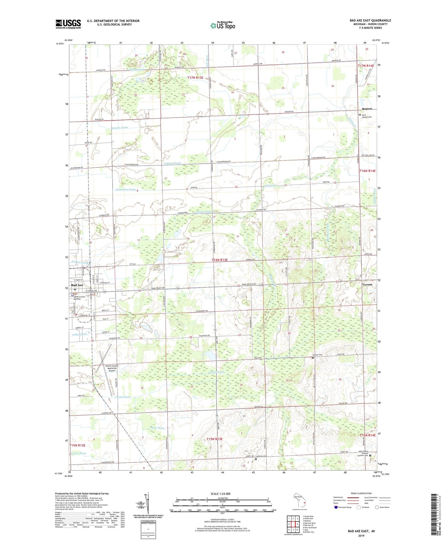
2019 topographic map quadrangle Bad Axe East in the state of Michigan. Scale: 1:24000. Based on the newly updated USGS 7.5' US Topo map series, this map is in the following counties: Huron. The map contains contour data, water features, and other items you are used to seeing on USGS maps, but also has updated roads and other features. This is the next generation of topographic maps. Printed on high-quality waterproof paper with UV fade-resistant inks.
Quads adjacent to this one:
West: Bad Axe West
Northwest: Kinde West
North: Kinde East
Northeast: Redman
East: Bad Axe SE
Southeast: Minden City
South: Ubly
Southwest: New Greenleaf
Contains the following named places: Bad Axe Area Fire Department, Bad Axe Church of Christ, Bad Axe City Hall, Bad Axe City Park, Bad Axe Museum, Bad Axe Police Department, Bad Axe Post Office, Bad Axe Public Library, Bad Axe Station, Bope Drain, Central Huron Ambulance Service, City of Bad Axe, Country Meadow Mobile Home Park, First Presbyterian Church, Grace Community Missionary Church, Holy Trinity Church, Hubbard Drain, Huron County Memorial Airport, Huron County Sheriff's Office, Linton Drain, Lutheran Cemetery, Mazure Drain, Most Holy Trinity Cemetery, Murray Drain, Nugents Dairy Farm, Philip Drain, R J Farms, Rapson, Rapson Post Office, Rapson School, Richardson Drain, Rochefort Farm, Sacred Heart Church, Saint Joseph Cemetery, Saint Joseph Church, Spring Creek Drain, Symons Drain, Thomas Farm, Township of Verona, United Methodist Church, Verona, Verona Cemetery, Verona Hills Golf Club, Verona Mills Post Office, Verona Mills School, Verona Township Hall, Wadsworth Post Office, Wadsworth Station, Wilcox Park, Willie Farms, ZIP Code: 48413