MyTopo
Bad Axe West Michigan US Topo Map
Couldn't load pickup availability
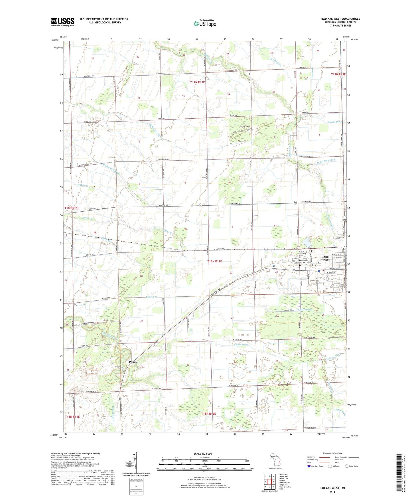
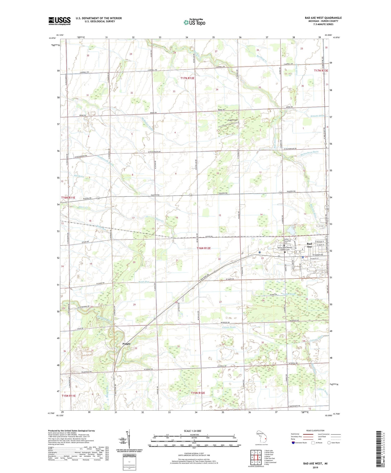
2023 topographic map quadrangle Bad Axe West in the state of Michigan. Scale: 1:24000. Based on the newly updated USGS 7.5' US Topo map series, this map is in the following counties: Huron. The map contains contour data, water features, and other items you are used to seeing on USGS maps, but also has updated roads and other features. This is the next generation of topographic maps. Printed on high-quality waterproof paper with UV fade-resistant inks.
Quads adjacent to this one:
West: Elkton
Northwest: Rush Lake
North: Kinde West
Northeast: Kinde East
East: Bad Axe East
Southeast: Ubly
South: New Greenleaf
Southwest: Gagetown
This map covers the same area as the classic USGS quad with code o43083g1.
Contains the following named places: Aquila Farms, Assembly of God Church, Bad Axe, Bad Axe Drain, Bad Axe High School, Bad Axe Intermediate School, Bad Axe Junior High School, Becking School, Big Burning Public School, Cameron Drain, Church of Jesus Christ of Latter Day Saints, Colfax Drain, Colfax School, Colfax Township Cemetery, Colfax Township Hall, Colona Drain, Engler Field, Errer Farms, First Baptist Church, Free Methodist Church, Grassmere Post Office, Grassmere Station, Greene Elementary School, Huron Community Fairgrounds, Huron County Medical Care Facility, Kingdom Hall, Lyndon Mobile Home Court, McKenzie School, Mclaren Thumb Region Hospital, McLean Drain, McMullen Drain, Michigan State Police Department, Miller Farms, Misty Meadows Mobile Home Park, Mount Forest Fire Station, Our Savior Lutheran Church, Pines Mobile Home Village, Popple, Popple Post Office, Ritter Farms, Sacred Heart Roman Catholic Cemetery, Saint Paul's Episcopal Church, Scott Farms, Seventh Day Adventist Church, Southworth Drain, Steciak Farms, Sunny Acres Nursing Center, Toner Farms, Township of Colfax, Victory in Christ Community Church, WLEW-AM (Bad Axe)