MyTopo
New Greenleaf Michigan US Topo Map
Couldn't load pickup availability
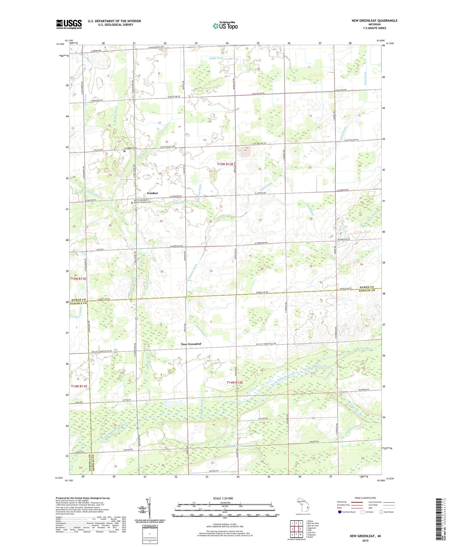
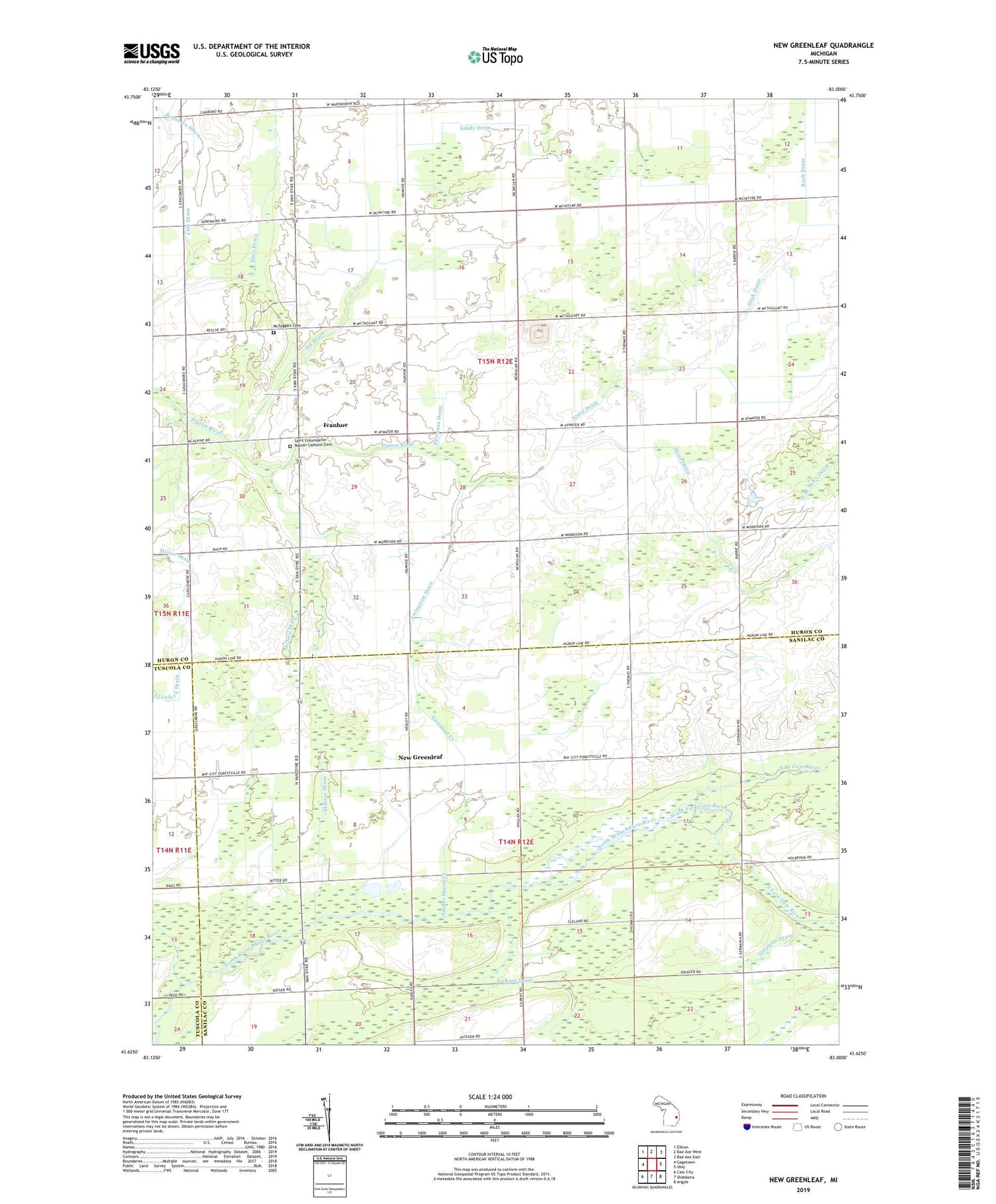
2023 topographic map quadrangle New Greenleaf in the state of Michigan. Scale: 1:24000. Based on the newly updated USGS 7.5' US Topo map series, this map is in the following counties: Huron, Sanilac, Tuscola. The map contains contour data, water features, and other items you are used to seeing on USGS maps, but also has updated roads and other features. This is the next generation of topographic maps. Printed on high-quality waterproof paper with UV fade-resistant inks.
Quads adjacent to this one:
West: Gagetown
Northwest: Elkton
North: Bad Axe West
Northeast: Bad Axe East
East: Ubly
Southeast: Argyle
South: Shabbona
Southwest: Cass City
This map covers the same area as the classic USGS quad with code o43083f1.
Contains the following named places: Appin Drain, Appin Post Office, Appin School, Batie School, Blair Drain, Clift Drain, Elk Drain, Faith Gospel Tabernacle Church, Fraser Church, Greenlead Station, Greenleaf Creek, Greenleaf Post Office, Holbrook Church, Holbrook Post Office, Holbrook School, Ivanhoe, Ivanhoe Post Office, Livingston Drain, McIntyre School, McNeil Drain, McTaggart Cemetery, New Greenleaf, New Life Ministries Church, North Branch Shier Drain, Northburns Post Office, Patterson Drain, Reid Drain, Saint Columbkille Church, Saint Columbkille Roman Catholic Cemetery, Sandy Drain, Sanilac Huron Creek, Sanilac Petroglyphs Historic State Park, Sanilac State Game Area, School Number 2, Shier Drain, Simpkins Drain, Skinner Drain, Slack Drain, South Fork Cass River, Stoner School, Township of Greenleaf, Township of Sheridan