MyTopo
Baraga Plains Michigan US Topo Map
Couldn't load pickup availability
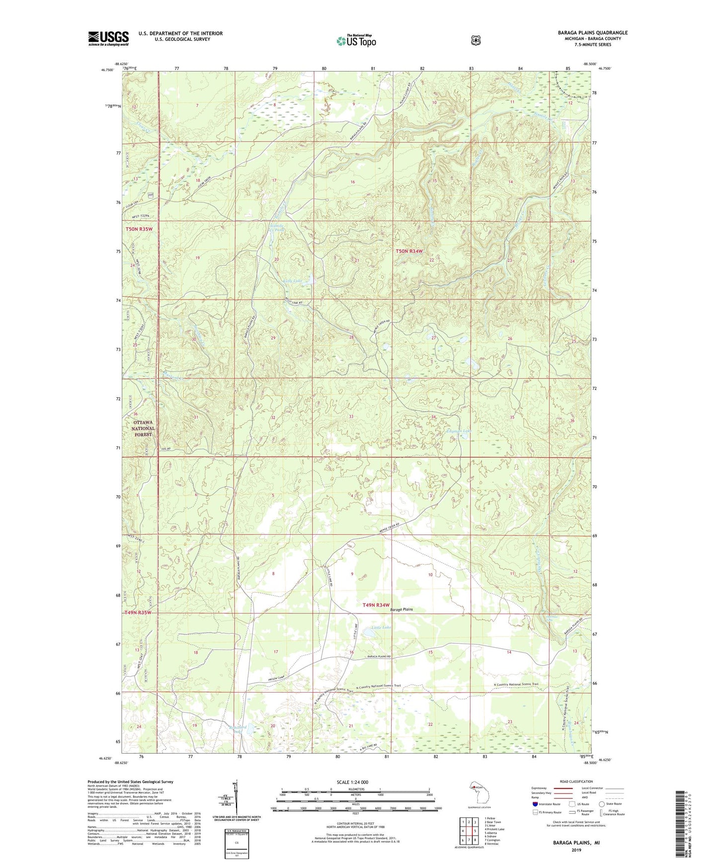
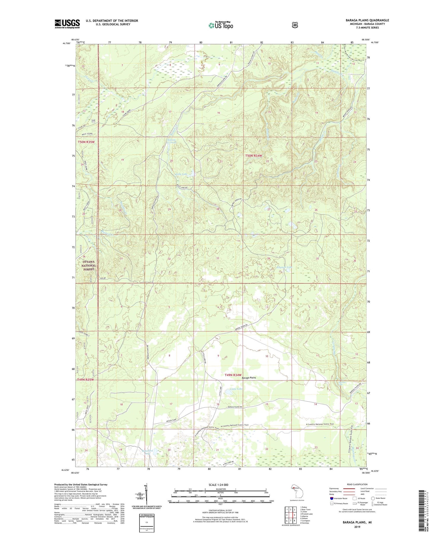
2019 topographic map quadrangle Baraga Plains in the state of Michigan. Scale: 1:24000. Based on the newly updated USGS 7.5' US Topo map series, this map is in the following counties: Baraga. The map contains contour data, water features, and other items you are used to seeing on USGS maps, but also has updated roads and other features. This is the next generation of topographic maps. Printed on high-quality waterproof paper with UV fade-resistant inks.
Quads adjacent to this one:
West: Prickett Lake
Northwest: Pelkie
North: Bear Town
East: Alberta
Southeast: Vermilac
South: Covington
Southwest: Sidnaw
Contains the following named places: Anderson Lake, Baraga Plains, Boyles Creek, Engman Lake, Kelly Lake, Leviture Creek, Little Lake, Nesters Creek, Ogemaw Creek, Ogemaw Falls, Robillard Lake, Sixmile Creek Pond, Township of Baraga