MyTopo
Prickett Lake Michigan US Topo Map
Couldn't load pickup availability
Also explore the Prickett Lake Forest Service Topo of this same quad for updated USFS data
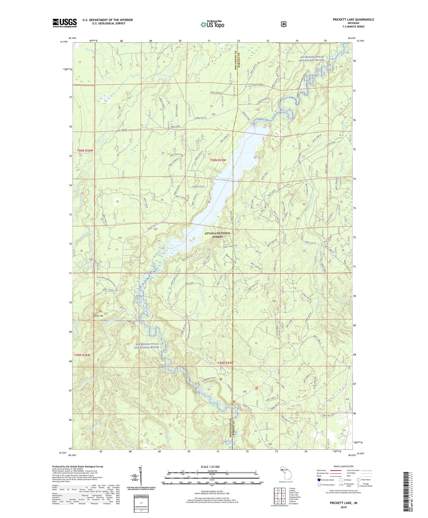
2023 topographic map quadrangle Prickett Lake in the state of Michigan. Scale: 1:24000. Based on the newly updated USGS 7.5' US Topo map series, this map is in the following counties: Houghton, Baraga. The map contains contour data, water features, and other items you are used to seeing on USGS maps, but also has updated roads and other features. This is the next generation of topographic maps. Printed on high-quality waterproof paper with UV fade-resistant inks.
Quads adjacent to this one:
West: Vista Falls
Northwest: Nisula
North: Pelkie
Northeast: Bear Town
East: Baraga Plains
Southeast: Covington
South: Sidnaw
Southwest: Echo Lake
This map covers the same area as the classic USGS quad with code o46088f6.
Contains the following named places: Boulder Creek, Clear Creek, Cliche Creek, Coach Creek, Dry Wash Creek, Funks Creek, Gallagher Creek, Hershley Creek, Little Silver River, Mountain Creek, Mustard Creek, Pelkie Creek Hunter Walking Trails, Pickett Dam, Posse Creek, Prickett Lake, Silver Mount, Stretch Creek, Sturgeon Falls, Sturgeon Wild and Scenic River, Sullivan Creek, Wiggle Creek