MyTopo
Bark River Michigan US Topo Map
Couldn't load pickup availability
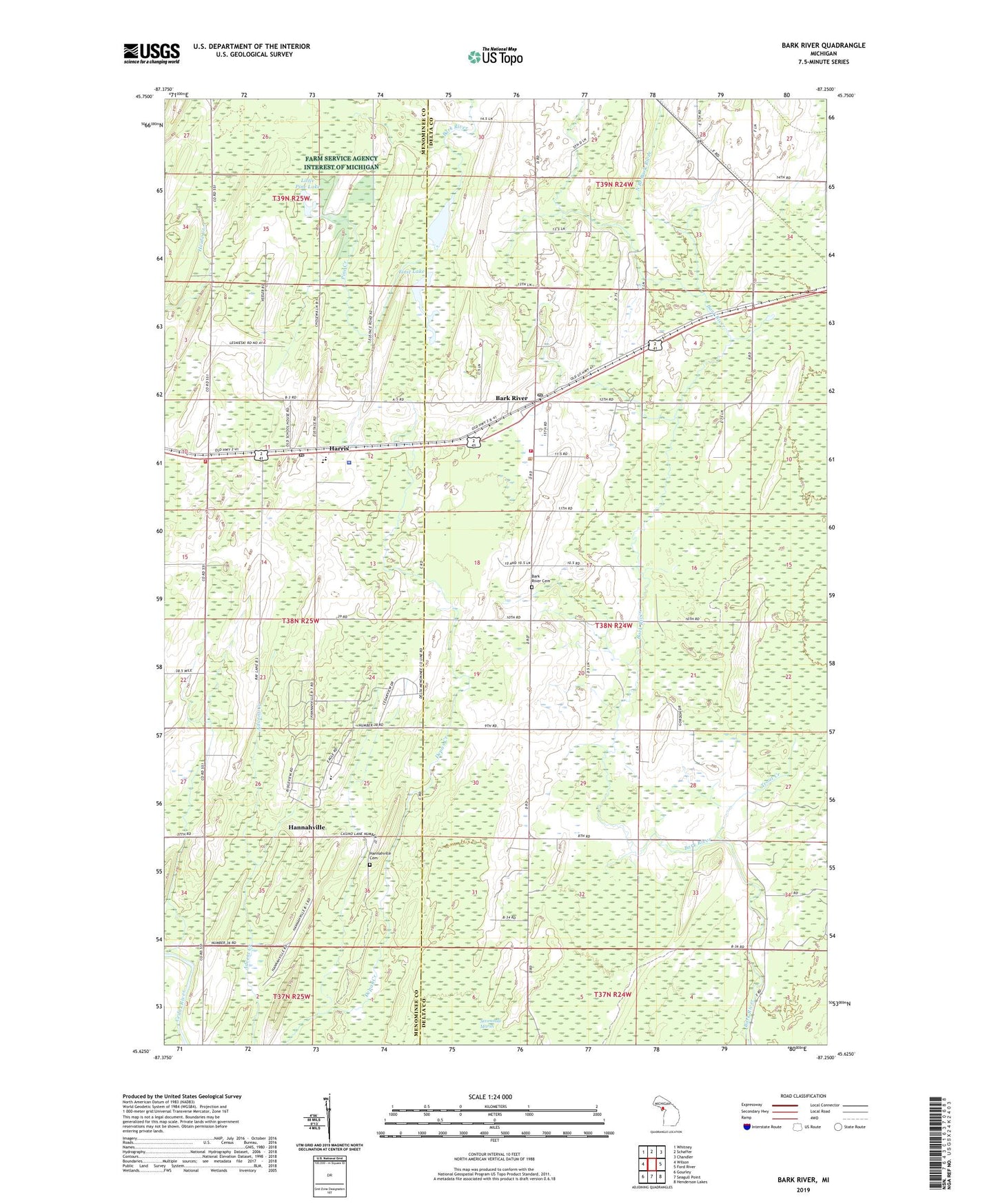
2023 topographic map quadrangle Bark River in the state of Michigan. Scale: 1:24000. Based on the newly updated USGS 7.5' US Topo map series, this map is in the following counties: Delta, Menominee. The map contains contour data, water features, and other items you are used to seeing on USGS maps, but also has updated roads and other features. This is the next generation of topographic maps. Printed on high-quality waterproof paper with UV fade-resistant inks.
Quads adjacent to this one:
West: Wilson
Northwest: Whitney
North: Schaffer
Northeast: Chandler
East: Ford River
Southeast: Henderson Lakes
South: Seagull Point
Southwest: Gourley
This map covers the same area as the classic USGS quad with code o45087f3.
Contains the following named places: Bark River, Bark River - Harris Junior / Senior High School, Bark River Bible Church, Bark River Cemetery, Bark River Church, Bark River Post Office, Bark River Station, Bark River Township Fire Department, First Lake, Hannahville, Hannahville Cemetery, Hannahville Indian School, Hannahville Police Department, Hannahville Tribal Police Department, Harris, Harris Post Office, Harris Station, Harris Township Volunteer Fire Department Station 2, Little Pine Lake, North Branch Bark River, Pine Creek, Pulaski Park, Saint Elizabeth Ann Seton Catholic Church, Salem Lutheran Church, Second Lake, Township of Bark River, Trout Creek