MyTopo
Roy Lake Michigan US Topo Map
Couldn't load pickup availability
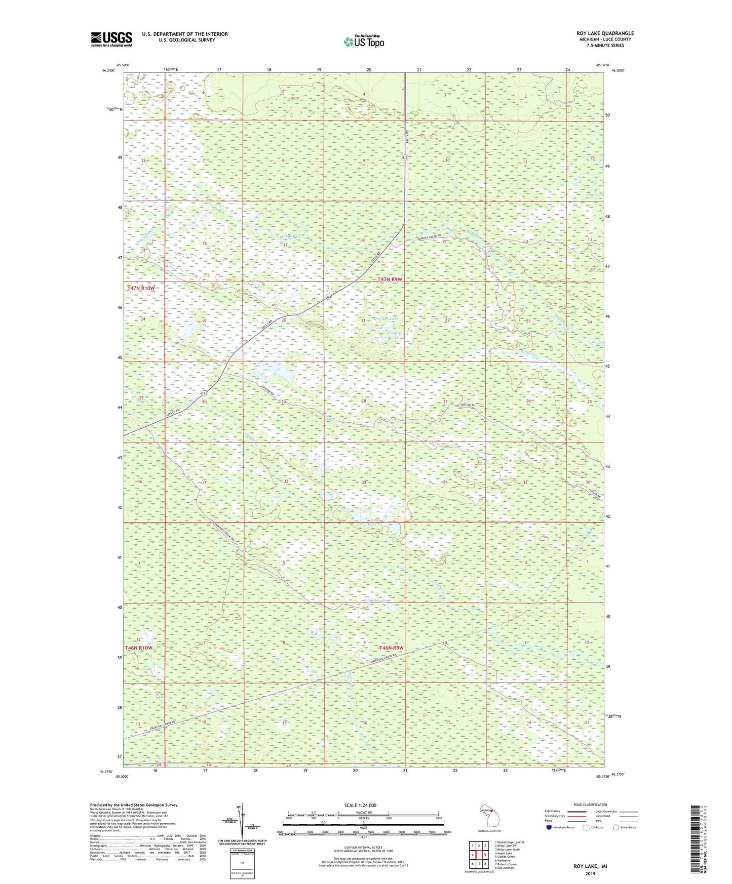
2023 topographic map quadrangle Roy Lake in the state of Michigan. Scale: 1:24000. Based on the newly updated USGS 7.5' US Topo map series, this map is in the following counties: Luce. The map contains contour data, water features, and other items you are used to seeing on USGS maps, but also has updated roads and other features. This is the next generation of topographic maps. Printed on high-quality waterproof paper with UV fade-resistant inks.
Quads adjacent to this one:
West: Auger Lake
Northwest: Muskallonge Lake SE
North: Betsy Lake SW
Northeast: Betsy Lake South
East: Gimlet Creek
Southeast: Soo Junction
South: Roberts Corner
Southwest: Newberry
This map covers the same area as the classic USGS quad with code o46085d4.
Contains the following named places: Coyote Lake, Lynch Lake, Quintus Lake, Roy Lake, Sixteen Creek, Sixteen Creek Campground