MyTopo
Birch Creek Michigan US Topo Map
Couldn't load pickup availability
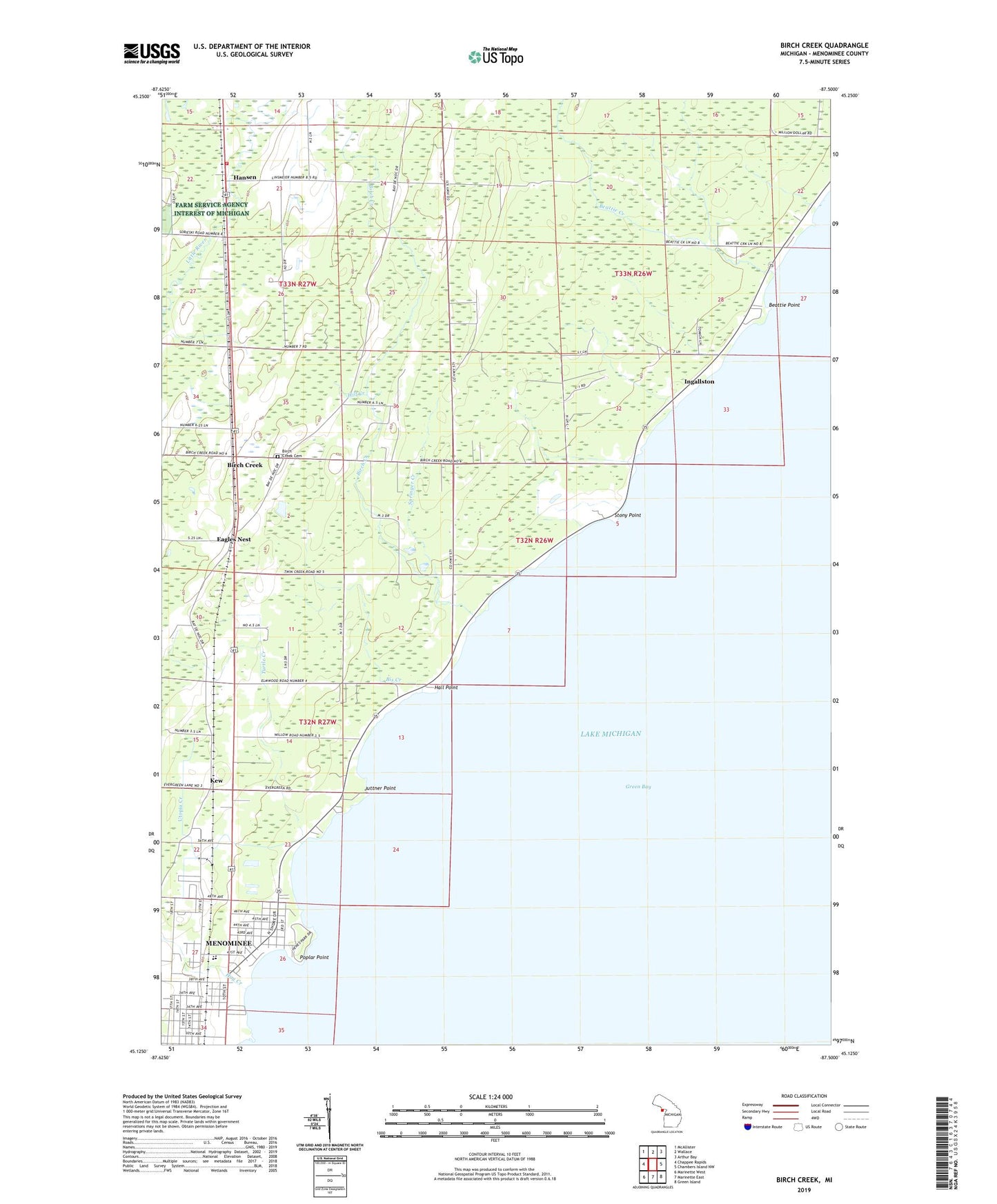
2023 topographic map quadrangle Birch Creek in the state of Michigan. Scale: 1:24000. Based on the newly updated USGS 7.5' US Topo map series, this map is in the following counties: Menominee. The map contains contour data, water features, and other items you are used to seeing on USGS maps, but also has updated roads and other features. This is the next generation of topographic maps. Printed on high-quality waterproof paper with UV fade-resistant inks.
Quads adjacent to this one:
West: Chappee Rapids
Northwest: McAllister
North: Wallace
Northeast: Arthur Bay
East: Chambers Island NW
Southeast: Green Island
South: Marinette East
Southwest: Marinette West
This map covers the same area as the classic USGS quad with code o45087b5.
Contains the following named places: Bayside Mobile Estates, Beattie Creek, Beattie Point, Birch Creek, Birch Creek Cemetery, Bis Creek, Crestview Adult Care Home, Eagles Nest, Emmanuel Lutheran Church, Evergreen School, Grant School, Hall Point, Hansen, Hay Creek, Hill Creek, Holy Trinity Church, Ingallston, Ingallston Post Office, Jehovah's Witnesses, John Henes Park, Juttner Point, Kew, Menominee Church of Christ, Menominee Ingallston Townships Volunteer Fire Department, North Shore Baptist Church, North Shore Country Club, Poplar Point, Saint Williams School, Spangle School, Springer Creek, Stony Point, Turtle Creek, Utopia Creek, Watertower Park, ZIP Code: 49858