MyTopo
Wallace Michigan US Topo Map
Couldn't load pickup availability
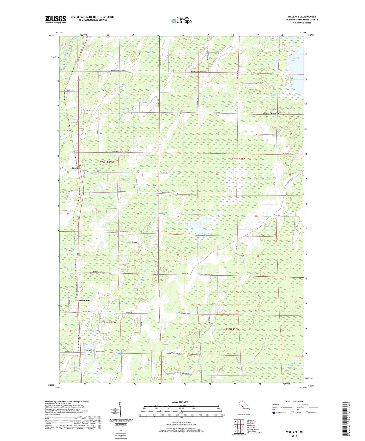
2023 topographic map quadrangle Wallace in the state of Michigan. Scale: 1:24000. Based on the newly updated USGS 7.5' US Topo map series, this map is in the following counties: Menominee. The map contains contour data, water features, and other items you are used to seeing on USGS maps, but also has updated roads and other features. This is the next generation of topographic maps. Printed on high-quality waterproof paper with UV fade-resistant inks.
Quads adjacent to this one:
West: McAllister
Northwest: Swanson
North: Stephenson
Northeast: North Lake
East: Arthur Bay
Southeast: Chambers Island NW
South: Birch Creek
Southwest: Chappee Rapids
This map covers the same area as the classic USGS quad with code o45087c5.
Contains the following named places: Bertholdt Lake, Bethel Church, Carbondale, Carbondale Post Office, Country Bible Church, Gethsemane Church, Hanson Creek, Hanson Lake, Hayward Creek, Lindberg Creek, Little Bear Golf Course, Little Nugget Golf Course, Mellen School, Mellen Township Fire Department, Myers Lake, Saint Marks Church, Township of Ingallston, Township of Mellen, Wallace, Wallace County Park, Wallace Post Office, Wallace Station, ZIP Code: 49893