MyTopo
Chappee Rapids Michigan US Topo Map
Couldn't load pickup availability
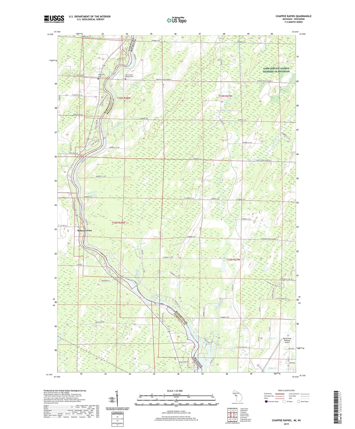
2023 topographic map quadrangle Chappee Rapids in the states of Michigan, Wisconsin. Scale: 1:24000. Based on the newly updated USGS 7.5' US Topo map series, this map is in the following counties: Menominee, Marinette. The map contains contour data, water features, and other items you are used to seeing on USGS maps, but also has updated roads and other features. This is the next generation of topographic maps. Printed on high-quality waterproof paper with UV fade-resistant inks.
Quads adjacent to this one:
West: Porterfield
Northwest: Bear Point
North: McAllister
Northeast: Wallace
East: Birch Creek
Southeast: Marinette East
South: Marinette West
Southwest: Harmony
Contains the following named places: Chappee Creek, Chappee Rapids, Chappee Rapids Historical Marker, Hamilton School, Kelley Creek, Little River, Little River Post Office, Martin Creek, Mason Park, Menominee Regional Airport, Miles, Ostrango Creek, Redling School, Rubys Corner, Saint Marys Mission, Saint Mary's Mission Cemetery, Sobiesky Creek, Township of Menominee, Twin Creek, Twin Island Rapids, Winesville Cemetery, Wineville School, Ziemann Park