
MyTopo
Boon Michigan US Topo Map
Couldn't load pickup availability
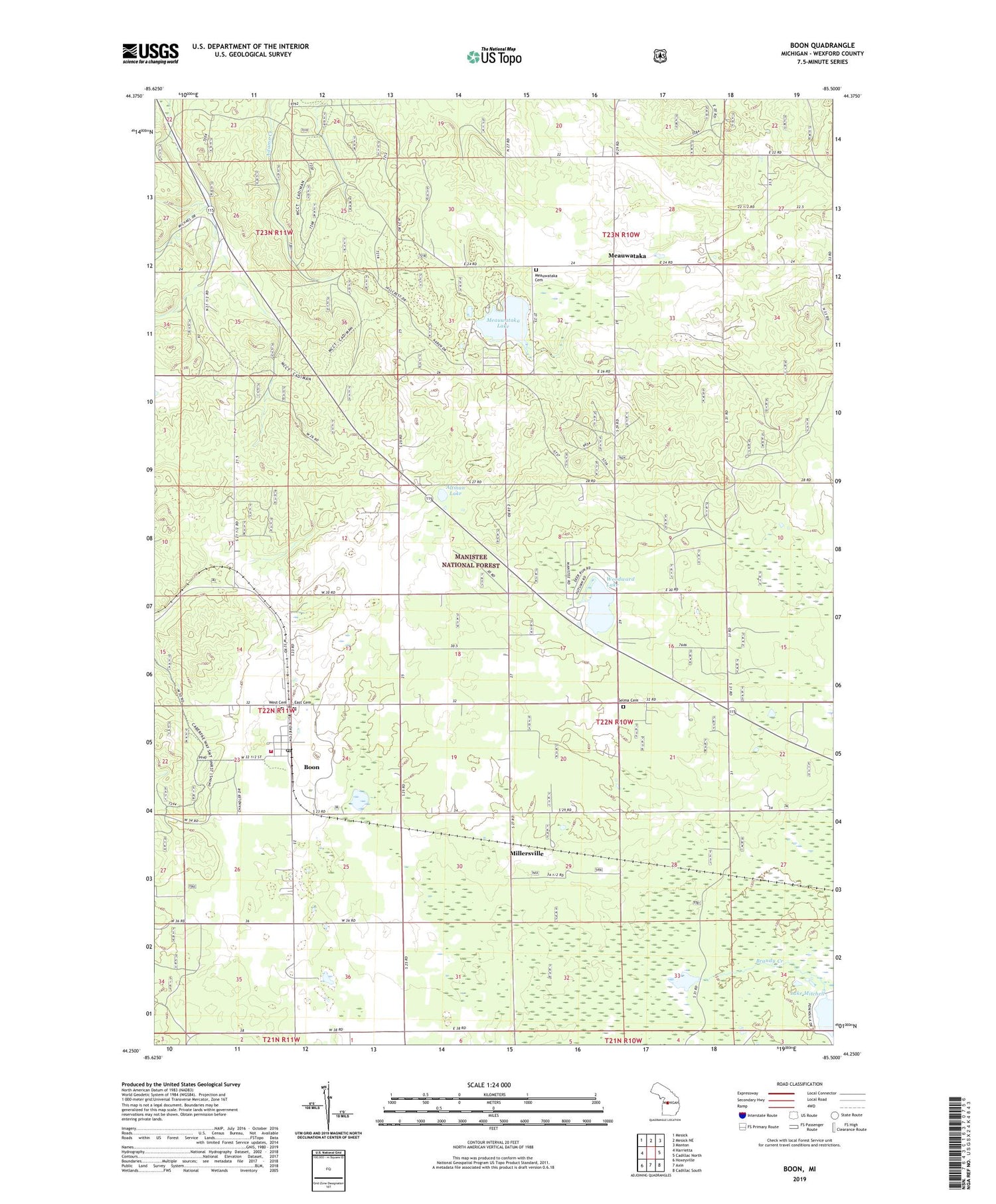
2019 topographic map quadrangle Boon in the state of Michigan. Scale: 1:24000. Based on the newly updated USGS 7.5' US Topo map series, this map is in the following counties: Wexford. The map contains contour data, water features, and other items you are used to seeing on USGS maps, but also has updated roads and other features. This is the next generation of topographic maps. Printed on high-quality waterproof paper with UV fade-resistant inks.
Quads adjacent to this one:
West: Harrietta
Northwest: Mesick
North: Mesick NE
Northeast: Manton
East: Cadillac North
Southeast: Cadillac South
South: Axin
Southwest: Hoxeyville
Contains the following named places: Altman Lake, Boon, Boon Baptist Church, Boon Census Designated Place, Boon Post Office, Boon Township Fire Department, Boyd School, Brandy Brook Waterfowl Area, Brandy Creek, Bunker Hill Golf Course, Bunyea Post Office, Clofax Township Park, Dayhuff Meauwataka Cemetery, East Cemetery, Foursquare Lighthouse Church, McNett School, Meauwataka, Meauwataka Free Methodist Church, Meauwataka Lake, Meauwataka Post Office, Millersville, Millersville Post Office, Millersville Station, Pilgrim Holiness Church, Selma Cemetery, Selma Center School, Township of Selma, West Cemetery, Wexford County, Woodward Lake, ZIP Code: 49618


