MyTopo
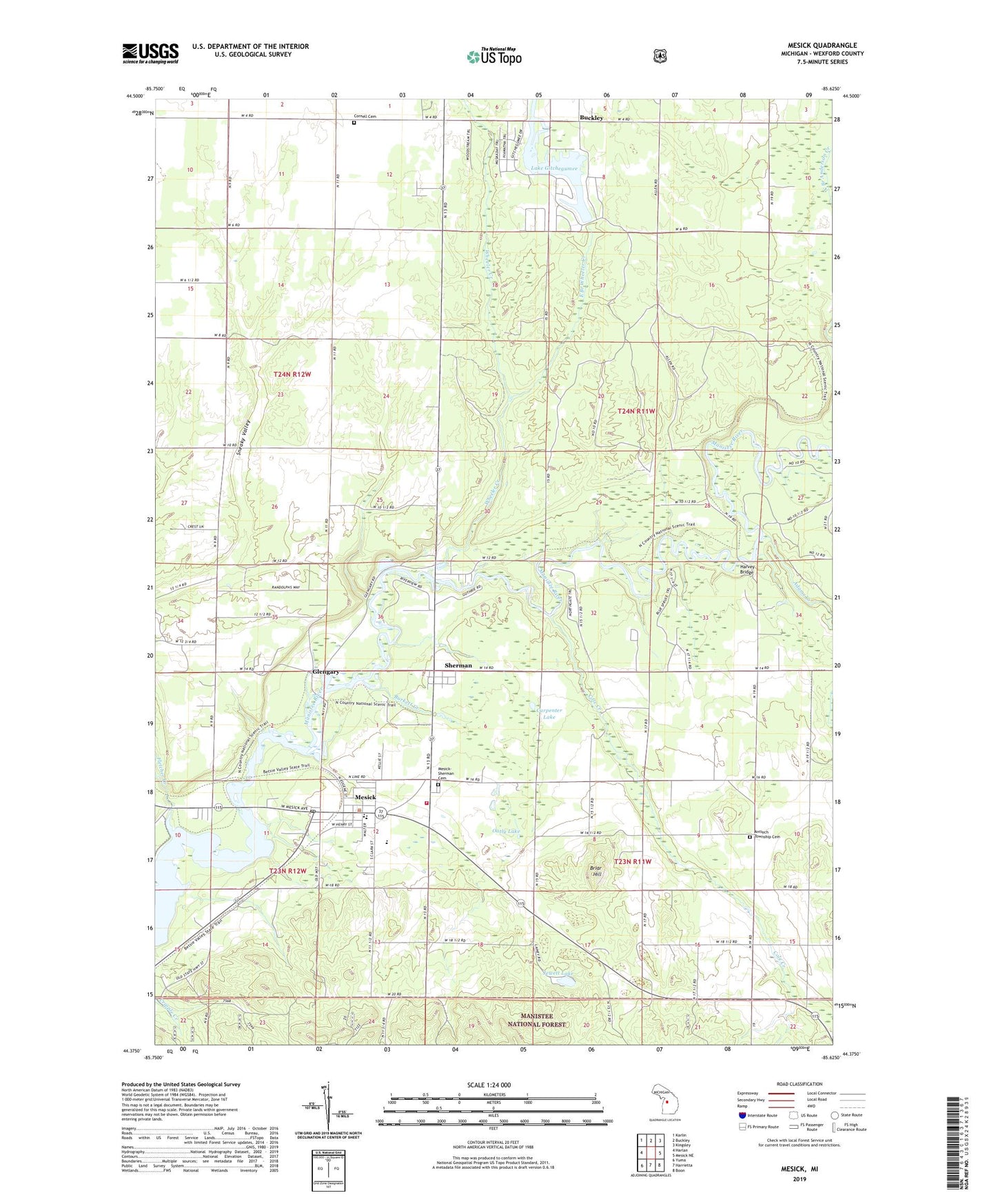
Mesick Michigan US Topo Map
Couldn't load pickup availability
Also explore the Mesick Forest Service Topo of this same quad for updated USFS data
2023 topographic map quadrangle Mesick in the state of Michigan. Scale: 1:24000. Based on the newly updated USGS 7.5' US Topo map series, this map is in the following counties: Wexford. The map contains contour data, water features, and other items you are used to seeing on USGS maps, but also has updated roads and other features. This is the next generation of topographic maps. Printed on high-quality waterproof paper with UV fade-resistant inks.
Quads adjacent to this one:
West: Harlan
Northwest: Karlin
North: Buckley
Northeast: Kingsley
East: Mesick NE
Southeast: Boon
South: Harrietta
Southwest: Yuma
This map covers the same area as the classic USGS quad with code o44085d6.
Contains the following named places: Adams Creek, Antioch Church, Antioch Township Cemetery, Bible Believers Fellowship Church, Briar at Mesick Golf Club, Briar Hill, Briar Hill Ski Jump, Burkett Creek, Carpenter Lake, Cole Creek, Cornell Cemetery, Cornell School, Dennis Family Campground, East Branch Wheeler Creek, Faith Lutheran Church, First Wexford County Courthouse Historical Marker, Fletcher Creek, Free Methodist Church, Glengary, Harvey Bridge, Indian Crossing Campground, Jewett Lake, Lake Gitchegumee, Lake of the Woods, Mesick, Mesick - Sherman Cemetery, Mesick High School, Mesick Medical Center, Mesick Middle School, Mesick Post Office, Mesick Public Library, Mesick Rescue Squad, Mesick Seventh Day Adventist Church, Mesick Station, Oatly Lake, Preston Creek, Sherman, Sherman Post Office, Springville Township Fire Department, Township of Antioch, Township of Hanover, United Methodist Church, Village of Mesick, Wheeler Creek, WTCM-FM (Traverse City), ZIP Code: 49668