MyTopo
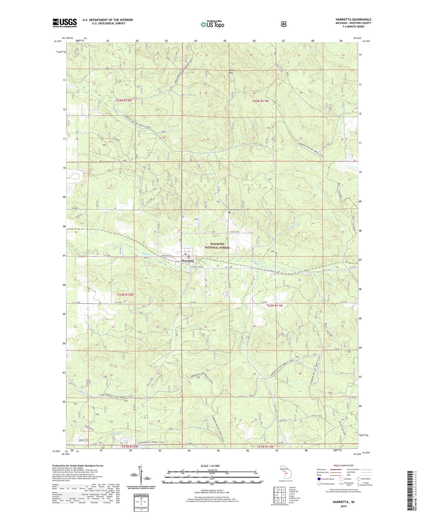
Harrietta Michigan US Topo Map
Couldn't load pickup availability
Also explore the Harrietta Forest Service Topo of this same quad for updated USFS data
2023 topographic map quadrangle Harrietta in the state of Michigan. Scale: 1:24000. Based on the newly updated USGS 7.5' US Topo map series, this map is in the following counties: Wexford. The map contains contour data, water features, and other items you are used to seeing on USGS maps, but also has updated roads and other features. This is the next generation of topographic maps. Printed on high-quality waterproof paper with UV fade-resistant inks.
Quads adjacent to this one:
West: Yuma
Northwest: Harlan
North: Mesick
Northeast: Mesick NE
East: Boon
Southeast: Axin
South: Hoxeyville
Southwest: Wellston NE
This map covers the same area as the classic USGS quad with code o44085c6.
Contains the following named places: Boon Lookout Tower, Briar Hill, Caberfae Way Snowmobile Trail, Cadillac Ranger District Work Station, Harrietta, Harrietta Cemetery, Harrietta Post Office, Harrietta State Fish Hatchery, Harrietta Station, Harrietta United Methodist Church, Machenie Trail Parking, Perkins Creek, Slagle - Harrietta Fire Department, Township of Boon, Village of Harrietta, WIAA-FM (Interlochen), WOLW-FM (Cadillac), WPBN-TV (Traverse City)