MyTopo
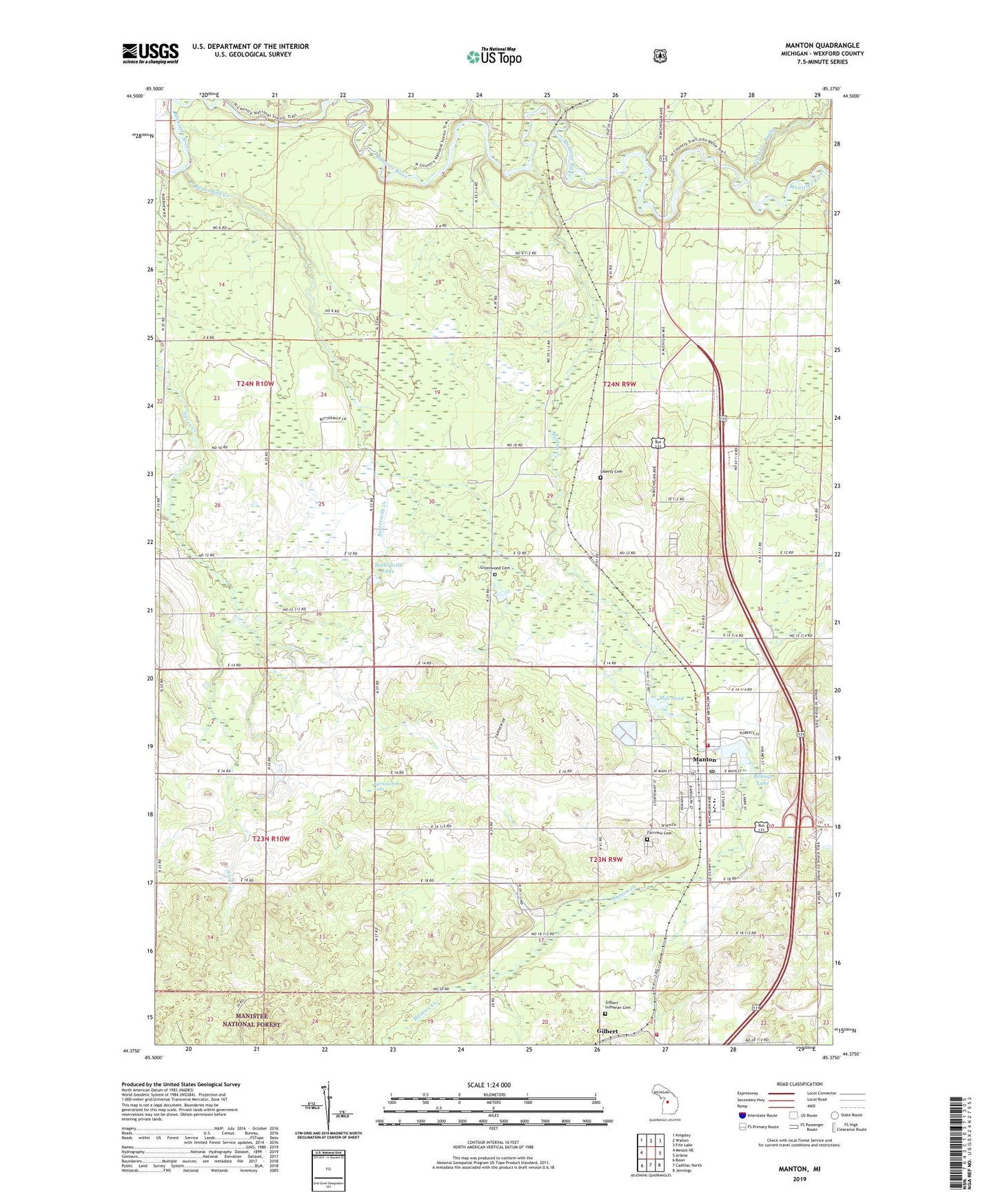
Manton Michigan US Topo Map
Couldn't load pickup availability
Also explore the Manton Forest Service Topo of this same quad for updated USFS data
2023 topographic map quadrangle Manton in the state of Michigan. Scale: 1:24000. Based on the newly updated USGS 7.5' US Topo map series, this map is in the following counties: Wexford. The map contains contour data, water features, and other items you are used to seeing on USGS maps, but also has updated roads and other features. This is the next generation of topographic maps. Printed on high-quality waterproof paper with UV fade-resistant inks.
Quads adjacent to this one:
West: Mesick NE
Northwest: Kingsley
North: Walton
Northeast: Fife Lake
East: Arlene
Southeast: Jennings
South: Cadillac North
Southwest: Boon
This map covers the same area as the classic USGS quad with code o44085d4.
Contains the following named places: Battle of Manton Historical Marker, Billings Lake, Buttermilk Creek, Buttermilk Lake, Carpenter School, Cedar Creek Township Volunteer Fire Department, Church of Christ Disciples, City of Manton, East Gilbert School, Emerald Vale Golf Course, Fairview Cemetery, Farnsworth Lake, Fife Lake Outlet, First Christian Church, Gentle School, Gilbert, Gilbert Lutheran Cemetery, Gilbert Post Office, Gilbert Station, Greenwood Cemetery, Greenwood School, Haire Post Office, Haire Station, Lake Billings Campground, Liberty Cemetery, Manton, Manton Area Historical Museum, Manton Baptist Church, Manton Consolidated Schools, Manton Creek, Manton Fire Department, Manton Free Methodist Church, Manton Police Department, Manton Post Office, Manton Public Library, Manton Station, Manton United Methodist Church, Michigan Department of Natural Resources Manton Field Office, Mill Pond, Mystic Post Office, Rotary Park, Saint Theresa's Church, Township of Cedar Creek, Township of Liberty, Trinity Lutheran Church, Walton Outlet, Wesleyan Campground, ZIP Code: 49663