MyTopo
Breckenridge Michigan US Topo Map
Couldn't load pickup availability
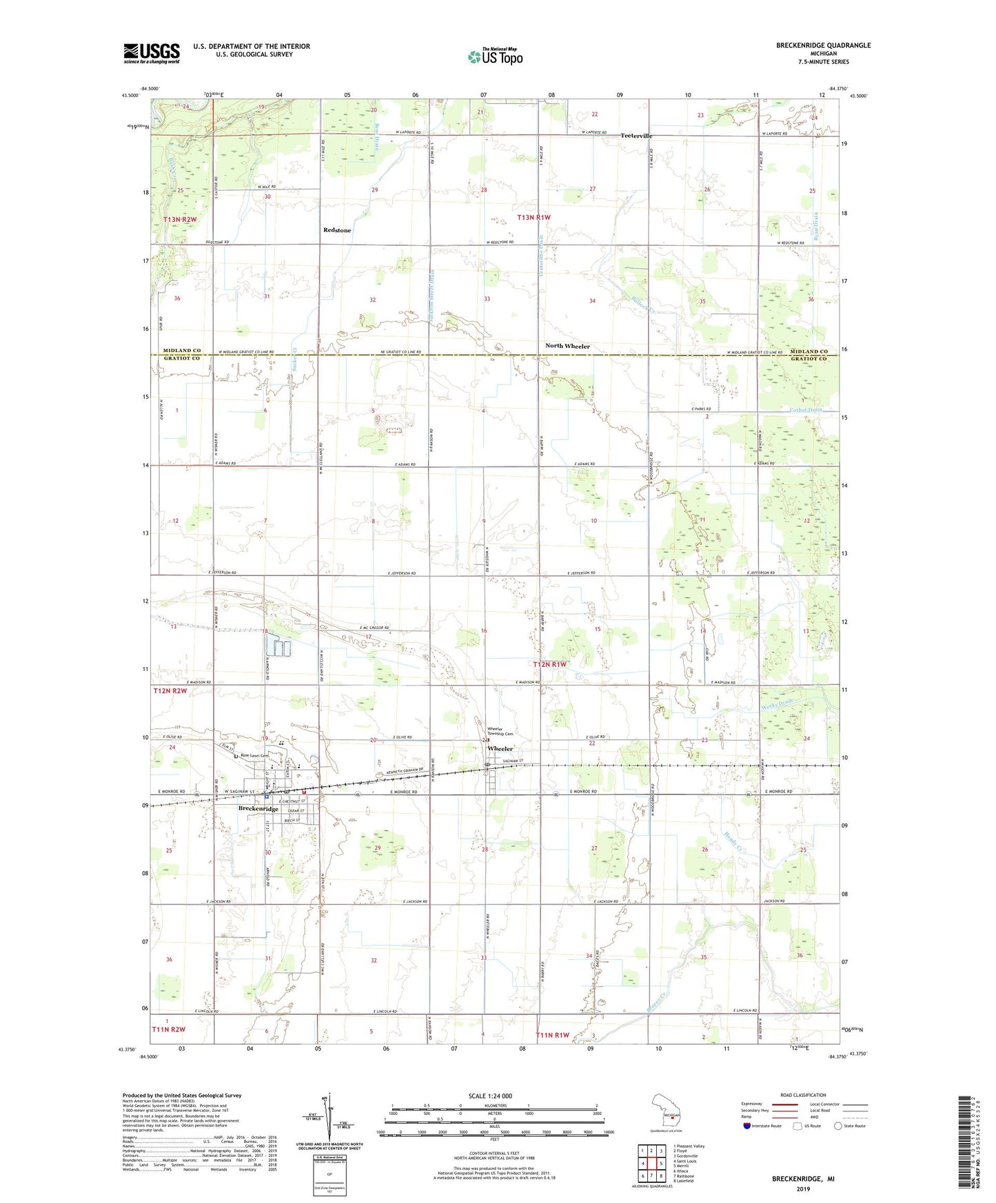
2019 topographic map quadrangle Breckenridge in the state of Michigan. Scale: 1:24000. Based on the newly updated USGS 7.5' US Topo map series, this map is in the following counties: Gratiot, Midland. The map contains contour data, water features, and other items you are used to seeing on USGS maps, but also has updated roads and other features. This is the next generation of topographic maps. Printed on high-quality waterproof paper with UV fade-resistant inks.
Quads adjacent to this one:
West: Saint Louis
Northwest: Pleasant Valley
North: Floyd
Northeast: Gordonville
East: Merrill
Southeast: Lakefield
South: Rathbone
Southwest: Ithaca
Contains the following named places: Amazing Grace Church, Bethel Church, Breckenridge, Breckenridge - Wheeler Township Fire Department, Breckenridge Elementary School, Breckenridge High School, Breckenridge Mobile Home Park, Breckenridge Police Department, Breckenridge Post Office, Breckenridge Station, Breckenridge Wesleyan Church, Bush Drain, Centerline Drain, Countryside United Brethren Church, Family Medical Care, First Congregational Church, Free Methodist Church, Immanuel Church, Jackson Street Drain, North Wheeler, North Wheeler Post Office, Plank Road Museum, Redstone, Redstone Drain, Redstone Post Office, Ridge Golf Course, Rose Lawn Cemetery, Ryan Drain, Saginaw and Gratiot County State Road Historical Marker, Saginaw Valley and Saint Louis Railroad Historical Marker, Teeterville, Townline Drain, Township of Wheeler, United Brethren Church, United Methodist Church, Village of Breckenridge, Weeks Drain, Wheeler, Wheeler Post Office, Wheeler Station, Wheeler Township Cemetery, ZIP Codes: 48615, 48662