MyTopo
Ithaca Michigan US Topo Map
Couldn't load pickup availability
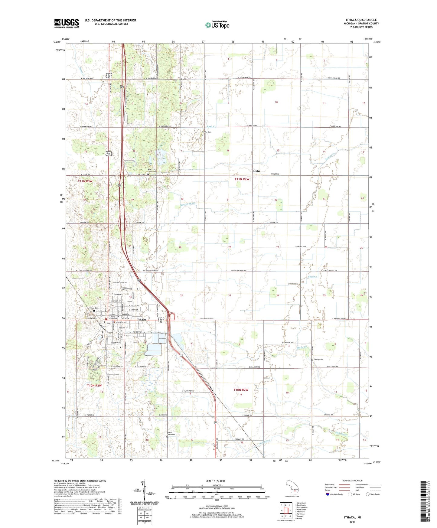
2023 topographic map quadrangle Ithaca in the state of Michigan. Scale: 1:24000. Based on the newly updated USGS 7.5' US Topo map series, this map is in the following counties: Gratiot. The map contains contour data, water features, and other items you are used to seeing on USGS maps, but also has updated roads and other features. This is the next generation of topographic maps. Printed on high-quality waterproof paper with UV fade-resistant inks.
Quads adjacent to this one:
West: Alma South
Northwest: Alma North
North: Saint Louis
Northeast: Breckenridge
East: Rathbone
Southeast: Ashley
South: Pompeii
Southwest: Perrinton
This map covers the same area as the classic USGS quad with code o43084c5.
Contains the following named places: Beaver Drain, Beebe, Beebe Cemetery, Beebe Post Office, Brady Cemetery, City of Ithaca, Community of Christ Church, Dodge School, Family Medical Care of Ithaca, First Presbyterian Church, Gratiot Country Club, Gratiot County, Gratiot County Courthouse, Gratiot County Historical Marker, Gratiot County Sheriff's Office, Herron School, Ithaca, Ithaca Baptist Church, Ithaca Cemetery, Ithaca Church of God, Ithaca City Hall, Ithaca City Library, Ithaca County Sheriff's Office, Ithaca Family Care Center, Ithaca Family Practice, Ithaca Fire Department, Ithaca High School, Ithaca Post Office, Ithaca Rest Area, Ithaca Station, Ithaca Wesleyan Church, Jackson Weller House Historical Marker, Meadow Lanes Estates Mobile Home Park, North School, Pine Grove Cemetery, Saint Pauls Apostolic Catholic Church, Seventh-Day Adventist Church, Seventh-Day Adventist School, South School, Staton Farm Cemetery, Township of Emerson, United Brethren Church, United Methodist Church, WFYC-AM (Alma), WFYC-FM (Alma), WMLM-AM (Saint Louis), Woodland Park, ZIP Code: 48847