MyTopo
Slaybaugh Corner Michigan US Topo Map
Couldn't load pickup availability
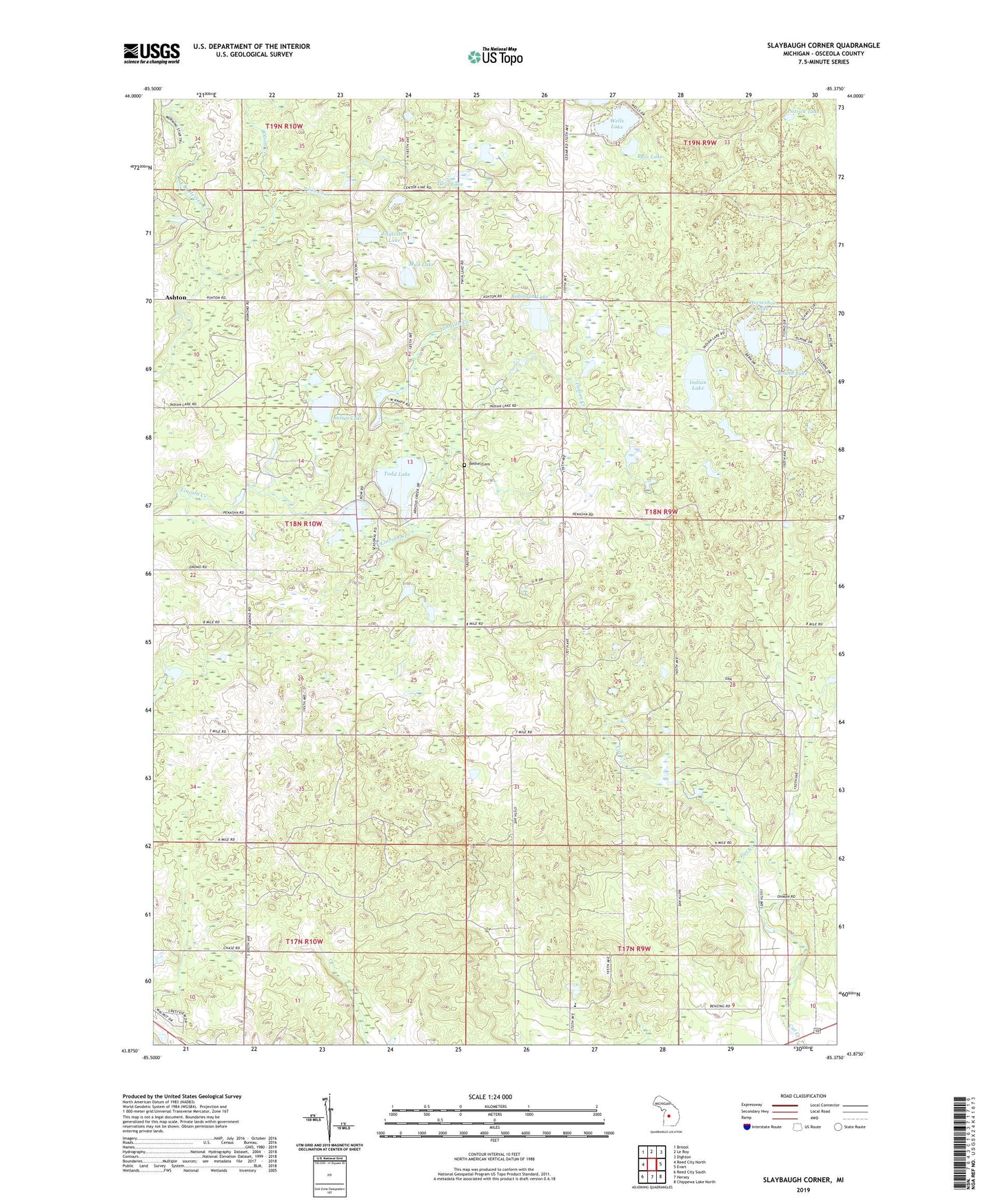
2023 topographic map quadrangle Slaybaugh Corner in the state of Michigan. Scale: 1:24000. Based on the newly updated USGS 7.5' US Topo map series, this map is in the following counties: Osceola. The map contains contour data, water features, and other items you are used to seeing on USGS maps, but also has updated roads and other features. This is the next generation of topographic maps. Printed on high-quality waterproof paper with UV fade-resistant inks.
Quads adjacent to this one:
West: Reed City North
Northwest: Bristol
North: Le Roy
Northeast: Dighton
East: Evart
Southeast: Chippewa Lake North
South: Hersey
Southwest: Reed City South
This map covers the same area as the classic USGS quad with code o43085h4.
Contains the following named places: Austin Lake, Bass Lake, Beaver Dam Lake, Bethel Cemetery, Bethel Church, Cedar Lakes, Cedar Oil and Gas Field, Eagle Boys Village, Eggleston Lake, Halfmoon Lake, Heritage Christian Academy, Horseshoe Lake, Indian Creek, Indian Lake, Johnson Creek, Lincoln Lake, Mud Lake, Olson Creek, Patrick Lake, Robinson Lake, Robinson School, Round Lake, Slaybaugh Corner, Todd Lake, Township of Cedar, Twin Creek, Twin Lake, Wells Lake