MyTopo
Browns Corners Michigan US Topo Map
Couldn't load pickup availability
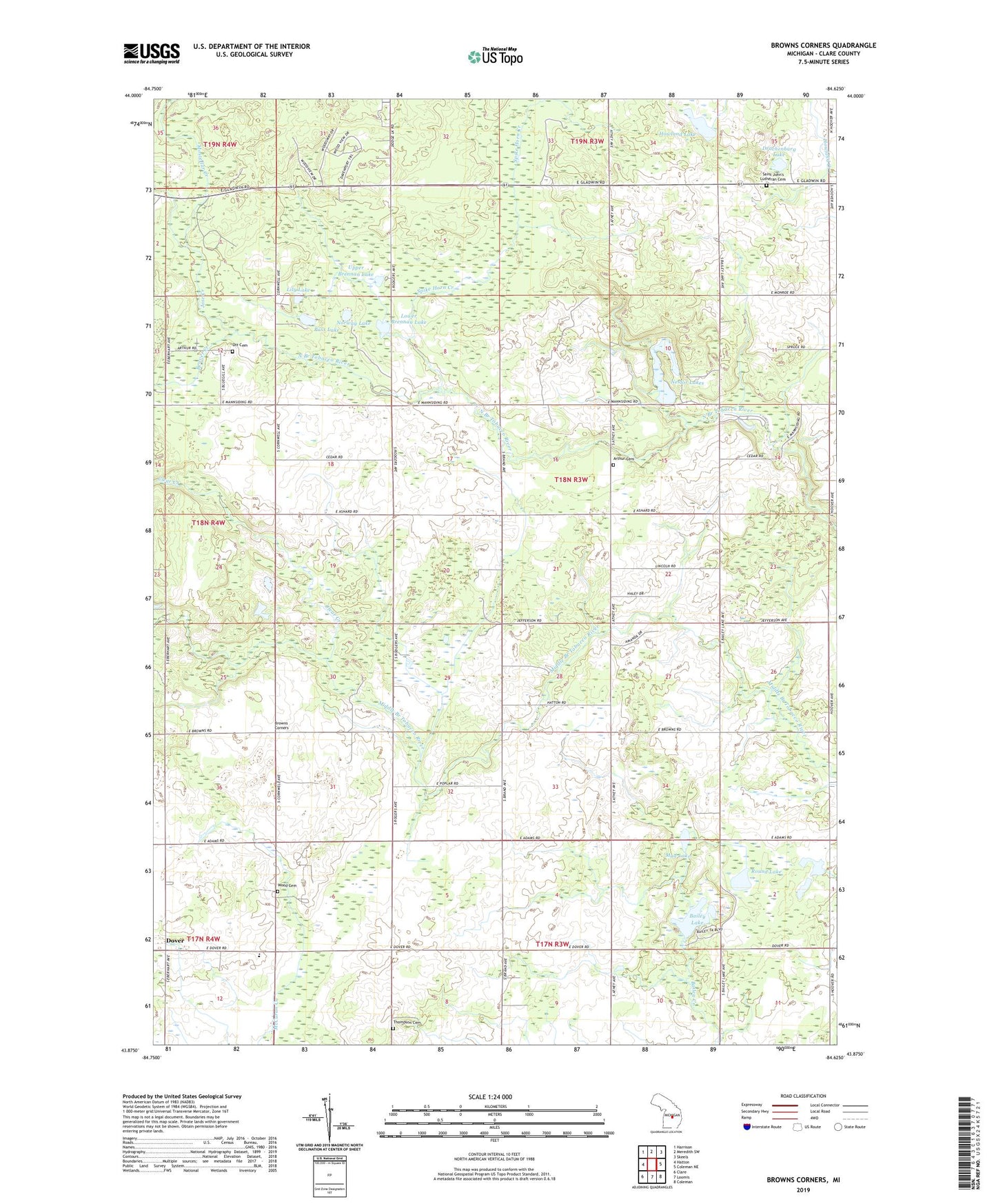
2019 topographic map quadrangle Browns Corners in the state of Michigan. Scale: 1:24000. Based on the newly updated USGS 7.5' US Topo map series, this map is in the following counties: Clare. The map contains contour data, water features, and other items you are used to seeing on USGS maps, but also has updated roads and other features. This is the next generation of topographic maps. Printed on high-quality waterproof paper with UV fade-resistant inks.
Quads adjacent to this one:
West: Hatton
Northwest: Harrison
North: Meredith SW
Northeast: Skeels
East: Coleman NE
Southeast: Coleman
South: Loomis
Southwest: Clare
Contains the following named places: Arthur Cemetery, Arthur Center Church, Arthur Township Hall, Bailey Lake, Bass Lake, Beaver Creek, Browns Corners, Clare County Historical Society and Museum, Clear Creek, Dover, Dover Post Office, Drachenburg Lake, Eagle Church, Howland Lake, Jose Creek, Lily Lake, Lower Brennan Lake, Mostellar Creek, Mud Lake, Nestor Lakes, Norway Lake, Ott Cemetery, River Valley RV Park, Round Lake, Saint Johns Church, Saint John's Lutheran Cemetery, Spike Horn Creek, Thompson Cemetery, Tonkin Post Office, Township of Arthur, Upper Brennan Lake, Wood Cemetery