MyTopo
Meredith SW Michigan US Topo Map
Couldn't load pickup availability
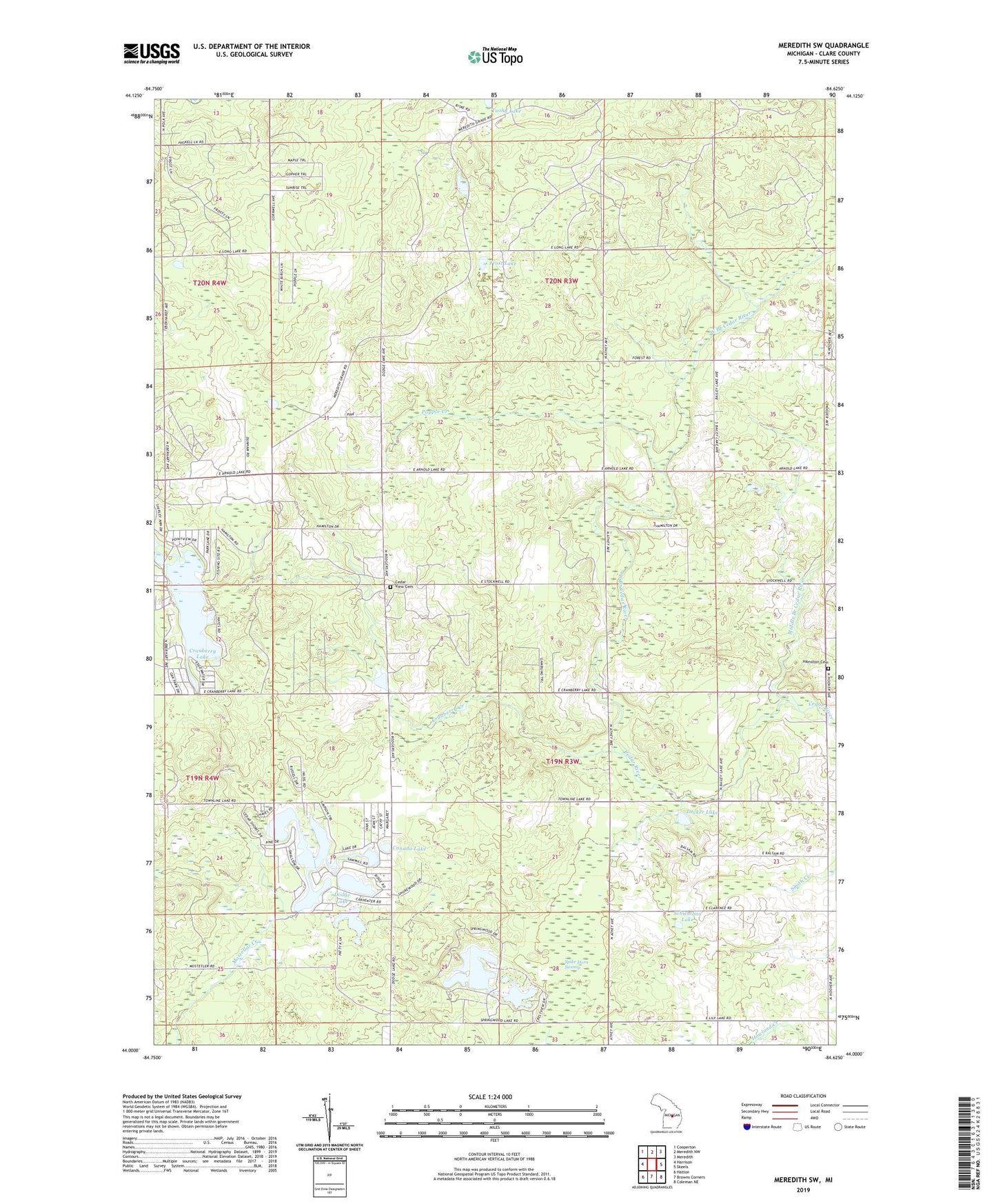
2023 topographic map quadrangle Meredith SW in the state of Michigan. Scale: 1:24000. Based on the newly updated USGS 7.5' US Topo map series, this map is in the following counties: Clare. The map contains contour data, water features, and other items you are used to seeing on USGS maps, but also has updated roads and other features. This is the next generation of topographic maps. Printed on high-quality waterproof paper with UV fade-resistant inks.
Quads adjacent to this one:
West: Harrison
Northwest: Cooperton
North: Meredith NW
Northeast: Meredith
East: Skeels
Southeast: Coleman NE
South: Browns Corners
Southwest: Hatton
This map covers the same area as the classic USGS quad with code o44084a6.
Contains the following named places: Amble School, Boathouse Lake, Canada Lake, Cedar Shores Campground, Cedar View Cemetery, Church of God in Christ, Cranberry Creek, Cranberry Lake, Decker Lake, Devil's Knob Golf Course, Dodge Lake, Dunham Lake, Frost Lake, Hamilton Cemetery, Haven Lake, Icehouse Lake, Middle Branch Cedar River, North Hamilton Oil and Gas Field, Popple Creek, River of Hope Christian Church, Sand Lake, Schiemann Lake, Spike Horn Swamp, Springwood Lakes, Townline Lake, Township of Franklin, Township of Hamilton, Tuohy Lake, West Branch Cedar River