MyTopo
Harrison Michigan US Topo Map
Couldn't load pickup availability
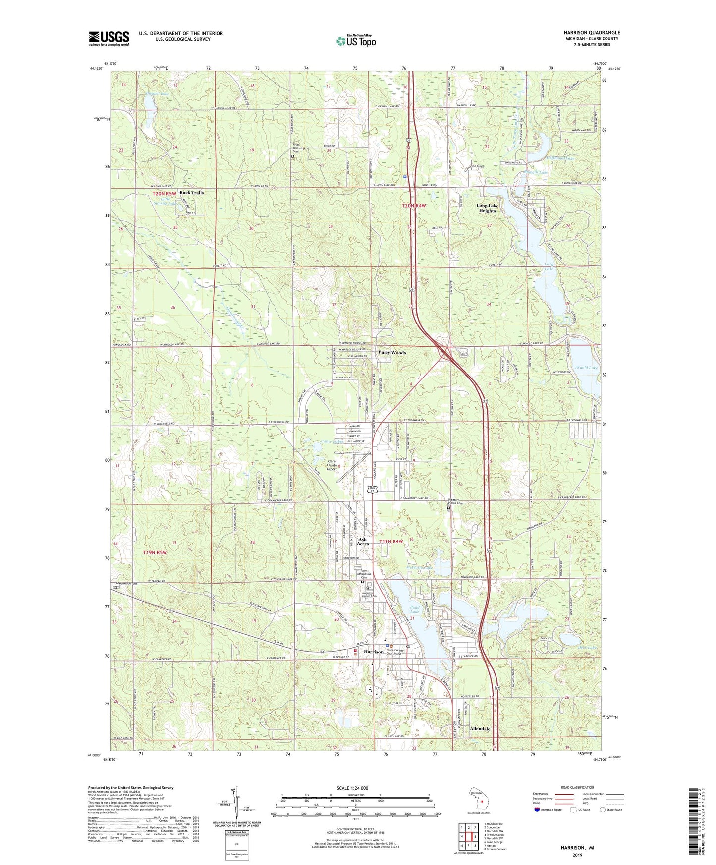
2023 topographic map quadrangle Harrison in the state of Michigan. Scale: 1:24000. Based on the newly updated USGS 7.5' US Topo map series, this map is in the following counties: Clare. The map contains contour data, water features, and other items you are used to seeing on USGS maps, but also has updated roads and other features. This is the next generation of topographic maps. Printed on high-quality waterproof paper with UV fade-resistant inks.
Quads adjacent to this one:
West: Prestle Creek
Northwest: Moddersville
North: Cooperton
Northeast: Meredith NW
East: Meredith SW
Southeast: Browns Corners
South: Hatton
Southwest: Lake George
This map covers the same area as the classic USGS quad with code o44084a7.
Contains the following named places: Airport Forest, Allendale, Arnold Lake, Ash Acres, Bluegill Lake, Buck Trails, Budd Lake, Camp Deer Trails, Camp Oak Hill, Camp Summer Trails, Caner Lakes, Central Clinic-Harrison, Church of Christ, Church of Jesus Christ of Latter-Day Saints, City of Harrison, Clare County Airport, Clare County Fairground, Clare County Sheriff's Office, Clark Memorial Park, Community of Christ, Countryside Campgrounds, Deer Lake, Downhours Shady Acres Campground, Faith Church, First Baptist Church, First Congregational United Church of Christ, Frost Township Cemetery, Frost Township Police Department, Gathering United Methodist Church, Greenwood Cemetery, Halfmoon Lake, Harrison, Harrison Area Park, Harrison Church of Christ, Harrison City Library, Harrison Fire Department, Harrison Historical Marker, Harrison Lookout Tower, Harrison Mobile Home Estates, Harrison Post Office, Harrison Senior High School, Harrison Sheriff's Office, Harrison Station, Haskell Lake, Hayes Township Outdoor Park, Hillside Elementary School, Hope Baptist Church, Jehovah's Witnesses Harrison, Larson School, Latter-Day Saints Church, Little Long Lake, Little Sunrise Lake, Long Lake, Long Lake Free Church, Long Lake Heights, Long Lake School, Longlake Post Office, Maple Grove Cemetery, McWatty Lake, Michigan Department of Natural Resources Harrison Field Office, Mid Michigan Medical Center, Parker's Trailer Park and Camp, Piney Woods, Pixley Pond, Pleasant Plains Cemetery, Saint Athanasius Cemetery, Saint Athanasius Church, Saint Luke Church, Spike Horn Creek, Sutherland Lake, Tamaracks Golf Course, Township of Frost, Township of Hayes, United Rescue Service, West Hamilton Oil and Gas Field, Wilson State Park, Withi Trailer Park, ZIP Code: 48625